by Craig O. Olsen
Originally Published in the IAMC Newsletter, October 2012
Two common themes running through most of the 2012 IAMC Challenge Sites are ghost towns and mountain lookouts as reflected in the selection of the majority of the sites. The Idaho forest fires this summer have taken a devastating toll on central Idaho, and have put a significant damper on our usual riding spots this year. If fact our annual club ride based out of Challis to be held over Labor Day weekend was cancelled due to the fires. Many of the challenge sites for this year are now behind fire lines or closed forest and BLM roads because of the fires. As a results, many in our club, myself included, may not get a chance to visit most of those sites this year. Only those who had the foresight to get an early start this year before the fires started will have a chance to visits most, if not all, of the challenge sites for this year. In the spirit of my last IAMC Newsletter article about the 2012 Southern Challenge Sites (Issue # 4, August, 2012), this article deals with two ghost towns close to Boise, the story of which many may not be familiar.
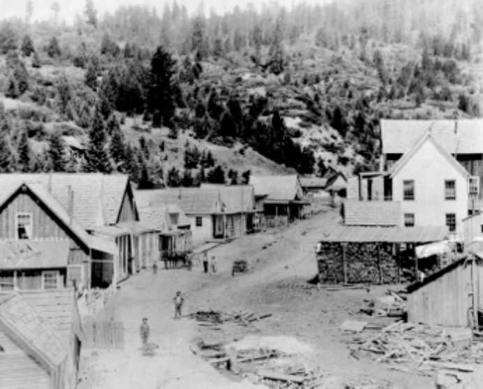
Gold was first discovered in the Boise Basin (centered about 24 miles north of Boise) along Grimes Creek in 1862 by George Grimes, Moses Splawn and an accompanying party of men. Within a few years the basin changed from a wilderness area inhabited mainly by Native Americans to the thriving mining towns of Idaho City, Centerville, Pioneerville, Placerville, and Quartzburg, supporting a composite population of 30,000 to 40,000 inhabitants. Of these five initial mining communities, Quartzburg is the only one today that is not inhabited. [1]
Placer gold was discovered along Granite Creek about 2-3 miles west of Placerville in 1863. In that same year the lode source responsible for the placer gold was discovered and ultimately became the Gold Hill Mine, which became one of the oldest and largest
producing gold mines in Idaho.
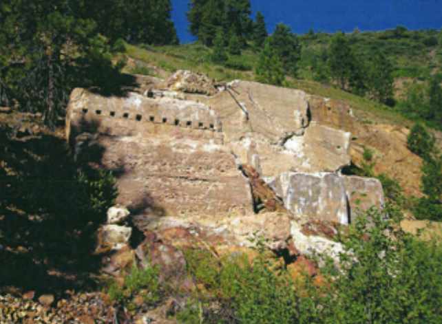
This mine was worked almost continuously from 1863 until 1938. Production from this mine exceeded $8,000,000 by 1938. The mine was closed by a significant forest fire in 1931 that destroyed the plant. It was rebuilt in 1938, but it was closed in 1938. [2]
This mine was developed with 1,246 foot vertical shaft in three compartments with nine intermediate levels totaling more than 40,000 of workings. Several other mines were developed in the immediate surrounding area, but none were as large or productive as the Gold Hill mine.
The town of Quartzburg (Site #-2), which lies about 2.5 miles due west of Placerville and 11 miles east of Horseshoe Bend, sprang up near the confluence of Confederate Gulch and Granite Creek just below the Gold Hill mine the following year, 1864. The townsite was laid out by David E. Coughanour, who later bought the Gold Hill mine in
1867, and James H. Hawley, who worked for Coughanour at the Gold Hill mine and
later became mayor of Boise (1903-1905) and then governor of Idaho (1911-1905). Hawley married Mary E. Bullock on July 4, 1875 in Quartzburg and lived there until he moved to Idaho City in 1878. Coughanour remained in Quartzburg until his death from cancer in 1904. [3]
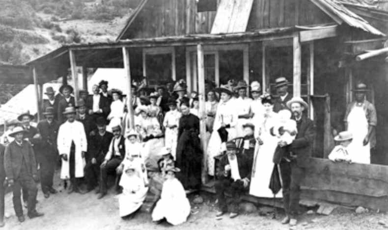
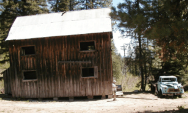
By 1890 Quartzburg supported several businesses including hotels, a boarding house, one or more a saloons, a store, a dance hall, a school and a stage stop. In addition, there were many homes including at least one mansion. Census records show that the population of Quartzburg varied between 91 and 128 from 1870 through 1910. By 1920 the population was 152. A fire in August 1929 destroyed most of Quartzburg, but the census population one year later was 181. The fire of 1931, which consumed the Gold Hill Mine mill, also burned every building in Quartzburg except the post office and store that still stand today. There are no 1940 census records for Quartzburg.
Today, Quartzburg and the Gold Hill Mine sit on 289 acres of private property purchased in 2005 by Don and Candy Miller, a Boise North End couple, who in turn sold it to Gold Hill Reclamation and Mining Company that began processing the estimated 180,000 tons of ore dug from the mine prior to its 1938 closure and left untouched in the intervening 71 years. Initially, it was estimated that $50 million worth of gold would be recovered from processing the ore. That remains to be seen since some of the processed ore contained no gold at all. The company is processing tailings from some of
the mines adjacent to the Gold Hill Mine, and it wants to handle the tailings from the Belshazzar Mine located on US Forest Service land and 1.5 southwest of Quartzburg on Granite Creek Road. [4]
The road to this private property on which Quartzburg and the Gold Hill Mine sits is gated, but Granite Creek Road from Placerville to the Belshazzar Mine remains open.
Pearl (Site #-3), which is located about 7 miles to the southwest of Horseshoe Bend and 9 miles to the east of Emmett, had a little later start and did not last as long as Quartzburg. Placer gold was discovered along Willow Creek, the future site of Pearl, as early as 1867, however the findings were rather meager and mining activities in the
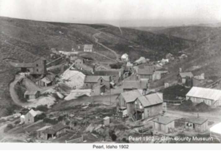
area were largely inactive until the panic of 1893. In 1894 the Pearl mining camp consisted of one cabin under a grove of cottonwood trees. It was occupied by cowboys as a summer cattle range headquarters. That same year, Dan Levan discovered a richer vane of ore that he began working on his own. He sold the claim to Colonel E. H. Dewey who began commercially to develop a mining operation. Pearl gold mines produced $30,000 in 1894 and $80,000 in 1896. [1]
As the mining camp grew, a post office was established in November 1895 and a two story boarding house followed a year later. By 1900 the US Census showed that 243 people lived in Pearl with single men outnumbering single women 75 to 8. There was also a variety of businesses to support the fledgling community (mercantile, drug store, livery stable, barber shop, shoemaker, butcher shop, saloon, stage and freight, and three hotels). In addition there were miners, millwrights, engineers, machinists, laborers, carpenters, farmers, wash-man and stenographer. In April 1903 Pearl received electricity from the power plant north of Pearl on the Payette River. The Checkmate Mine was the major producer in the area shipping ore and bullion via stage and freight to Emmett and then by rail to Nampa. Most mining production came from 1894 to 1908 resulting in about $2 million.
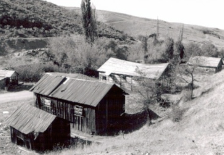
By 1910 Pearl’s population had declined by roughly half and much of the occupational diversity was gone. Gem County was formed in May 1915, including portions of Boise and Canyon counties, moving Pearl into the new county. In January 1920 the census showed on 40 people living in Pearl, and by 1940 there were only 21 listed in six households on the census records. [2,3]
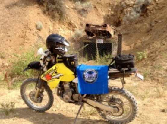
Today, the ghost town of Pearl no longer exists, with the last remaining buildings being razed in the spring of 2004. Nevertheless, it is still an enjoyable afternoon ride not far from downtown Boise (about 18 miles north northeast). Just before you get to old townsite of Pearl along the Pearl Road that follows North Fork Willow Creek, you will come to the remains of the Gem State Mine with a rusted out half buried auto body above the fenced mine entrance. A grove of trees stands near where the remaining buildings were razed in 2004, and tailings from some of the old mines in the area can be seen on the surrounding hillsides. The townsite of Pearl and old mines all lie on private property.
Andrew Mentzer, one of our club members, reporting on outdoor adventure spots wrote an article for the Boise Weekly about Pearl that appeared April 12, 2011. [4]
References for Quartzburg:
1. History of Gold Rush in Boise Basin. http://suite101.com/article/history-of-the-gold-rush-to-the-boise-basin-a141502
2. Quartzburg Preliminary Assessment Report, 2004. http://www.google.com/url?sa=t&rct=j&q=&esrc=s&source=web&cd=6&cad=rja&ved=0CEIQFjAF&url=http%3A%2F%2Fwww.deq.idaho.gov%2Fmedia%2F554041-_newinternet_waste_data_reports_mining_waste_quartzburg_pa_0904.pdf&ei=GCJYUL2DNKzqigLB3YCIg &usg=AFQjCNGbmUqtBwcAmux6gMU80Hvv1iEkcg
3. Payette Independent; August 5, 1904. http://boards.ancestry.com/localities.northam.usa.states.idaho.counties.boise/290/mb.ashx
4. Series of three articles in the Idaho Statesman; August 8, 2010, September 4 and 15, 2012.http://www.idahostatesman.com/2010/08/08/1295770/digging-for-chinese-gold-in-idaho.html
http://voices.idahostatesman.com/2012/09/04/rockybarker/gold_hill_producing_gold_historic_boise_basin_mine
http://www.idahostatesman.com/2012/09/15/2272575/gold-mining-with-a-green-twist.html
5. History of Belshazzar and Mountain Chief Mines, 2008. http://www.google.com/url sa=t&rct=j&q=&esrc=s&source=web&cd=1&cad=rja&ved=0CCIQFjAA&url=http%3A%2F%2Fwww.idahogeology.org%2FPDF%2FStaff_Reports_(S) %2F2008%2FS-08-.pdf&ei=SiVYUJi5DYnDigLWpYHgCw&usg=AFQjCNFFMpu1ZDUOrOxioNnmeMcLPp3zlA
References for Pearl:
1. Great Pearl Mining Camp. http://www.gemcountymuseum.org/history-greatpearlcamp.html
2. Pearl, Idaho. http://www.sevensummitsranch.com/?page_id=37
3. Pearl in the Early 1900s. http://www.gemcountymuseum.org/history-Pearl.html
4. Motojournal Entry No 1: Pearl, Idaho. http://www.boiseweekly.com/Cobweb/archives/2011/04/12/motojournal-entry-no-1-pearl-idaho