by Mike Anderson
Originally Published in the IAMC Newsletter, December 2012
(March 2012): “So are you going to get that Dempster thing out of your system or not? I don’t want you to look back and say, ‘I wish I had done that when I could have.’ You have new knees now, so get it done,” she said. I love my wife, but replied, “I don’t even have a bike.” “Well you know how to fix that!” was her retort.
OK, buy a bike – BMW GSA; never had one of those. Next, fix the seat. You would think, in today’s world, a motorcycle seat would fit straight from the factory. A trip to Fisher’s Upholstery in Eagle cured those ills. Next, buy a guide book to Alaska and Canada. Milepost is definitely the leading authority; $29.95 at Hastings. Next, talk to someone who has been there and done that. Dr. Olsen sent me some valuable information and a timeline in which to get it done. Next, visit Happy Trails and spend a little moola acquiring all the tidbits and service items I will need on the road. Trust me, you do not want to have to buy anything in Canada $$$$.
And so it began – the fulfillment of a dream ride that started in 2005.
“You’re going where?” was the question most of my friends asked, along with “How are you going to do that?” “Well, you go out the driveway and turn North,” was my reply, “and 2800 miles later you are there.”
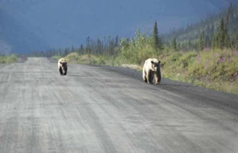
(July 2012): Ge]ng to the start of the Dempster Highway is the ride of a lifetime. Spence’s Bridge, The Glacier Highway, The Caribou Highway, The Cassiar Highway, The Klondike Highway, and The Alaskan Highway – roads to be enjoyed with all their beauty, and the hundreds of untouched lakes and wildlife.
Camping at Provincial Parks in Canada is economical: $20 in B.C., $15 in Yukon and $10 in NWT. Loonies are required for showers, which are $1 coins.
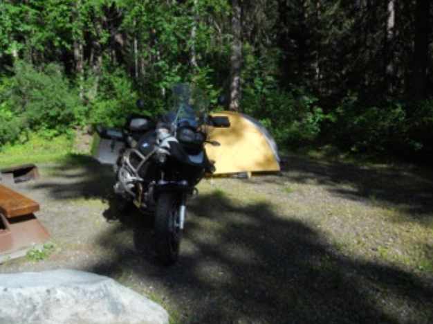
The campgrounds get more primitive the farther north you go. Surprisingly, you seem to get more for your money the farther north you go, free firewood and of course nicer views. One mistake I did make was the choice in color of my tent. Go with a darker color, such as dark green, as the sun doesn’t set and the gold accentuated the midnight sun.
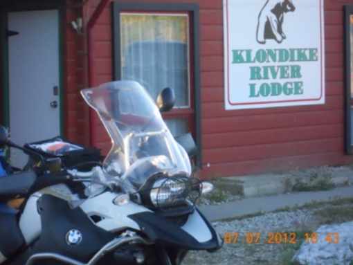
Ride north until you get to the Klondike River Lodge. I chose to stay here for the night (there is no darkness this time of year), do laundry and catch some sleep in a real bed before attempting the Dempster alone. All the horror stories about the Dempster were in the back of my mind. I was originally going to fly and rent a motorcycle, but the rental agencies will not rent for the Dempster anymore. In their words it is too much liability and too difficult to retrieve their broken bikes.
The Dempster Highway (Yukon Highway 5 and NWT Highway 8) is Canada’s greatest adventure road. Officially opened to the public on August 18, 1979, it is 736 km (457 miles) – each way – of mud, shale and bad weather, leading from just east Dawson City, Yukon, to Inuvik, in the North West Territories. It is the only all-weather public road in Canada that crosses the ArcHc Circle (at only 403 km into its total length), and it is the Mecca for motorcyclists hungry for adventure. For the past seven years, I have been single-minded in my quest to become one of those mud-soaked adventure riders.
The Dempster is a well-graded road that when dry, can be ridden as fast or as slow as a rider desires. My goal was to just keep moving as long as I felt good and as long the sun was out – that can be a rare event on the Dempster.
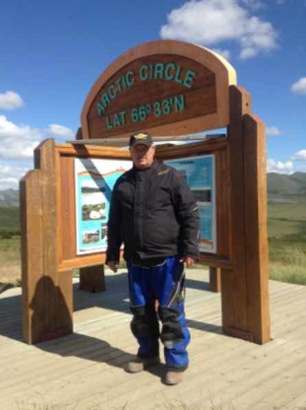
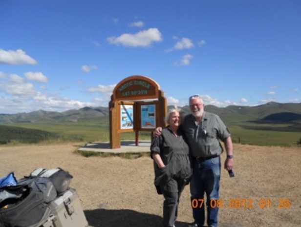
After stopping at Eagle Plains for a nice lunch, gas and a mandatory souvenir, I was off to the ArcHc Circle! Words cannot explain the feelings and memories of riding with my dad that overcame me at this point. Although he didn’t live to make the trip, we often talked about going.
A big thank you to Hans from Berlin, Germany for taking this picture. He spoke English well, and his wife spoke none. They were on holiday, and in their words “on the Holy Grail of adventure roads.”
From the Arctic Circle it was a dash up the Dempster to Inuvik. There were a couple of road blocks on the way. You just wait until they say you can continue, as they are at the top of the food chain.
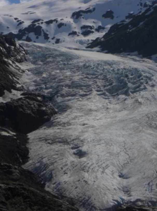
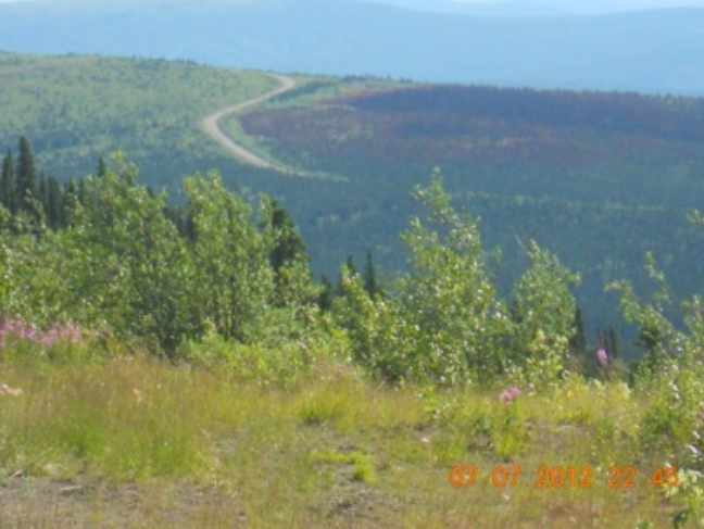
The views on the Dempster are something that will live in your memories for the rest of your life. When you look east and west from Eagle Plains, which is really a ridge in between the Oglivie and Richardson Mountains, you realize there is nothing out there east or west for 750 miles.
After crossing the Peel and then the Mackenzie Rivers on the ferries, it is a just a few hours to Inuvik on some straight gravel roads. Watch out for the truck traffic and pull over so you don’t get blasted with gravel. Speed limits are largely ignored by the locals. One of the ferry workers told me it was only a little over an hour ride to Inuvik from the ferry 125 miles away. OK.
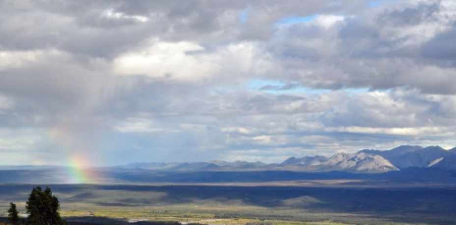
I stayed at the Nova Inn in Inuvik – rooms were $160 per night. In the hotel lobby, the tour guide to Tuktoyaktuk (shortened to Tuk) on the Beaufort Sea has a desk. This is where you can arrange to fly another 194 km (121 mi) north to Tuk and dip your toes in the Beaufort Sea. The cost is $450 for four hours. I slept well, as the rooms are set up for the midnight sun. When I awoke, the rain had set in. In the ArcHc, when the weather changes, it changes hard. From my vantage point above The Circle, I witnessed the northern horizon turn from endless summer to the monsoons of southern Asia overnight. I had planned to ride my motorcycle the Dempster’s whole length – come hell or high water; but common sense was tasking me to stay another day. Hence the forecast was for four days of this weather, and costs and scheduling would not allow me that long of a layover.
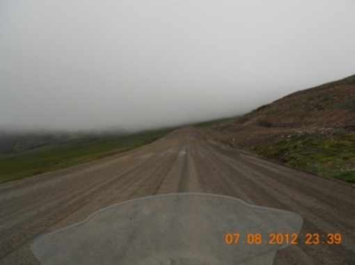
So off I went in the rain. The once hard- packed roads became chunky cake batter. My rear tire spun wildly and the 550 pounds of motorcycle I straddled told me it wanted to lie down and give up, with or without me. My helmet’s face shield was lousy with fog, but the rain whacked my eyes if I liued it. My hands were numb and useless – so much for waterproof gloves. Ahead, the clouds were sinister enough to shut out even the eternal sun of an ArcHc summer. Still, I continued south. When I leu Inuvik, a couple of young riders fell in with me, and we rode together to the Mackenzie River ferry. My pace was set to the conditions of the road. After the ferry ride across the river, the boys told me they wanted to pick up the pace, as they had plans in Dawson City that night. So we parted ways.
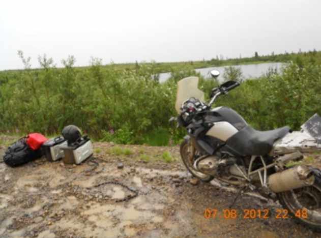
The result for riding too fast on an unknown road in the mud can be disastrous. As I came over a rise, I found one of the two young riders and his bike, a brand new BMW GS, spread out over about 50 yards. In the crash he had ripped the cylinder head open spilling oil into the mud puddle, broken his handlebars, and tore off one of his hand guards. He had no cylinder head protectors or crash bars on his bike; and he was only wearing a hoody, jeans and tennis shoes! Motorcycling north of 66 degrees is no sightseeing tour, no joke and no tourist-friendly amusement ride. Fortunately for him, Inuvik fire and rescue happened alone about 30 minutes after his wreck on their way to a training seminar in Dawson City, and they loaded him up; otherwise, he might still be there!
For the first time since leaving Caldwell, I felt my sense of safety slip away. Eagle Plains was still over a 100 miles away. As the fog began to lift and the rain started to let up, and with only one bar-swapping incident in 250 miles, my feeling of confidence began to return. It was a few more miles to a bowl of gut-warming soup at Eagle Plains, a fill-up of the tank on the GSA, and then six more hours to the Klondike Highway Junction and end of my return trip on the Dempster.
It was only 2300 miles to Caldwell from there – Piece of cake!
If you can dream it, you can do it.
Mike/tvbh40a
Editor’s Note: As Mike says, riding the Dempster is “no sightseeing tour, no joke and no tourist-friendly amusement ride.” The Dempster is a desolate nearly 500 mile stretch of dirt and gravel road between the Klondike River Lodge and Inuvik, a small community of about 3,500 people, with Eagle Plains (only a gas station with small motel and restaurant) positioned approximately midway between the two. Just how desolate is it? When I rode the Dempster in July 2010 and was in Inuvik, I looked through the phone book for possible restaurants. In addition to the few eating establishments listed for Inuvik, I noted several listed in the surrounding NWT community of Yellow Knife – 1,900 miles away by road and 690 miles away by air; and there is very li=le in the way of any civilization in-between the two.
If you plan to ride the Dempster, be well-prepared and well-equipped to handle a wide range of potential emergencies. Don’t be like the two young riders Mike encountered. If you break down, you really are on your own, and any help is a very long distance away. Though you can do it solo, as Mike did, I recommend riding the Dempster in a small group, even if that group is only one other rider. We took two days riding in and two days coming out, staying over at Eagle Plains each way. We also stayed two days in Inuvik. I would not recommend riding the entire Dempster in one day unless you are a very skilled and confident rider, like Mike.