By Alan Smutz
Originally Published in the IAMC Newsletter, October 2012
If you are like me, winter can be a bit of a drag. One way we (my wife Katy and me) have found to break the winter blues is to take a winter riding trip. One of our favorite winter destinations is Death Valley.
Winter can be a great time to visit Death Valley. Like any trip to a new place, a little preparation and knowledge can go a long way to insure a great trip.
We took our first trip to Death Valley between Christmas and New Year of 2009/2010. We like to take winter riding vacations and have been to Moab, Utah and Arizona in past years. The hardest part for us is figuring out where to go.
For our Death Valley trip we have to give credit to Tom, aka DesertDog for the idea. Unfortunately, Tom was not able to go on the trip with us, but once we had a destination in mind, the rest was history. We did a little research before the trip which helped a lot, but once we got there, found out we still had a lot to learn. The purpose of this article is not only to share information about our trip, but to assist you in planning your own winter time riding trip to Death Valley.
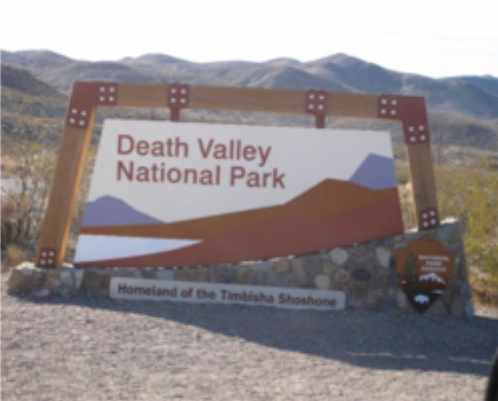
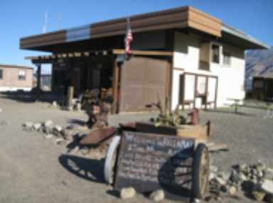
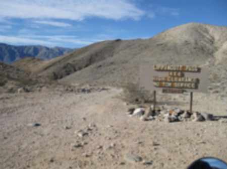
Planning your trip. A good place to start is with the National Park Death Valley Web Site [1]. It is full of information about Death Valley. One other thing I recommend is getting a copy of the Death Valley Backcountry Road map. This is different than the regular park map you get when you pay your park access fee. You have to specifically ask for the backcountry map. Unlike the regular map, it shows all of the legal roads and also gives a description of many of the roads. You can also view a copy of the map at Backcountry Map [2]. One other source of information is the book, Death Valley SUV Trails, by Roger Mitchell. It was written with 4 wheel drives in mind, but will still give you things to see and look for and a good idea of what the roads are like. We didn’t buy our copy until the first day we arrived at Death Valley at the gift shop at Scotty’s Castle. Having the book ahead of time would have been useful for planning each day’s ride.
Some important decisions before going. What bikes do you take? Bikes must be street legal to ride any roads in the park. Any good smaller dual sport with a 200 mile fuel range should work well for any of the routes we rode. Many of the backcountry roads are level 3 with a few level 4 spots thrown in. However, you will also have to ride a fair amount of pavement if you want to make any large loops like we did. Our bikes consisted of my BMW 650 X Challenge and Katy’s KTM 640 E. They served us well. A DRZ with a large fuel tank or similar bike should also work well.
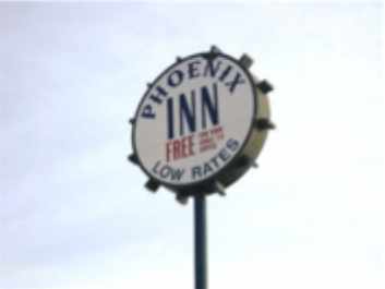
The second decision is where to stay. Camping or motels are two options. Camping is available in the park at Furnace Creek and Stovepipe Wells. Motels are also available at those two locations; however, the cost (in my opinion) is way too high to be practical for most of us. Reasonably priced motels are available in nearby Beatty, Nevada. If you choose to tent camp, remember that although it gets warm during the day, it can and does get down to below freezing at night. We chose to stay at the Phoenix Inn in Beatty. It worked well for us. Unless you really want to camp, I would recommend Beatty as the prices are reasonable and it is close enough to the good riding.
One other thing I recommend is a good GPS and getting ahold of some good tracks. Many of the backcountry roads are not marked that well. For example, without our GPS and tracks, we would have never found the Manson hideout as it was not marked at all. All of my Death Valley tracks are available.
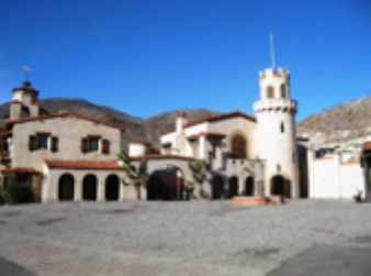
Day 1: Our first day at Death Valley we arrived at midday. Since we came in from the north, it was not too far out of our way to stop at Scotty’s Castle. We wanted to see it and felt it was worth the visit. If you are interested in those types of things and have a few extra hours to spare, it is worth seeing. By the time we got to our motel in Beatty, it was late in the day so we only did a very short ride to the nearby ghost town of Rhyolite. Be sure to see the “bottle house.”
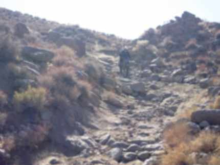
Day 2: Titus Canyon was our first ride of the day. Much of the road is one way from east to west. The road takes off near Beatty, so we rode directly
from the motel. This was the only day we rode from the motel. Titus Canyon is a good first backcountry road to ride in Death Valley. I would recommend anyone that has not ridden Death Valley to start with Titus Canyon.
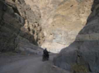
It is only moderately difficult at best, but will give you a little taste of riding in Death Valley without getting in over your head. After Titus Canyon, we then rode to the Emigrant Canyon/Wild Rose road and explored many sites in that area. Due to poor planning on my part, we ended up ridding and back tracking on a lot more pavement than I would have liked. That night in the motel room, I carefully studied the maps and GPS tracks I had and put together better loops for the rest of the week.
Day3: The day’s ride would be approximately 200 miles and would visit the last hideout of Charles Manson and his group. To save time and fuel range on the bikes, we trucked the bikes into the park and staged from a small parking area near the intersection of Furnace Creek, Stovepipe Wells and Scotty’s Castle. On all days except the day we rode Titus Canyon, we staged from somewhere in the park along the planned route. This saved us a lot of pavement riding and allowed us to ride in the comfort of the truck during the very cool early morning hours. It also saved us daylight riding time as we were there during the shortest days of the year and we could drive the truck in the dark and park and unload and get on the bikes at sunrise. It was a good thing we got an early start as it was nearly dark by the time we got back to the truck. We could also start our loops with full fuel tanks, which is very important in Death Valley. Even with trucking the bikes, we still had nearly 50 miles of pavement at the start of our loop. Our plan was to ride to Panamint Springs and top off our fuel tanks before hitting the dirt portion of the ride. Get to Panamint Springs and find the only gas station is out of gasoline.
Most Important Lesson for Death Valley. Don’t count on being able
to buy fuel or anything else you may want or need. Although fuel is supposed to be available at Panamint Springs and a few other locations, it is not always available as we found out.
In my opinion, the safest way is to just bring it yourself. Had we known there was no fuel at Panamint Springs, we could have taken a better route to the dirt. Lesson learned; we will never count on getting fuel at Panamint Springs again.
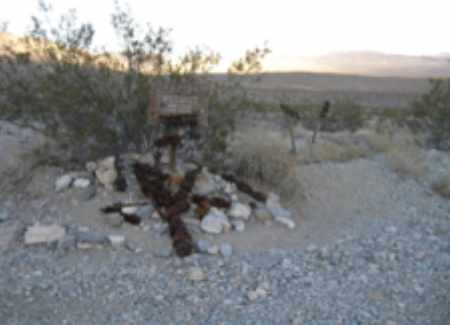
Soon after leaving Panamint springs, we said goodbye to pavement and took Indian Ranch road to the ghost town of Ballarat. Ballarat is worth taking the time to look around and buy a cold drink from the local store. From Ballarat we rode to Goler Wash. In Goler wash, take an unmarked road to the Manson hideout (also known as the Barker Ranch.) I was glad I had the GPS and tracks to show me the way. The actual house the Manson group lived in has burned, but you can still see lots of the hideout.
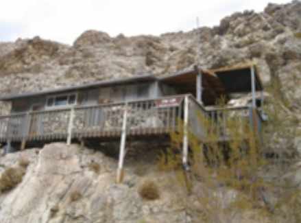
After leaving the Manson hideout, we reach Mengel Pass, one of the level 4 sections of road. As usual, Katy made it look easy. On the other side of Mengel Pass we passed several public use cabins. Most were occupied, but we were able to stop and see the stone Geologists Cabin. The cabins are available for public use on a first come basis. Most have a flag and if you are occupying a cabin you need to fly the flag which is the signal the cabin is occupied. After the cabins, we passed Stripped Butte on the way to Warm Springs camp where we looked at many old buildings. From there we dropped down in the actual valley of Death Valley. We took the west side road, which is dirt as opposed to the paved main road through the valley. At one point along this road, my GPS said the
elevation was 286 feet below sea level. After that, it was a few miles of pavement and back to the truck. We reached the truck just as the sun was setting and our fuel tanks were nearly empty.
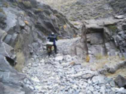
Day 4: This day ride started with Echo Canyon. Echo canyon is rated as one of the more difficult roads in Death Valley. Sections of the road are level 4. We staged at the Borax Works near Furnace creek as it looked like a safe place to leave the truck and was close to the start of Echo canyon. Beyond Echo Canyon is Lee’s Camp and then we rode a sand road that took us nearly back to Beatty. Had I planned things better, we could have ridden Titus Canyon and then Echo Canyon in one loop instead of the way we did. As it was, we then explored around the Chloride Cliffs before riding back down into the valley and to the truck. Since it was a short day, we drove into Pahrump for supplies and a great dinner at one of the casino buffets.
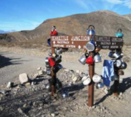
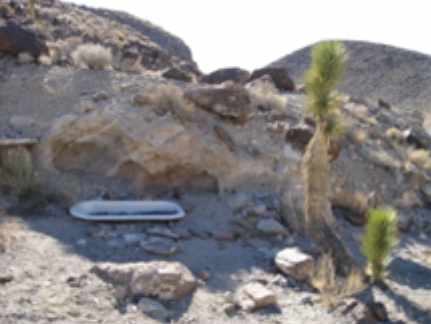
Day 5: We staged at Ubehebe Crater not far from Scotty’s Castle. As usual, we arrived just at sunrise and needed every minute of daylight we had. Our first stop was Teakettle Junction. From there we rode by the Racetrack where from the tracks they leave, it appears rocks move along the ground on their own. From there we rode to the Lippincott Mine and then to Lippincott Pass. While not as difficult as Echo Pass, it is still a level 3 to 4 road. Beyond Lippincott Pass is in the Saline valley. Across the Saline valley we turned onto an unmarked road that lead us to the Warm Springs area. (Again, I was thankful for the GPS and the tracks I had.) The Warm Springs area consists of Lower Warm Springs and a couple miles further is Palm Springs. Both areas are semi developed in that there are several soaking pools. Clothing is optional at both places, and from what we observed, most chose to forgo clothing while soaking in the hot spring pools. After Warm Springs we rode to Steel Pass. Near Steel Pass is Marble Bathtub.
Some interesting folklore about Marble bathtub is that the 1913 Ballarat quadrangle map and 1957 Dry mountain topo map showed a feature named Marble Bath. Many people searched for the land mark and were unable to locate it. After becoming frustrated, Wendell Moyer, who knew Saline valley very well, hauled an old claw foot tub to the place on the maps marked as Marble Bath and filled it with hundreds of blue marbles. Thus, those looking for the landmark could find it. Unfortunately, the National Parks did not share his humor and removed it. No one knows who provided the replacement.
We then rode down Dedeckera Canyon that leads to Eureka Dunes, the highest dunes in California. Beyond Eureka Dunes we rode to Crankshaft Crossing. It was several miles of fast dirt road back to the truck. As it was nearly sunset, we raced the last several miles as fast as we could. We arrived back at the truck when it was nearly dark. The day’s loop was approximately 140 miles, and less than 10 miles of it was pavement. All the days in Death Valley had been good, but this day was by far the best.
Day 6: We staged at a radar site near the town of Ballarat. We chose that spot as it was paved most of the way from the motel and still close to Ballarat. We rode through Ballarat and then turned up a steep canyon a few miles south of Ballarat. We stopped and looked at the Stone Cabin at Briggs Camp. We passed several more of the public use cabins today. Past Briggs camp, we rode an old hand built wagon road to South Park where we saw several wild burros. We then rode over Rogers Pass and down into Pleasant Canyon. We rode by Clair’s camp and then back down to Ballarat. This was the shortest loop of the trip, but was also the most technical. We had more riding planned for the day, but were both tired from all the days riding and decided to call it a day. It was our last day riding in Death Valley for that trip. A more complete write up of our Death Valley trip can be seen at: Steep and Rocky’s Death Valley Trip [3]
Death Valley is a big place and is also very remote. Except for the few popular touristy areas, we saw very few people while riding. Make sure both you and your bikes are well prepared. Help can be hard to contact and can take a long time to arrive. I strongly recommend never riding alone in this area. We experienced no bike breakdowns or other issues, but we were prepared and had means to fix flat tires and other common breakdowns. We carried extra water and some food, which you will likely need. We always started with full fuel tanks and had a 200 mile fuel range. It is quite cold in the mornings, but by midday, it was very warm and we were shedding most of our warm clothes. Dress appropriately. Just be prepared for any conditions and enjoy. Death Valley is a great place for a winter riding trip.
References:
1. Death Valley, The National Park Service. http://www.nps.gov/deva/index.htm
2. Death Valley Back Country Roads. http://www.nps.gov/deva/planyourvisit/maps.htm
3. Steep and Rocky’s Death Valley Trip. http://www.advrider.com/forums/showthread.php?t=536847
Editor’s Note: Alan and Katy Smutz’s GPS tracks for this ride are available for download from the Route Library on our club website (motoidaho.org). If you want to download the GPS, right click on it first and then save it to your computer where you can open it up into a Garmin or other compatible GPS mapping program or device.