
07 – War Eagle Mountain
War Eagle Mountain is an 8,051-foot mountain in Idaho’s Owyhee Mountains. It’s located in the Silver City Mining District, 70 miles southwest of Boise, Idaho.
The mountain is a historic resource for gold and silver. In 1862, the Oro Fino Vein was discovered, and by 1875, it had produced around 415,000 ounces of gold. In 1863, prospectors from Boise Basin towns found rich gold-silver quartz veins on the mountain.
War Eagle Mountain has a prominence of 853 feet and an elevation of 8,213 feet. The most common access route is Linehan Flat Road.
More Information
Idaho Magazine – War Eagle Mountain
Coordinates: 43.00684, -116.70459
Elevation: 8025 ft
Difficulty: 3
What to Expect: Rocky trails, stairsteps, steep sections
[reblex id=’779′]
Check In
Use the form below to check in. Check-ins must include a photo of you or your bike at the challenge site with the 2024 bandanna. All participants must be registered IAMC Challenge Members. Leave a description of your ride and share road conditions — snow, water, obstacles, and tips for future riders are all appreciated.
Replying to another person's check-in is encouraged, but take care not to accidentally create your own check-in.
The stated difficulty is an estimate. Rating your experience helps future riders stay safe. You alone are responsible for the safety of your ride.
23 Check-Ins
The Trail up to the tower is a bit rutted - watch for some babyheads. It was windy up there.


Well worth the trip up there. I went up the short direct way it was a little steep and rough to the peak probably a 3. I came down a way that was slightly longer but easier. But either way is worth the view.


Thanks to Alec for persuading me this was within my capabilities. The last few hundred yards are a little rocky and steep - but the exceptional view is worth the climb.

This has always been a cool spot both temp and stuff to look at. Side note I had 5G service but could not make a call. AT&T. I also found evidence that Special Ed had made it here before me 🙂


Big storm blowing over, rain, high winds. It's been so hot and dry lately. Picked the only day of the month with bad weather.

Incredible view. Awesome to get above 8k elevation. There are two ways up at the top to access the actual peak. Well worth the ride up there. It was a warm day and the breeze up there felt great. Visibility in the distance was hindered by smokey haze in the valleys but you could still see forever all around.

Thus was my favorite spot near Silver city. I took the harder entrance and it was fun. Spectacular views!

Great place to stop and take in the views. Took the harder way up, and the way way down, still not to difficult.


The challenge sites around Silver City were not too bad. Make sure you take the second road to get to the top of War Eagle, the first one is a really rough shortcut. Time Ahrens and I thought we could come back on Reynolds Creek road, not knowing that the upper portion is closed because it passes through private land. We wound up making our way down a really rough rutted and rocky road (5) but were fortunate to run into a skilled dirt biker in a RZR who helped us get through the last big hurdle.

I followed the grader up at about 0900 yesterday. It made for some very soft moon dust. I came back down at about 1700 and the dirt had already started to set up. No snow on the road all the way up.

Finally. Was thwarted by snow a couple of weeks ago, but the road is clear now. They have recently graded the road since my last attempt. Watch for hidden ruts, runnels, and rocks under the moon dust and sandy sections. Spun a complete 180 around a mellow corner due to major hidden rut under the loam and dust. Fun times!


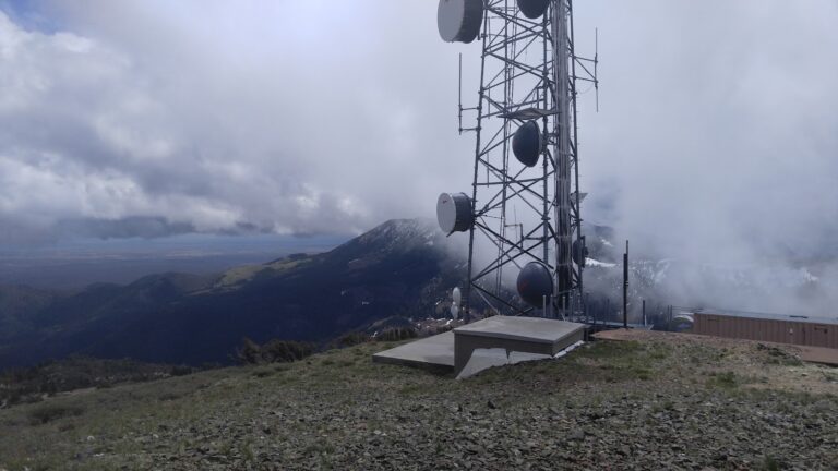
I went to this checkpoint with my dad right after we went to miners cabin. We had to go through some snow but other than the ride was pretty smooth. The view from up there is crazy, you can see for miles. there is a huge T-Mobile tower up there that is really cool.


So took the first right up to the peak after Miner's Cabin and it was a bit spicy but both made it fine (my friend was on a Kawi Z125...Grom-like...with street tires!). The easiest way up was the way we came down (Alex Crane's post has a good depiction of it). Once at the top SPECTACULAR VIEWS all around. It was a bit hazy off in the distance but man are the Owyhees a really beautiful place....I've overlooked the whole area and am finding out there's a lot to explore out there. I gave this a 3 only because of the straight-up approach we took from due south.....had we taken the loop-around to the west, then up past the little repeater site on the west slope I may have said 2.


This was a fantastic ride. After Miners Cabin we ran into some snow, but folks before us had cut us a decent trail so it wasn't too much trouble getting through. The ride all the way to this point was a 2 to 2.5. From this point on it's a solid 3, maybe a 3.5 in sections. For the last little bit the easiest way is the section marked in Red. You can see from our GPX file we took the first left which is a very small shortcut, but quite a bit more difficult. But it was really fun as well. Take the red path if you are unsure about the difficulty. We also followed the trail around to approach from the West, and it get's a bit hairy around the spot we turned around. Probably about the same as coming up from the South, perhaps a bit worse.
The view from here is spectacular, and the ride is probably one of my favorites all the way up.


finally able to get to war eagle. A couple of small snow banks and a final slightly rocky section


The Trail up to the tower is a bit rutted – watch for some babyheads. It was windy up there.
Awesome and fun stop!
Well worth the trip up there. I went up the short direct way it was a little steep and rough to the peak probably a 3. I came down a way that was slightly longer but easier. But either way is worth the view.
Nice capper to a Silver City day. Last 1\2 mile is the true 3.
Thanks to Alec for persuading me this was within my capabilities. The last few hundred yards are a little rocky and steep – but the exceptional view is worth the climb.
This has always been a cool spot both temp and stuff to look at. Side note I had 5G service but could not make a call. AT&T. I also found evidence that Special Ed had made it here before me 🙂
I took the back way to War Eagle, nice cool day for a ride
Big storm blowing over, rain, high winds. It’s been so hot and dry lately. Picked the only day of the month with bad weather.
Incredible view. Awesome to get above 8k elevation. There are two ways up at the top to access the actual peak. Well worth the ride up there. It was a warm day and the breeze up there felt great. Visibility in the distance was hindered by smokey haze in the valleys but you could still see forever all around.
Thus was my favorite spot near Silver city. I took the harder entrance and it was fun. Spectacular views!
Great place to stop and take in the views. Took the harder way up, and the way way down, still not to difficult.
Nice and easy ride up to War Eagle this morning. Snow is all gone.
The challenge sites around Silver City were not too bad. Make sure you take the second road to get to the top of War Eagle, the first one is a really rough shortcut. Time Ahrens and I thought we could come back on Reynolds Creek road, not knowing that the upper portion is closed because it passes through private land. We wound up making our way down a really rough rutted and rocky road (5) but were fortunate to run into a skilled dirt biker in a RZR who helped us get through the last big hurdle.
I followed the grader up at about 0900 yesterday. It made for some very soft moon dust. I came back down at about 1700 and the dirt had already started to set up. No snow on the road all the way up.
Finally. Was thwarted by snow a couple of weeks ago, but the road is clear now. They have recently graded the road since my last attempt. Watch for hidden ruts, runnels, and rocks under the moon dust and sandy sections. Spun a complete 180 around a mellow corner due to major hidden rut under the loam and dust. Fun times!
First time up to War Eagle, Wow what a view!
I went to this checkpoint with my dad right after we went to miners cabin. We had to go through some snow but other than the ride was pretty smooth. The view from up there is crazy, you can see for miles. there is a huge T-Mobile tower up there that is really cool.
So took the first right up to the peak after Miner’s Cabin and it was a bit spicy but both made it fine (my friend was on a Kawi Z125…Grom-like…with street tires!). The easiest way up was the way we came down (Alex Crane’s post has a good depiction of it). Once at the top SPECTACULAR VIEWS all around. It was a bit hazy off in the distance but man are the Owyhees a really beautiful place….I’ve overlooked the whole area and am finding out there’s a lot to explore out there. I gave this a 3 only because of the straight-up approach we took from due south…..had we taken the loop-around to the west, then up past the little repeater site on the west slope I may have said 2.
Nice view
had to get through some snow but worth it for the view
This was a fantastic ride. After Miners Cabin we ran into some snow, but folks before us had cut us a decent trail so it wasn’t too much trouble getting through. The ride all the way to this point was a 2 to 2.5. From this point on it’s a solid 3, maybe a 3.5 in sections. For the last little bit the easiest way is the section marked in Red. You can see from our GPX file we took the first left which is a very small shortcut, but quite a bit more difficult. But it was really fun as well. Take the red path if you are unsure about the difficulty. We also followed the trail around to approach from the West, and it get’s a bit hairy around the spot we turned around. Probably about the same as coming up from the South, perhaps a bit worse.
The view from here is spectacular, and the ride is probably one of my favorites all the way up.
I made it through the snow drift! What a cool ride and an amazing view.
finally able to get to war eagle. A couple of small snow banks and a final slightly rocky section
Comments are closed.