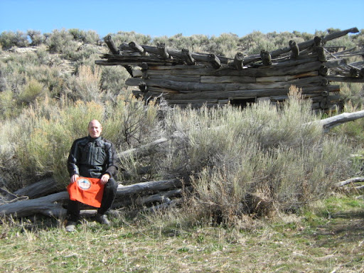
16 – Doyle Place Cabin
No info for this site.
More Information
Links to Additional Info
Coordinates: 42.84519, -116.33399
Elevation: 4176 ft
Difficulty: 3
What to Expect: No info
[reblex id=’779′]
Check In
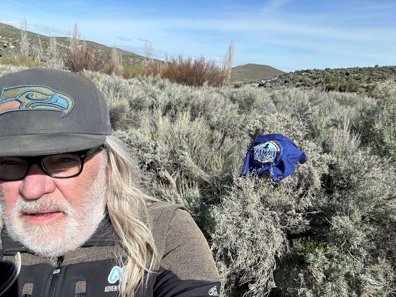
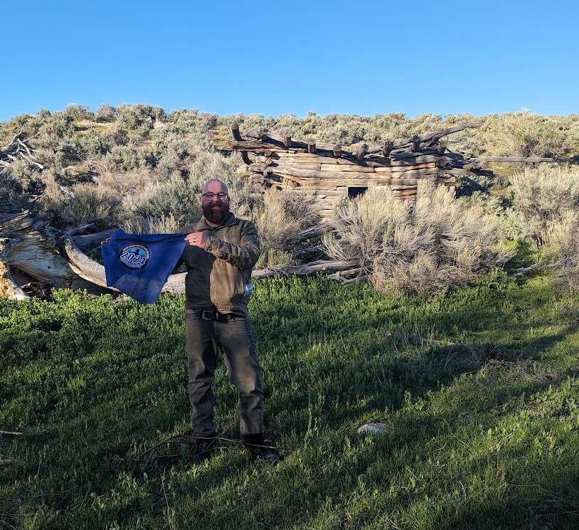
Use the form below to check in. Check-ins must include a photo of you or your bike at the challenge site with the 2024 bandanna. All participants must be registered IAMC Challenge Members. Leave a description of your ride and share road conditions — snow, water, obstacles, and tips for future riders are all appreciated.
Replying to another person's check-in is encouraged, but take care not to accidentally create your own check-in.
The stated difficulty is an estimate. Rating your experience helps future riders stay safe. You alone are responsible for the safety of your ride.
20 Check-Ins
It was a bit hard to find. I wandered around for 20 minutes and stumbled across the cabin at the Northwest end of a clearing near the bend in the road to the left and then crosses a revine. Tthe clearing was to the west & a bit North of the bend in the road. Cool hut! Road there is well maintained for most of the way there. Starts getting a little sketchy just about the time you get to the cabin.


Walked in the last bit off the two track. Made for a great ride. A little rain held the dirt together. Would have like to work this into a big south desert loop, but not today.

Never noticed the 2nd cabin across the stream before. Doyles neighbors?

I took the day off to knock of several outstanding challenge sites. Rode the back country byway for the first time. Rained last night, roads soupy and slippy. I was 2-up with my wife. We had a great time.

The road in is a lot better than it was in years past. The last part is a two track which will make it a 3.


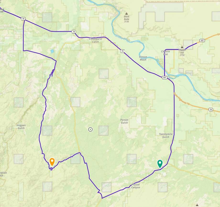
2nd stop on our overnighter out in the Owyhee/Jordan Valley/Silver City area. Easy trek to Cabin via gravel road off of MudFlat road. Took small two track across range, heading southwesterly, to reconnect to MudFlat road

This was a beautify spot, hidden away. I came up from the south, so it was just a level 2.


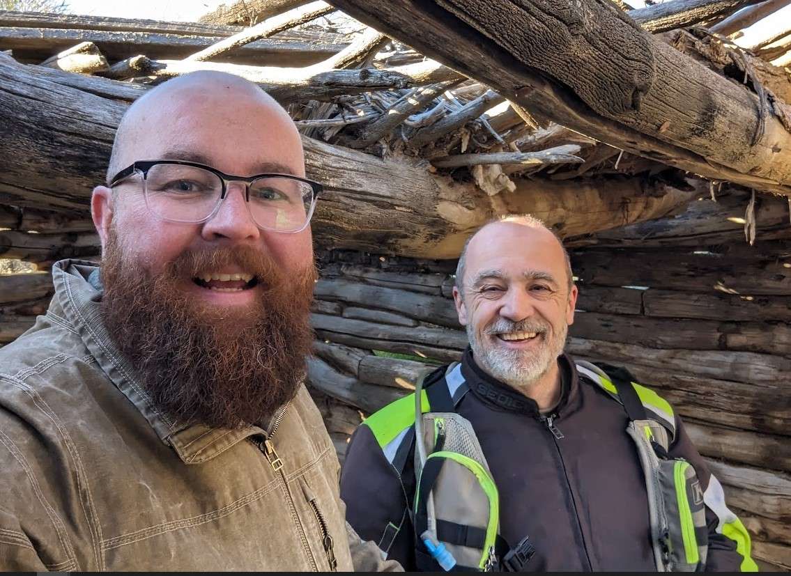
Got this one today with my friend Phillip, who rides a Kawi Z125 (looks like a Honda Grom.....and he still has the stock street tires on it!! Rode all this gravel, plus a very wet and watery sand wash, like a champ!!). 2 up until the little spur road with the water crossing that leads to the front yard of the place...then 3. There's also a geo-cache box in the rocks behind and above the cabin. Interesting collection of stuff including someone's beard wax.


What a cool place. I was just imagining what it must have been like when cabin was in great shape and that giant tree next to it was still standing. It must have been quite the nice oasis in the middle of the desert


Nice ride. Interesting. Park before you get to the creek (east) and walk in.
Photos will not load.
Nice ride past Shoo fly in. If you expand the picture you can see the cabin in the background. There was a vary vocal murder cow guarding the place. As I was alone I honored the warning and got no closer. Rode the Oreana cut road north out of there. Pretty good shape
Doyle's Place Cabin has been the most challenging site I have hit so far this year. You can approach it from two different ways, depending on your desired difficulty. Coming in from the north is solid into level 3 territory, but you can also come in from the south which is a level 2 except for the last 100 yards or so. I did both on my 1200GS which is about the limit for what I'm going to try on the larger bike.
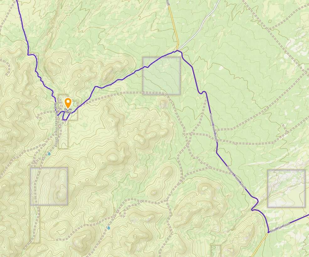
To come in from the North take 78 and get off at Oreana Loop Rd. Follow that around for about 7.5 miles and then head south when it T's at Castle Creek Road. About a half mile from there is track that will take you all the way there. You will need to go through a couple of gates. If following my GPX file be sure to be zoomed out far enough to know when we took a couple of wrong turns and had to back track. We did plenty of that on this ride. From there it's about 12 miles of gradually increasing difficulty right up until the end. The last 3 miles are the hardest with uneven roads, large gravel, patches of sand, rocky terrain, etc.
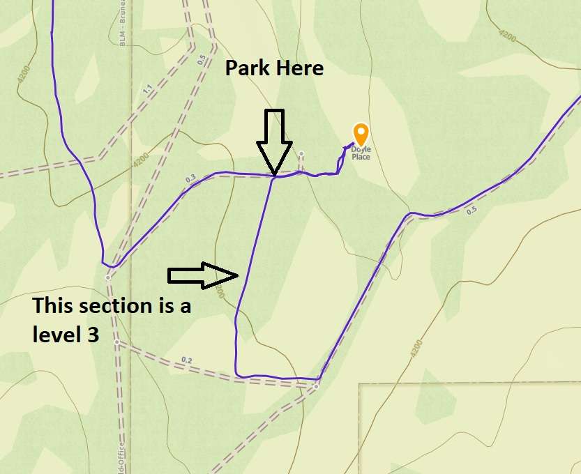
Once you get to Doyle Place Cabin park at the top of the hill and walk down to know what you are getting into. This is what our group did, it's about 50 or so yards at the end. There is a small creek you need to cross, but I wouldn't advise trying to get a bike through unless you are braver than I am.
When leaving we went East which took us to Poison Creek Cutoff. For folks wanting a bit easier route I would suggest coming in from this direction. The road from the direction was much easier, with only a few minor washouts. I would rate it a heavy 2.
Say hi to the cows on the way out. They are very friendly.
From there we headed over to Shoo Fly thinking about cheeseburgers.
EDIT: Look in my replies for the GPX file.
It was a bit hard to find. I wandered around for 20 minutes and stumbled across the cabin at the Northwest end of a clearing near the bend in the road to the left and then crosses a revine. Tthe clearing was to the west & a bit North of the bend in the road. Cool hut! Road there is well maintained for most of the way there. Starts getting a little sketchy just about the time you get to the cabin.
Amazing
Nice fast dirt road.
Walked in the last bit off the two track. Made for a great ride. A little rain held the dirt together. Would have like to work this into a big south desert loop, but not today.
Never noticed the 2nd cabin across the stream before. Doyles neighbors?
I took the day off to knock of several outstanding challenge sites. Rode the back country byway for the first time. Rained last night, roads soupy and slippy. I was 2-up with my wife. We had a great time.
The road in is a lot better than it was in years past. The last part is a two track which will make it a 3.
I picked up 4 sites today, this one was my first.
Continuing on the Cabin and Cemetery Tour with a stop at Doyle’s Place.
2nd stop on our overnighter out in the Owyhee/Jordan Valley/Silver City area. Easy trek to Cabin via gravel road off of MudFlat road. Took small two track across range, heading southwesterly, to reconnect to MudFlat road
This was a beautify spot, hidden away. I came up from the south, so it was just a level 2.
Got this one today with my friend Phillip, who rides a Kawi Z125 (looks like a Honda Grom…..and he still has the stock street tires on it!! Rode all this gravel, plus a very wet and watery sand wash, like a champ!!). 2 up until the little spur road with the water crossing that leads to the front yard of the place…then 3. There’s also a geo-cache box in the rocks behind and above the cabin. Interesting collection of stuff including someone’s beard wax.
The road in was in pretty good shape!
Great ride in and definitely a 2 if you’re coming from Mud Flat Rd.
What a cool place. I was just imagining what it must have been like when cabin was in great shape and that giant tree next to it was still standing. It must have been quite the nice oasis in the middle of the desert
The cows didn’t seem to enjoy my company
Nice ride. Interesting. Park before you get to the creek (east) and walk in.
Photos will not load.
Pare Here to walk to the cabin: 42.84425, -116.33305
Nice ride past Shoo fly in. If you expand the picture you can see the cabin in the background. There was a vary vocal murder cow guarding the place. As I was alone I honored the warning and got no closer. Rode the Oreana cut road north out of there. Pretty good shape
Doyle’s Place Cabin has been the most challenging site I have hit so far this year. You can approach it from two different ways, depending on your desired difficulty. Coming in from the north is solid into level 3 territory, but you can also come in from the south which is a level 2 except for the last 100 yards or so. I did both on my 1200GS which is about the limit for what I’m going to try on the larger bike.
To come in from the North take 78 and get off at Oreana Loop Rd. Follow that around for about 7.5 miles and then head south when it T’s at Castle Creek Road. About a half mile from there is track that will take you all the way there. You will need to go through a couple of gates. If following my GPX file be sure to be zoomed out far enough to know when we took a couple of wrong turns and had to back track. We did plenty of that on this ride. From there it’s about 12 miles of gradually increasing difficulty right up until the end. The last 3 miles are the hardest with uneven roads, large gravel, patches of sand, rocky terrain, etc.
Once you get to Doyle Place Cabin park at the top of the hill and walk down to know what you are getting into. This is what our group did, it’s about 50 or so yards at the end. There is a small creek you need to cross, but I wouldn’t advise trying to get a bike through unless you are braver than I am.
When leaving we went East which took us to Poison Creek Cutoff. For folks wanting a bit easier route I would suggest coming in from this direction. The road from the direction was much easier, with only a few minor washouts. I would rate it a heavy 2.
Say hi to the cows on the way out. They are very friendly.
From there we headed over to Shoo Fly thinking about cheeseburgers.
EDIT: Look in my replies for the GPX file.
Here is the GPX File.
went in the back way, fun but a bit sandy.
Comments are closed.