
18 – Paddock Valley Dam
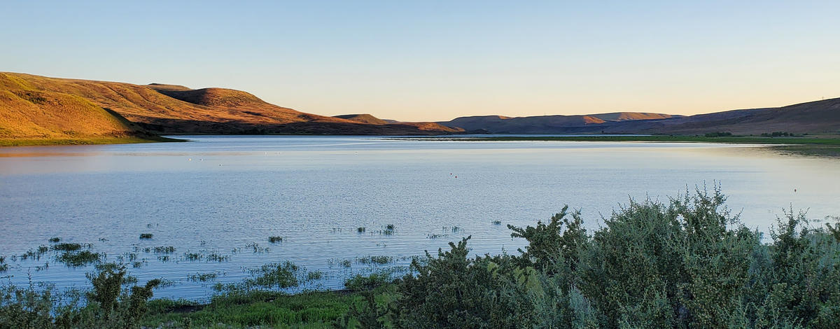
Paddock Valley Dam is an earthen dam in Washington County, Idaho, built in 1949 by the Little Willow Irrigation District. Paddock Valley Reservoir is a 1,500-acre irrigation reservoir located in the remote foothills of Washington County..
More Information
Links to Additional Info
Coordinates: 44.19790, -116.59903
Elevation: 3222 ft
Difficulty: 3
What to Expect: No info
[reblex id=’779′]
Check In
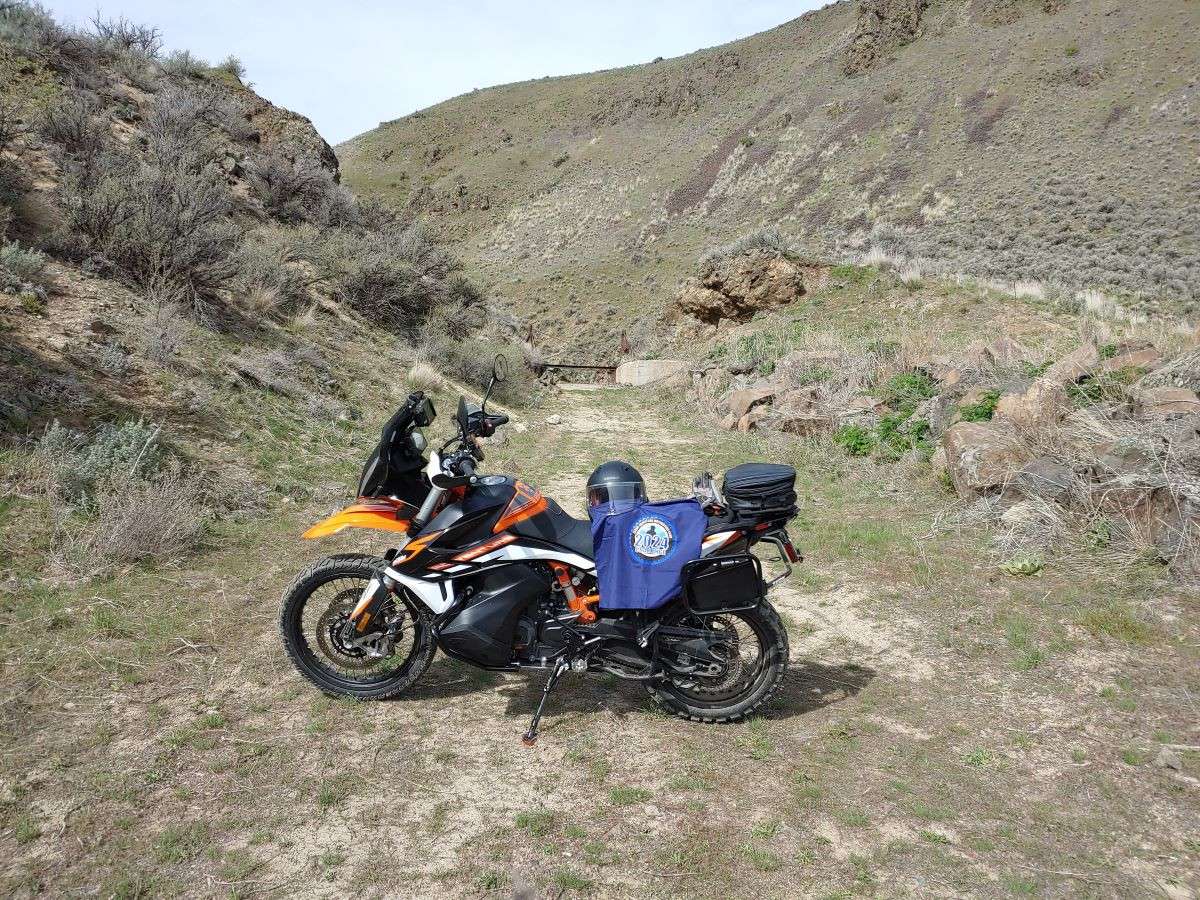
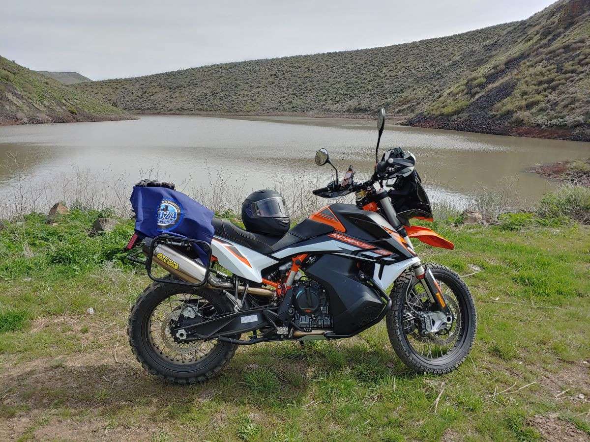
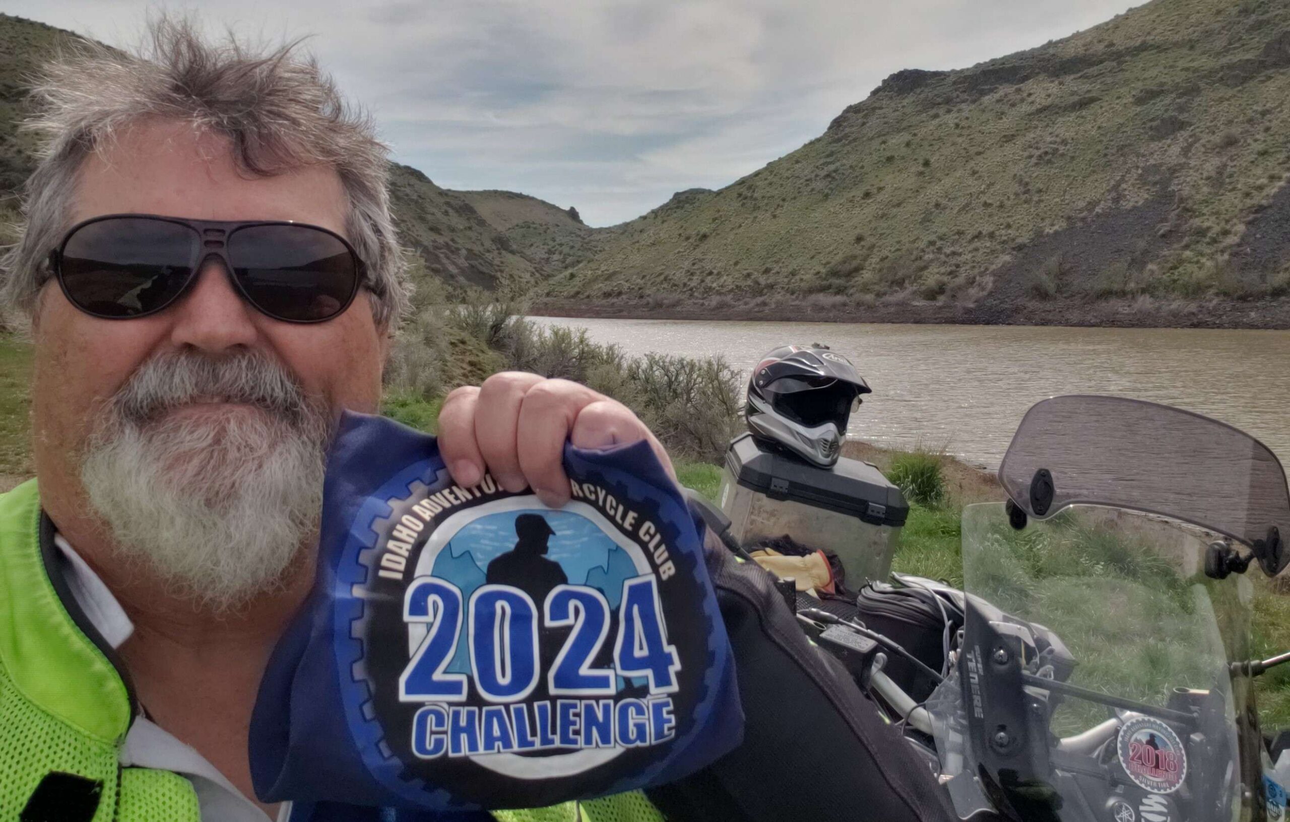
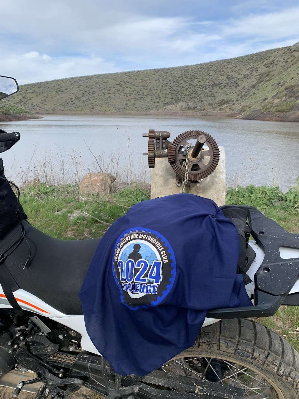
Use the form below to check in. Check-ins must include a photo of you or your bike at the challenge site with the 2024 bandanna. All participants must be registered IAMC Challenge Members. Leave a description of your ride and share road conditions — snow, water, obstacles, and tips for future riders are all appreciated.
Replying to another person's check-in is encouraged, but take care not to accidentally create your own check-in.
The stated difficulty is an estimate. Rating your experience helps future riders stay safe. You alone are responsible for the safety of your ride.
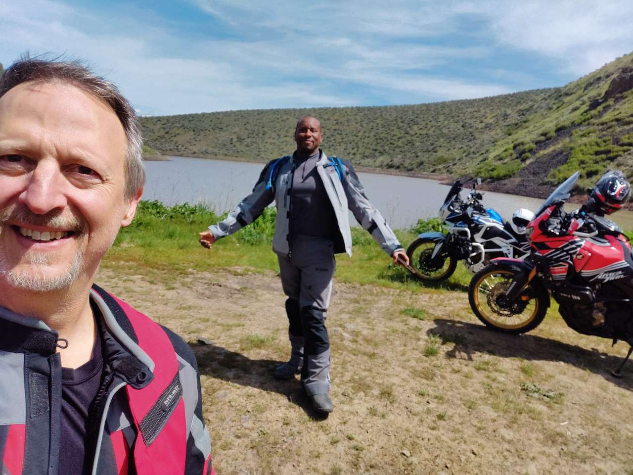
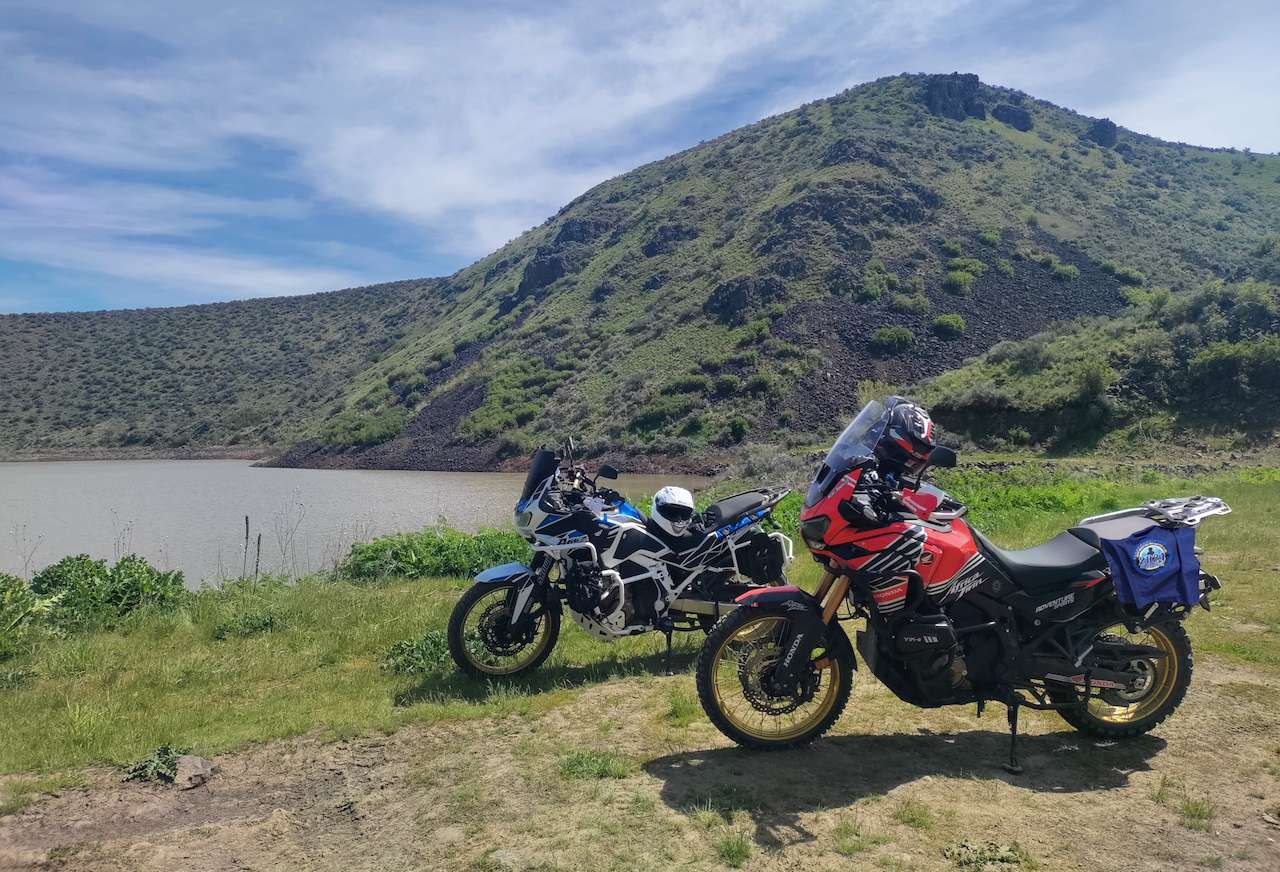
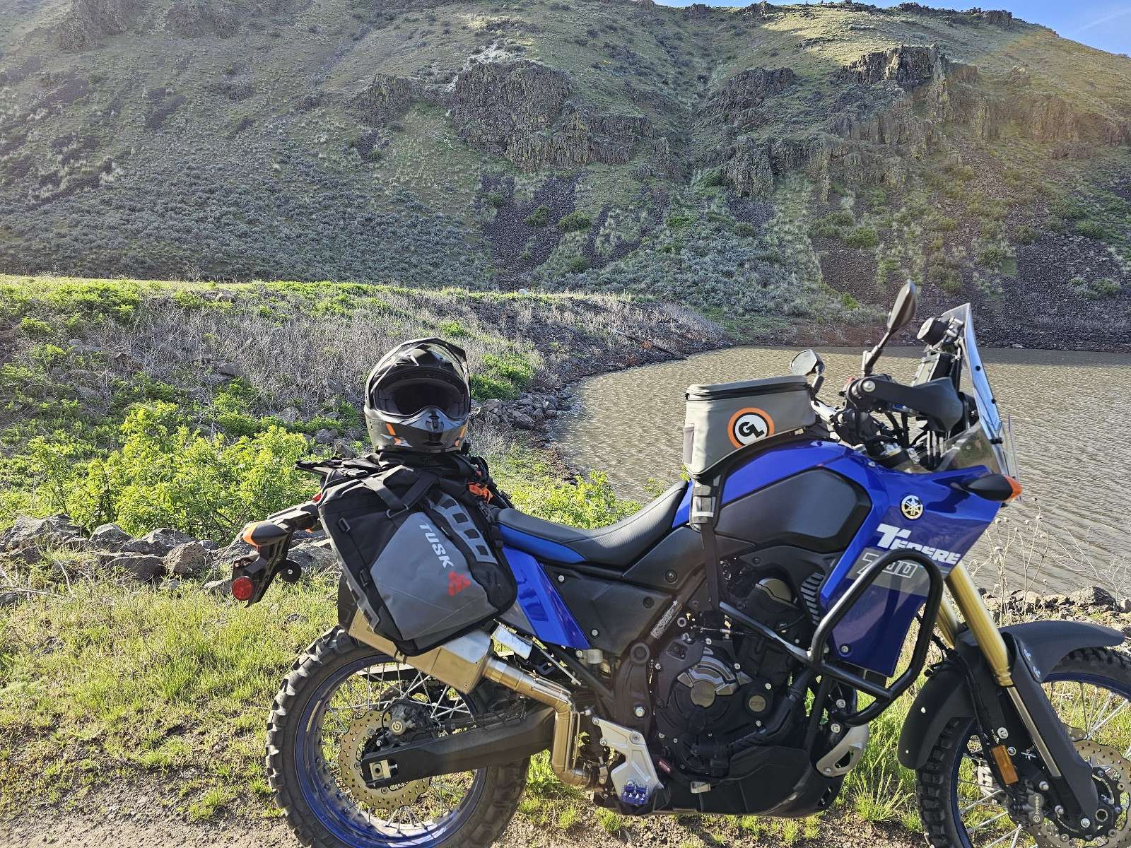
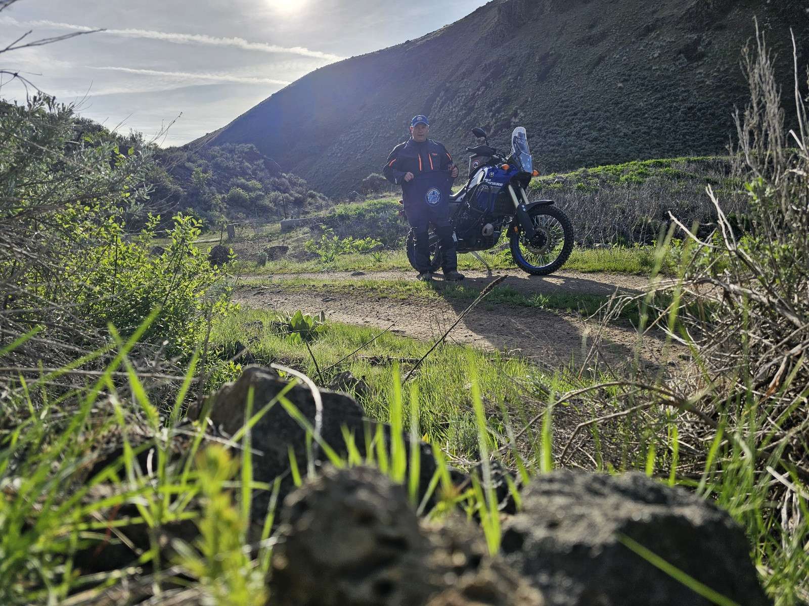
23 Check-Ins
Nov. 6th smooth ride to what feels like a forgotten place. Time to buy heated grips.


I came in right after Dusty1 I saw his fresh tracks. it got burnt pretty good.

Did this ride solo after the fires burned through. I opted not to take the final trail and stick to the road to the reservoir since the area is still pretty sensitive. Nothing hard, but the road does have some rocks and ruts.

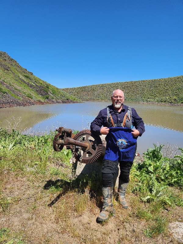
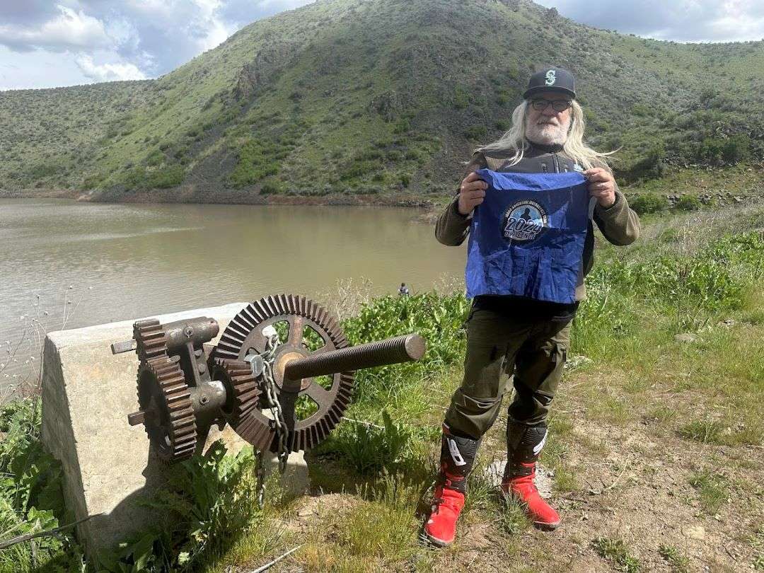
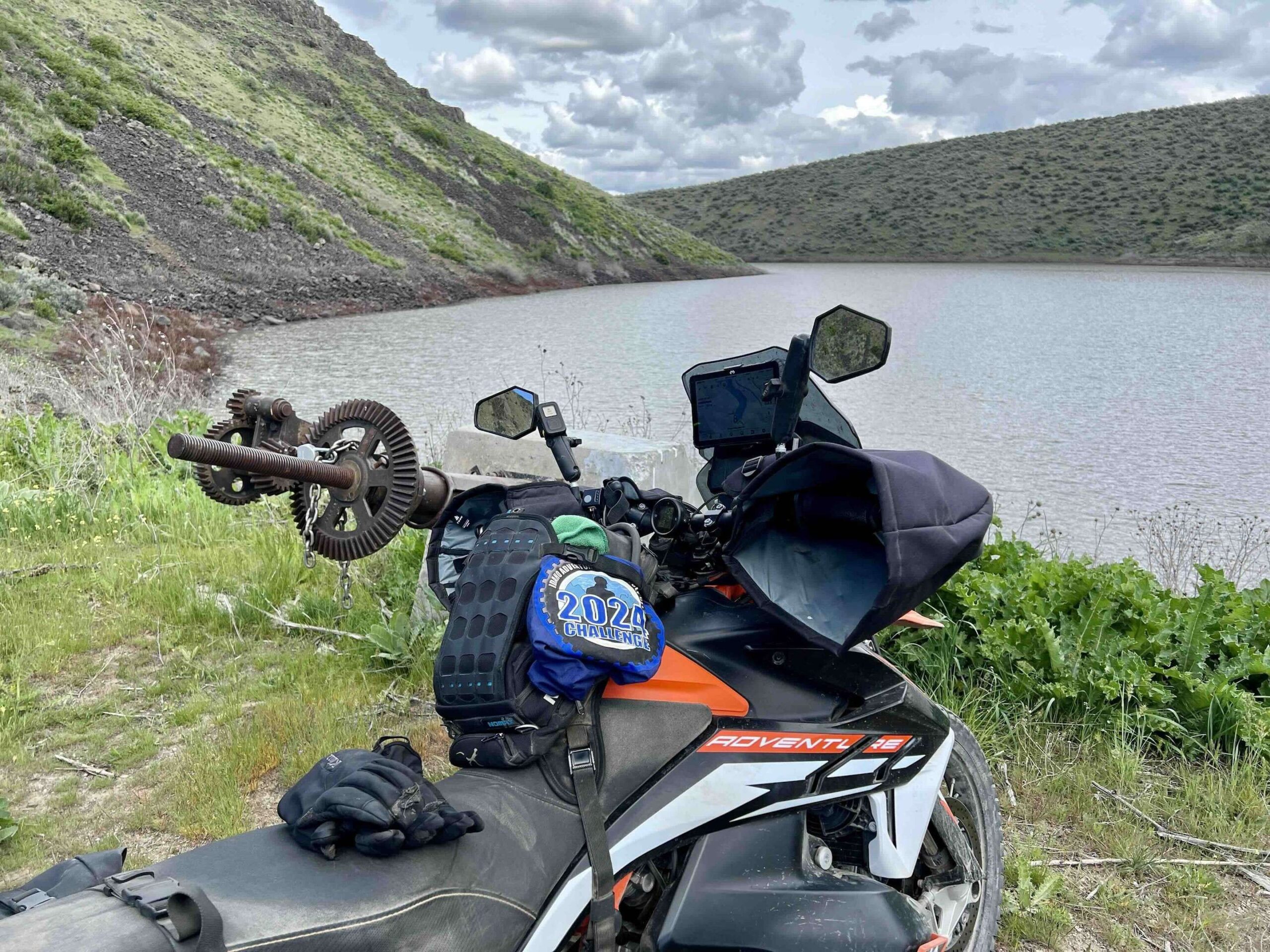
There were a couple of pickups parked next to the valve so I didnt get a close up pic but I included the dam and sign


Fun ride. From Emmet I went up Van Deusen Road where it changes to gravel fairly soon. Roads are well maintained, but be careful around the sandy sections. After a while it will turn into Big Willow Road, and then Dry Creek Road. Then you will hit Little Willow Road where it turns back to pavement for a bit. When you hit Paddock Valley Road it goes back to gravel, and this section of the road has some fairly deep ruts but it's still about a 2 for difficulty.
The last little trail is much rockier at a 3. I made it on the GS just fine, but if you want to stay on Paddock Valley Road you can go a bit further and go to the East side of the reservoir and get your picture there.


Interesting site, what with the concrete dam just downstream from the earthen dam where the pic was taken. Having seen everyone else's picture with that valve in the background, I just assumed that the valve was some sort of relic of the past. Now I'm convinced that it actually works (thus the chain and lock on it) and allows that flow of water downstream (for irrigation purposes??). Anyway...cool site (in a 100 degree temp sort of way today). I'm saying 2 on the rating because the gravel getting to this site was pristine, and the two-track to get the final mile was as pristine as a rocky two-track can get.


Nice evening ride out to the dam. Happy to be learning about all these tucked away places.


Missed the turn and went to the other side of the reservoir. Nice ride out along windy roads.


Roads were in great shape and didn't see anyone out at all. The approach to the dam was a bit rutted and rocky. Still, quiet and blue skies!

Starting to warm up! Gravel road to two track turn is in great shape. Nice breeze to keep the dust down

We did some rugged cross country on a ranch road to get here, but took the main road back out. It was fun, but challenging the way we went!

Never been down this valley before. Nice ride with good sweepers on the pavement. Missed the turn on the way in to the dam but grabbed a picture at the reservoir. Then ran into Dan Huff on the way out and he guided me to the dam, where the final picture was taken. Much appreciated.
This is an interesting place to visit. It is a long gravel road to get there. Just the last half mile or so down to the dam is a bit steep and rocky but nothing too difficult.
Was windy but otherwise a great day. Was dry everywhere that actually went to the dam. We did some extra exploring and got into some mud but had to almost seek it out. The gravel road was in good shape and gradually got rougher the farther in you went. Then the 2-track going to the dam was in good shape just a bit narrow and rocky.
It was just a short ride from the house, about 31 miles. The hardest part if the ride was fighting the wind to try to get a picture
Nice ride, took a side trail down into a canyon. When I found the right trail, it got a lot easier. Glad I went before the snakes came out. Gravel road then a two-track road last 2 miles.
The Dam was a no-go for me, in my 70th year, on a 1200cc beast and all alone... the road into the dam is a two track, deaply rutted jeep road that I would never attempt alone on the beast and even with company, I'd want a much smaller bike. I could see the two track trail going over the hill but had no idea what the road was like on the other side of that hill and being all alone, I passed. I got my pic at the boat ramp. The last three or four miles of the regular road before the reservior are pretty rutted from the rains... I'd rate that portion a class 2+...
I enjoyed the ride and went by way of Emmett, VanDuesen/Big Flat Rd to Sucker Creek RD to Dry Creek Rd and finally Little Willow Rd up to Paddock Res. This was a very fun ride and I highly recommend it! Best part of my 219 mile day!... But be aware that what google maps calls "North Washington Ave" is signed as "VanDuesen/Big Flat Rd"... and what google maps calls "Bluf Rd" is signed as "Sucker Creek rd"... other than that, google and the signs agreed. this is the route I rode and I highly recommend it! Very fun! https://maps.app.goo.gl/dhocAaVquYLYYcNJ8
Conditions were perfect. All the mud is dried up. That said this ride gets more difficult the closer you get to the challenge point. I came back via dry creek, big willow creek, succor creek. These roads were also in great shape and the hills are as green as they can get
Not impressed
Nov. 6th smooth ride to what feels like a forgotten place. Time to buy heated grips.
Cool little reservoir. Easy dirt road ride.
I came in right after Dusty1 I saw his fresh tracks. it got burnt pretty good.
Did this ride solo after the fires burned through. I opted not to take the final trail and stick to the road to the reservoir since the area is still pretty sensitive. Nothing hard, but the road does have some rocks and ruts.
There were a couple of pickups parked next to the valve so I didnt get a close up pic but I included the dam and sign
Fun ride. From Emmet I went up Van Deusen Road where it changes to gravel fairly soon. Roads are well maintained, but be careful around the sandy sections. After a while it will turn into Big Willow Road, and then Dry Creek Road. Then you will hit Little Willow Road where it turns back to pavement for a bit. When you hit Paddock Valley Road it goes back to gravel, and this section of the road has some fairly deep ruts but it’s still about a 2 for difficulty.
The last little trail is much rockier at a 3. I made it on the GS just fine, but if you want to stay on Paddock Valley Road you can go a bit further and go to the East side of the reservoir and get your picture there.
Nice ride in. Fun going 2 up.
Interesting site, what with the concrete dam just downstream from the earthen dam where the pic was taken. Having seen everyone else’s picture with that valve in the background, I just assumed that the valve was some sort of relic of the past. Now I’m convinced that it actually works (thus the chain and lock on it) and allows that flow of water downstream (for irrigation purposes??). Anyway…cool site (in a 100 degree temp sort of way today). I’m saying 2 on the rating because the gravel getting to this site was pristine, and the two-track to get the final mile was as pristine as a rocky two-track can get.
Nice evening ride out to the dam. Happy to be learning about all these tucked away places.
Nice road in
Missed the turn and went to the other side of the reservoir. Nice ride out along windy roads.
This was right before I biffed.
Roads were in great shape and didn’t see anyone out at all. The approach to the dam was a bit rutted and rocky. Still, quiet and blue skies!
Starting to warm up! Gravel road to two track turn is in great shape. Nice breeze to keep the dust down
We did some rugged cross country on a ranch road to get here, but took the main road back out. It was fun, but challenging the way we went!
Never been down this valley before. Nice ride with good sweepers on the pavement. Missed the turn on the way in to the dam but grabbed a picture at the reservoir. Then ran into Dan Huff on the way out and he guided me to the dam, where the final picture was taken. Much appreciated.
This is an interesting place to visit. It is a long gravel road to get there. Just the last half mile or so down to the dam is a bit steep and rocky but nothing too difficult.
Was windy but otherwise a great day. Was dry everywhere that actually went to the dam. We did some extra exploring and got into some mud but had to almost seek it out. The gravel road was in good shape and gradually got rougher the farther in you went. Then the 2-track going to the dam was in good shape just a bit narrow and rocky.
It was just a short ride from the house, about 31 miles. The hardest part if the ride was fighting the wind to try to get a picture
Nice ride, took a side trail down into a canyon. When I found the right trail, it got a lot easier. Glad I went before the snakes came out. Gravel road then a two-track road last 2 miles.
The Dam was a no-go for me, in my 70th year, on a 1200cc beast and all alone… the road into the dam is a two track, deaply rutted jeep road that I would never attempt alone on the beast and even with company, I’d want a much smaller bike. I could see the two track trail going over the hill but had no idea what the road was like on the other side of that hill and being all alone, I passed. I got my pic at the boat ramp. The last three or four miles of the regular road before the reservior are pretty rutted from the rains… I’d rate that portion a class 2+…
I enjoyed the ride and went by way of Emmett, VanDuesen/Big Flat Rd to Sucker Creek RD to Dry Creek Rd and finally Little Willow Rd up to Paddock Res. This was a very fun ride and I highly recommend it! Best part of my 219 mile day!… But be aware that what google maps calls “North Washington Ave” is signed as “VanDuesen/Big Flat Rd”… and what google maps calls “Bluf Rd” is signed as “Sucker Creek rd”… other than that, google and the signs agreed. this is the route I rode and I highly recommend it! Very fun! https://maps.app.goo.gl/dhocAaVquYLYYcNJ8
Conditions were perfect. All the mud is dried up. That said this ride gets more difficult the closer you get to the challenge point. I came back via dry creek, big willow creek, succor creek. These roads were also in great shape and the hills are as green as they can get
Comments are closed.