
50 – Pick Your Own Site
This one is up to you! Pick a site that is special to you, go there, and post it here! Be sure to mention where you went, how to get there, and why you like it! If you really want to impress, be sure to make it into a group ride! Happy trails!
More Information
Additional Info
Coordinates: ????, ????
Elevation: ???? ft
Difficulty: 1-5
What to Expect: Adventure
[reblex id=’779′]
Check In
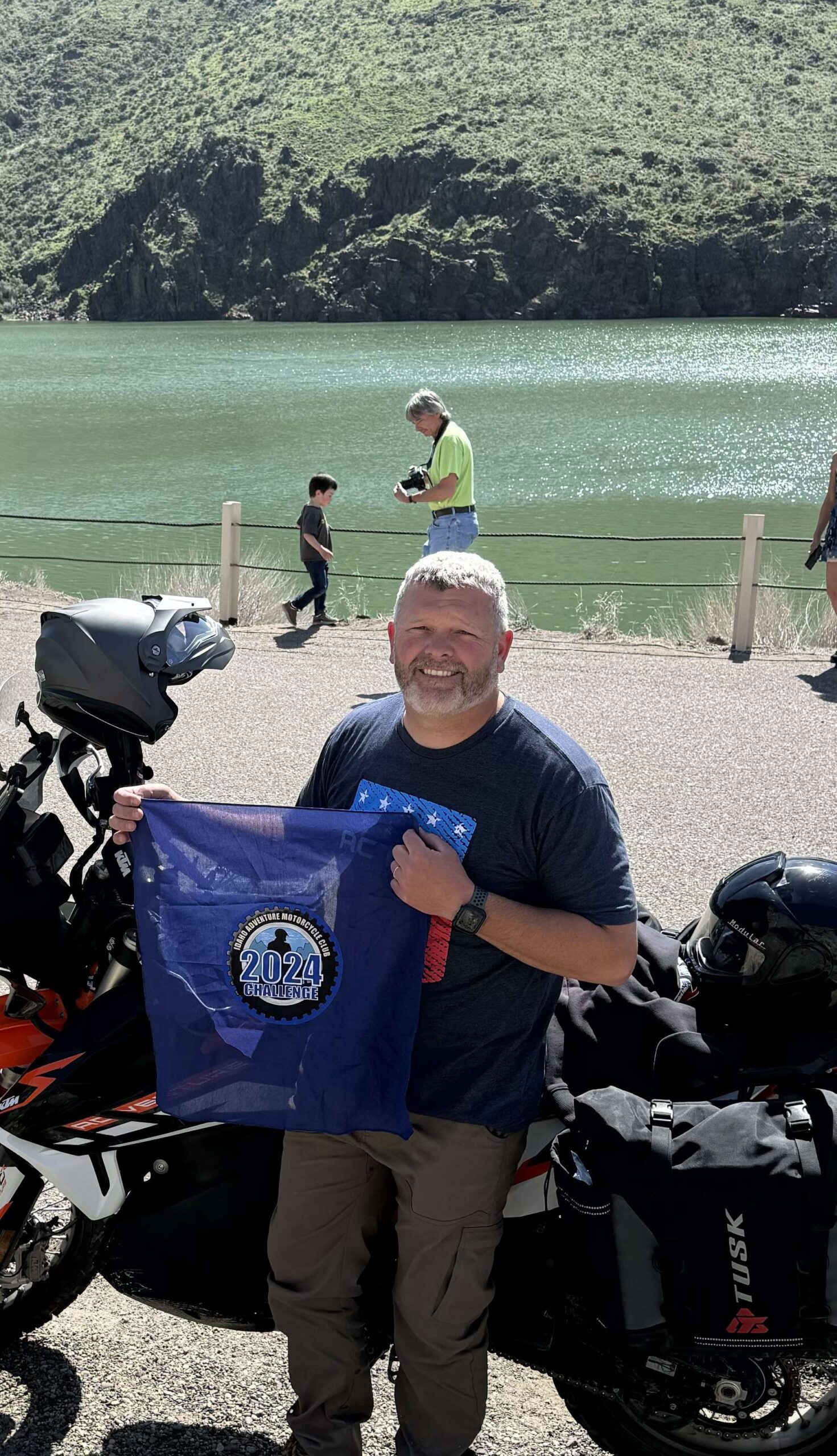
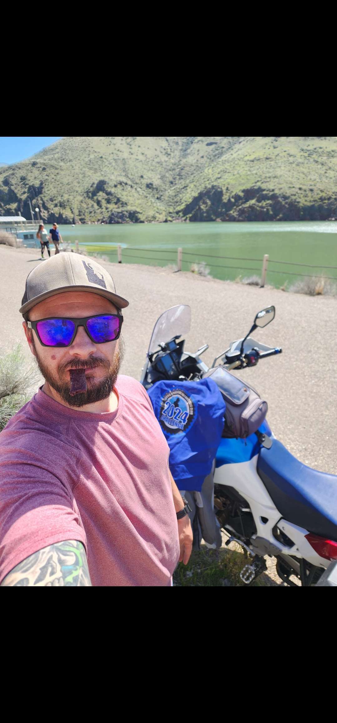
Use the form below to check in. Check-ins must include a photo of you or your bike at the challenge site with the 2024 bandanna. All participants must be registered IAMC Challenge Members. Leave a description of your ride and share road conditions — snow, water, obstacles, and tips for future riders are all appreciated.
Replying to another person's check-in is encouraged, but take care not to accidentally create your own check-in.
The stated difficulty is an estimate. Rating your experience helps future riders stay safe. You alone are responsible for the safety of your ride.
29 Check-Ins
Squaw Butte Lookout (don't know if that's the official name)
The last 100 yards might be a 3, there were some rocks in the road near the top, but it was a nice ride up the hill.


Big Trinity Lookout...The harder way. We started over by Anderson Res. as Trailhead CampCreek. (Single Track) we linked it to Bearhole then on the main dirt road up the South side of the mountain to the lookout. For the return we continued north to connect the Trinity Ridge trail to CrossCut and back into Camp Creek. FYI that is as far as you can go on 1 tank of gas on my 24 TE300.

Rattlesnake Station Historical Marker off Hwy20 in Elmore County near Mountain Home 43° 8.868′ N, 115° 39.516′ W
You can check out the M1 Abrams tank also.


Our Lady, Queen of Heaven Church is a Roman Catholic church in Oreana, Idaho. The church's building was built c. 1883, originally to house Oreana's general store and post office. It was renovated in 1961 as a church.
less than a mile south of Oreana.


I went to Initial Point, which is 10 or so miles south of Kuna and Swan Falls Rd. The turnoff from the paved road is about 1 mile of dirt/gravel--the first half of which is a level 2 and the 2nd half is 2.5. At the base of the mount, where I ended up parking my bike, begins a rocky incline around the backside and to the top (level 3). I went the first 100 ft or so but decided it wasn't worth the risk of a pinch flat and turned around. I then did the 5 min hike on foot for pictures. Afterward I played around on the surrounding dirt trails and tried to go up the dirt bike trail (shown in the photo) to the top but only made it 3/4 the way before my 60 street/40 dirt tire tread lost traction in the soft dirt/sand. It was a fun area.


I found this Cemetery out goofing around. Wagontown Cemetery 43°01'29.3"N 116°51'40.6"W

Jutting up between the dump and the gun range, is one of the hidden gems of Canyon County, Pickles Butte. I go there often because its a close practice area to ride sand, powder and climb hills. Its also a great spot to see the whole valley, and to just be alone and observe the movements of the universe. I have clocked many equinoxes, solstices and full moons from there. Last night Stacy and I rode to the top and watched the final sunset of summer fade into the past. If you wait patiently you will see coyotes, rabbits, mice, snakes and hawks. Its also a launch spot for paragliders. Unfortunately the landfill fence keeps moving and soon Dead Horse canyon will be nothing but a mound of human detritus, so go visit it while you can 🙂

Last day summer evening ride to the top of Pickle Butte to watch the sunset. Not a long ride but with the sun directly in my eyes and powdery dirt over ruts I dumped my bike on the way up. This is one of Foolhardy’s favorite spots with a pretty view of the valley. Sad to see the landfill taking over the area.

Sunset mountain lookout via Rabbit creek-sunset trail 43.89870, -115.64693. Definitely a 5. Rode in with a couple guys on 2 strokes if that sets the stage lol. Steep, long, soft sand and rocky singletrack with a rocky uphill/sidehill/downhill sections with some decent exposure. Some roots and logs as well. 10ish miles in all from Granite creek to the bottom ending at the 21 entrance to pilot peak. Was fun, but hard. Could come from 21 via the staging area, and would be a 1 and is only 2 or so miles.

To acknowledge the camaraderie and community.. I think it is fitting to commemorate a place where the bike just decided to take a nap.. for no good reason other than the inattention of the pilot.. but m’learned colleagues were ready to assist in waking it back up. Many thanks to everyone who leads rides and to all those that help pick us up when we’re down!!

Smoky Bar Store 43.60911 -114.87542 I feel it's good to support these little places kinda out in the middle of know where. Nice ride along the Southfork Boise River.

I had designs of using a really cool, well-known site east of the Continental Divide for my own pick, but it'll have to wait until next year.....no m/c trips back east for me this year. Anyhoo!............This is the earthquake fault site north of Chilly ID. The turn-off to it is about 6 miles north of Chilly where Trail Creek Rd (from Ketchum) intersects Hwy 93 between Mackey and Challis. From the turn-off the site is about 2 miles from the highway. In October 1983 a 7.3 Richter scale earthquake hit this area. This giant gash in the earth is the result. Borah Peak is in the background of one of these photos....Borah is the highest point in Idaho. Gaia says this site is at 44.16381, -113.86801. Giving it a 2 because of the graded gravel from the highway.


Viewpoint at the top of Steens Mountain, Oregon looking out towards the Alvord.

Baptism is a great idea when you want to get right with God. Not so great for your motorcycle. I believe there will be motorcycles in Heaven, but that doesn't mean you can take yours with you.
Dad learned this a few years back when he fully submerged his XR650L at this very spot, coordinates 43.01924, -116.73471. He flailed, floundered, and got soaked to the bone. All in the most dignified type of way. The Honda, however, never quite ran the same.
Now every year I make a pilgrimage to this spot to commemorate his water crossing attempt. And send him a snarky text.


I was trying to get to Scott Mt. lookout but snow in the road made me turn around. The road was a little rocky on the way up but while I was up in the snow a road grader graded up the bottom couple miles of the road. Then it was very loose dirt and rocky not a good combination. I had more than a couple Yeehaw moments. I'm giving it a 3 because if it weren't for the snow Turning me around the road wasn't too bad. Till they fixed it.


Looking for a 'short cut', Bart and I came across Long Tom Reservoir and rode to the dam. Really a fun and beautiful ride with several sketchy sections. Rocks, ruts, and water keeps you on your toes!


Long Tom Dam at Long Tom Reservoir. Took fun two track to N of Reservoir to access Dam. Track had two small stream crossings, various lava rocks, and ruts from vehicles. Giving it a 3 rating but it would be harder on ADV bike if there had been lots of rain or runoff from snow. Creeks would be deep and the two track would likely be paved in mystery mud---- a-la what you find sometimes in the Owyhees. Fun ride with Norb. Coordinates: 43.2861944°, -115.5788333°

I had no idea we had a Little City of Rocks right off of Highway 46 north of Gooding. I really like this short stretch of road heading north.
Behold my Sage Bush. Ok, so I was planning on putting something more scenic, but hear we are. This happened on the way down to Bitch Creek I think. I was going through the water and hit a rock that kicked me over to the left into the sage bush and got stuck. If this is the worst thing that happens while doing this challenge I am ok with that.
44°29'54.6"N 118°38'23.3"W
https://www.goeasternoregon.com/grab_bag/say-whoa-when-you-see-the-wagon/article_dbd117a4-977e-11ed-abc0-13a5c9b66ccd.html
John Day Highway, near Prarie City, Oregon.
Roadside Wagon.
Difficulty: 1
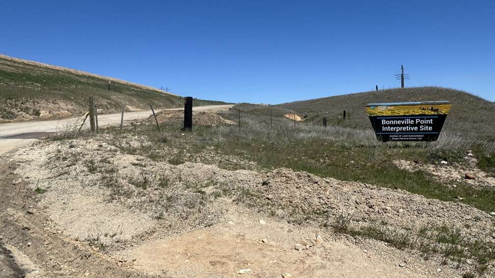
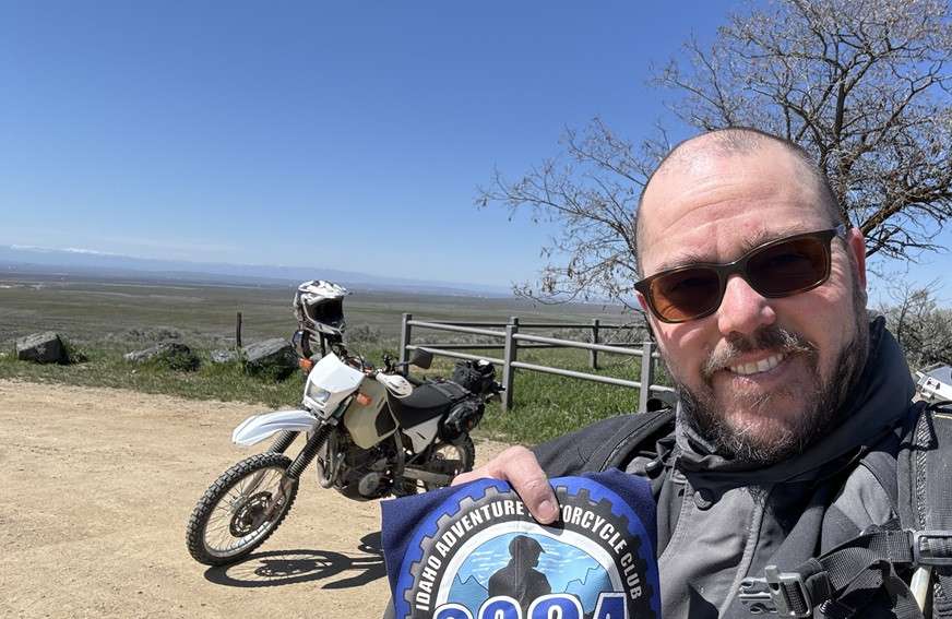
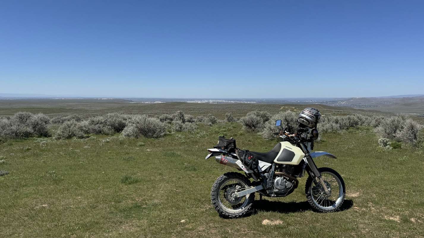
Bonneville Point Interpretive Site: drove by on the way back from the Y-Stop, thinking it would be a good, quick pick. Beautiful weather, but the Treasure Valley was a bit to hazy for a good picture.
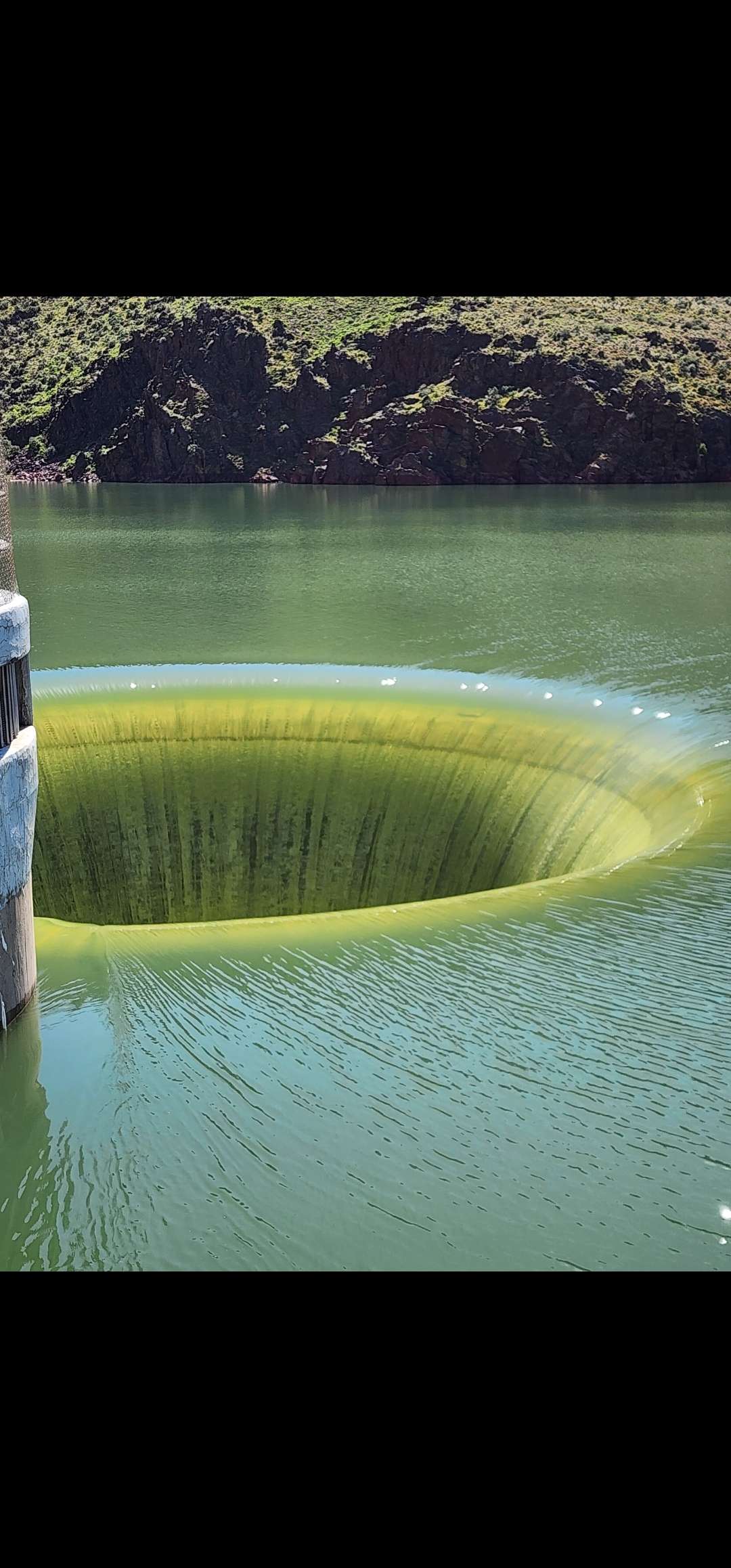
Owyhee reservoir is full right now 4/13. Make the trip and go see the glory hole and flooding river.
Squaw Butte Lookout (don’t know if that’s the official name)
The last 100 yards might be a 3, there were some rocks in the road near the top, but it was a nice ride up the hill.
Love the Trinity lookout.
Big Trinity Lookout…The harder way. We started over by Anderson Res. as Trailhead CampCreek. (Single Track) we linked it to Bearhole then on the main dirt road up the South side of the mountain to the lookout. For the return we continued north to connect the Trinity Ridge trail to CrossCut and back into Camp Creek. FYI that is as far as you can go on 1 tank of gas on my 24 TE300.
Rattlesnake Station Historical Marker off Hwy20 in Elmore County near Mountain Home 43° 8.868′ N, 115° 39.516′ W
You can check out the M1 Abrams tank also.
Our Lady, Queen of Heaven Church is a Roman Catholic church in Oreana, Idaho. The church’s building was built c. 1883, originally to house Oreana’s general store and post office. It was renovated in 1961 as a church.
less than a mile south of Oreana.
Bruneau Canyon Overlook
I went to Initial Point, which is 10 or so miles south of Kuna and Swan Falls Rd. The turnoff from the paved road is about 1 mile of dirt/gravel–the first half of which is a level 2 and the 2nd half is 2.5. At the base of the mount, where I ended up parking my bike, begins a rocky incline around the backside and to the top (level 3). I went the first 100 ft or so but decided it wasn’t worth the risk of a pinch flat and turned around. I then did the 5 min hike on foot for pictures. Afterward I played around on the surrounding dirt trails and tried to go up the dirt bike trail (shown in the photo) to the top but only made it 3/4 the way before my 60 street/40 dirt tire tread lost traction in the soft dirt/sand. It was a fun area.
I found this Cemetery out goofing around. Wagontown Cemetery 43°01’29.3″N 116°51’40.6″W
Jutting up between the dump and the gun range, is one of the hidden gems of Canyon County, Pickles Butte. I go there often because its a close practice area to ride sand, powder and climb hills. Its also a great spot to see the whole valley, and to just be alone and observe the movements of the universe. I have clocked many equinoxes, solstices and full moons from there. Last night Stacy and I rode to the top and watched the final sunset of summer fade into the past. If you wait patiently you will see coyotes, rabbits, mice, snakes and hawks. Its also a launch spot for paragliders. Unfortunately the landfill fence keeps moving and soon Dead Horse canyon will be nothing but a mound of human detritus, so go visit it while you can 🙂
Last day summer evening ride to the top of Pickle Butte to watch the sunset. Not a long ride but with the sun directly in my eyes and powdery dirt over ruts I dumped my bike on the way up. This is one of Foolhardy’s favorite spots with a pretty view of the valley. Sad to see the landfill taking over the area.
Sunset mountain lookout via Rabbit creek-sunset trail 43.89870, -115.64693. Definitely a 5. Rode in with a couple guys on 2 strokes if that sets the stage lol. Steep, long, soft sand and rocky singletrack with a rocky uphill/sidehill/downhill sections with some decent exposure. Some roots and logs as well. 10ish miles in all from Granite creek to the bottom ending at the 21 entrance to pilot peak. Was fun, but hard. Could come from 21 via the staging area, and would be a 1 and is only 2 or so miles.
That is a fun ride!
To acknowledge the camaraderie and community.. I think it is fitting to commemorate a place where the bike just decided to take a nap.. for no good reason other than the inattention of the pilot.. but m’learned colleagues were ready to assist in waking it back up. Many thanks to everyone who leads rides and to all those that help pick us up when we’re down!!
Smoky Bar Store 43.60911 -114.87542 I feel it’s good to support these little places kinda out in the middle of know where. Nice ride along the Southfork Boise River.
I had designs of using a really cool, well-known site east of the Continental Divide for my own pick, but it’ll have to wait until next year…..no m/c trips back east for me this year. Anyhoo!…………This is the earthquake fault site north of Chilly ID. The turn-off to it is about 6 miles north of Chilly where Trail Creek Rd (from Ketchum) intersects Hwy 93 between Mackey and Challis. From the turn-off the site is about 2 miles from the highway. In October 1983 a 7.3 Richter scale earthquake hit this area. This giant gash in the earth is the result. Borah Peak is in the background of one of these photos….Borah is the highest point in Idaho. Gaia says this site is at 44.16381, -113.86801. Giving it a 2 because of the graded gravel from the highway.
Viewpoint at the top of Steens Mountain, Oregon looking out towards the Alvord.
Baptism is a great idea when you want to get right with God. Not so great for your motorcycle. I believe there will be motorcycles in Heaven, but that doesn’t mean you can take yours with you.
Dad learned this a few years back when he fully submerged his XR650L at this very spot, coordinates 43.01924, -116.73471. He flailed, floundered, and got soaked to the bone. All in the most dignified type of way. The Honda, however, never quite ran the same.
Now every year I make a pilgrimage to this spot to commemorate his water crossing attempt. And send him a snarky text.
I was trying to get to Scott Mt. lookout but snow in the road made me turn around. The road was a little rocky on the way up but while I was up in the snow a road grader graded up the bottom couple miles of the road. Then it was very loose dirt and rocky not a good combination. I had more than a couple Yeehaw moments. I’m giving it a 3 because if it weren’t for the snow Turning me around the road wasn’t too bad. Till they fixed it.
Galena Summit. But not in the snow and rain!
Hait Reservoir: 44.834444,-116.174167
Owyhee Canyon Overlook. Nice view
Hell’s Canyon Dam, coordinates are 45.243033, -116.701713
Looking for a ‘short cut’, Bart and I came across Long Tom Reservoir and rode to the dam. Really a fun and beautiful ride with several sketchy sections. Rocks, ruts, and water keeps you on your toes!
Long Tom Dam at Long Tom Reservoir. Took fun two track to N of Reservoir to access Dam. Track had two small stream crossings, various lava rocks, and ruts from vehicles. Giving it a 3 rating but it would be harder on ADV bike if there had been lots of rain or runoff from snow. Creeks would be deep and the two track would likely be paved in mystery mud—- a-la what you find sometimes in the Owyhees. Fun ride with Norb. Coordinates: 43.2861944°, -115.5788333°
I had no idea we had a Little City of Rocks right off of Highway 46 north of Gooding. I really like this short stretch of road heading north.
43.111499, -114.677636
Behold my Sage Bush. Ok, so I was planning on putting something more scenic, but hear we are. This happened on the way down to Bitch Creek I think. I was going through the water and hit a rock that kicked me over to the left into the sage bush and got stuck. If this is the worst thing that happens while doing this challenge I am ok with that.
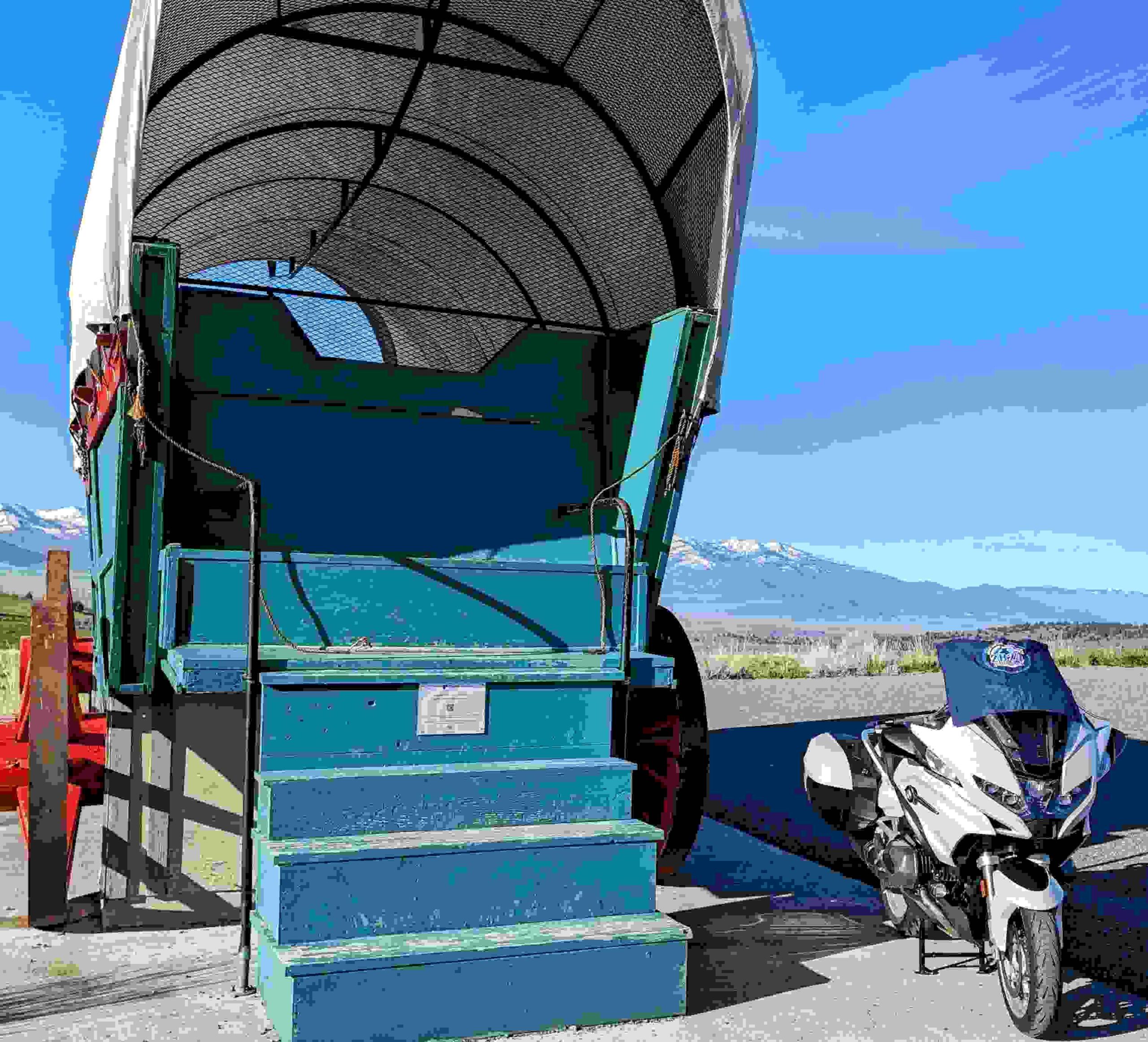
44°29’54.6″N 118°38’23.3″W
https://www.goeasternoregon.com/grab_bag/say-whoa-when-you-see-the-wagon/article_dbd117a4-977e-11ed-abc0-13a5c9b66ccd.html
John Day Highway, near Prarie City, Oregon.
Roadside Wagon.
Difficulty: 1
Bonneville Point Interpretive Site: drove by on the way back from the Y-Stop, thinking it would be a good, quick pick. Beautiful weather, but the Treasure Valley was a bit to hazy for a good picture.
Owyhee reservoir is full right now 4/13. Make the trip and go see the glory hole and flooding river.
Owyhee Reservoir glory hole
Comments are closed.