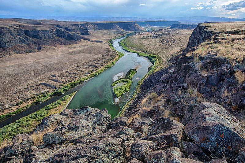
02 – Snake River Birds of Prey Overlook
The Dedication Point overlook is a great place to see the Snake River’s famous birds of prey. It’s located on the rim of the Snake River Canyon, 400 feet above the river.
The Morley Nelson Snake River Birds of Prey National Conservation Area also has many birds of prey. The area’s cliffs, which are up to 700 feet tall, have many ledges, cracks, and crevices where raptors nest. About 800 pairs of hawks, eagles, falcons, and owls nest in the desert plateau and lava cliffs. Some birds of prey that can be found in the Snake River include: Prairie Falcons, American Kestrel, Golden Eagle, Northern Harrier, Western Screech-owls.
Coordinates: 43.29791, -116.43377
Elevation: 2780 ft
Difficulty: 2
What to expect: Well maintained gravel roads right up until last 500 feet where it turns to a mild trail. Hike the last 500 feet to the destination if needed.
Check In
Please read before attempting challenge site or checking in:
Use the form below to check in. Check in’s must include a photo of you or your bike, at the challenge site, with the 2024 bandanna. To check in, all participants must be registered IAMC Challenge Members. Be sure to leave a description about the ride, and share any road conditions as snow, water, or obstacles. Please provide any other information that might help future visitors navigate to this site safely. Replying or commenting on another persons Check In is encouraged, but take care not to create your own Check In on accident.
The stated ride difficulty is just an estimate. By rating the ride difficulty in your experience according to this scale you can help future riders stay safe. You, and you alone are responsible for the safety of your ride. While we do our best to accurately convey the challenge level for each site, it is up to you to make sure you have the skills needed to reach each destination. If you feel the trail exceeds your skill level please turn around immediately.
NOTE: We have been having some issues uploading images. We are working on this. If you are having trouble, try resizing your images to less than 1280×1280 pixels and keep files sizes down to a minimum. If the problem persists, please reach out on the Forums under “Website Tips and Questions.” This should just be a temporary issue as we get the tech figured out. Thank you.
Been here many times!
The last 1/2 mile track was a bit dusty, but easy. We tried to go out the alternate route, but there was a locked gate by the road so we had to backtrack. i.e. go out the same way you came in 🙂
Bandanna left in other bike. So not sure if this counts. But…
Very nice view everything was nice and green. Easy to get to off of Swan falls road.
Malibu Stacy and I had yet another nice afternoon ride and collected a couple more challenge sites.
Luckily Foolhardy knew where to turn off the main road to find this awesome view of the Snake River. We took two different hard packed dirt roads to see the sights off the cliffs then went down the Swan Falls dam before heading back to Caldwell through Melba then around the south side of Lake Lowell.
Cool spot to look down on the river. If you get the chance and have a few spare minutes stop at the Pointe Fire Memorial on the way.
Well I’m upset that the lat/long copied into satnav tried to take me to the river a mile or so west of the dedication site parking lot. Thinking the parking lot at the side of a paved road did not match the description of a well maintained gravel road, I rode back and forth on Victory lane trying to find this nonexistent gravel road. And failed to get a photo at the actual site. But I did get a screen shot of my ride to it.
Never knew this was here. Normally I’m not afraid of heights, but walking up to the cliff gave me the willies.
I also broke my all time record for peeing-for-distance. So hooray for that.
The best road to take coming in wasn’t on my map, so I switched to Satellite view and marked in it red.
This is a bit harder than a 2, (well kept gravel) but not quite a 3 either. I’d call it a 2.5.
very nice site… reminds me a bit of Toroweep on the Grand Canyon… except Toroweep is 3000′ straight down to the river… here it’s more like 300′ but still very nice!
Super cool spot, and I never knew there were so many off road trails off the side of this road!
Wow what a stunning view! I’ve been up and down Swan Falls Rd since 1994 and never knew this spot existed. I guess that’s the point of this Challenge. Beautiful views! Great choice for a Challenge site.
Nice view
Timed it just right!
Nice view of the snake river.
Finished off my sunday ride with a nice view of the snake river. This was looking south to the swan falls dam. There were a few puddles to go around and dirt was moist and packed.
A beautiful view to end a 200 mile afternoon.
I forgot to add it my check in picture, and I don’t see an option when I edit my comment. Instead I have put my check in picture in the reply to this post.
Turn off of S Swan Falls Rd at 43.29959, -116.41417 and go west along cement ditch. The unimproved dirt road was easy going. Views are fabulous and the cliff is scary.