10 – Birch Creek Ranch
From the BLM Website:
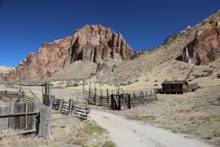
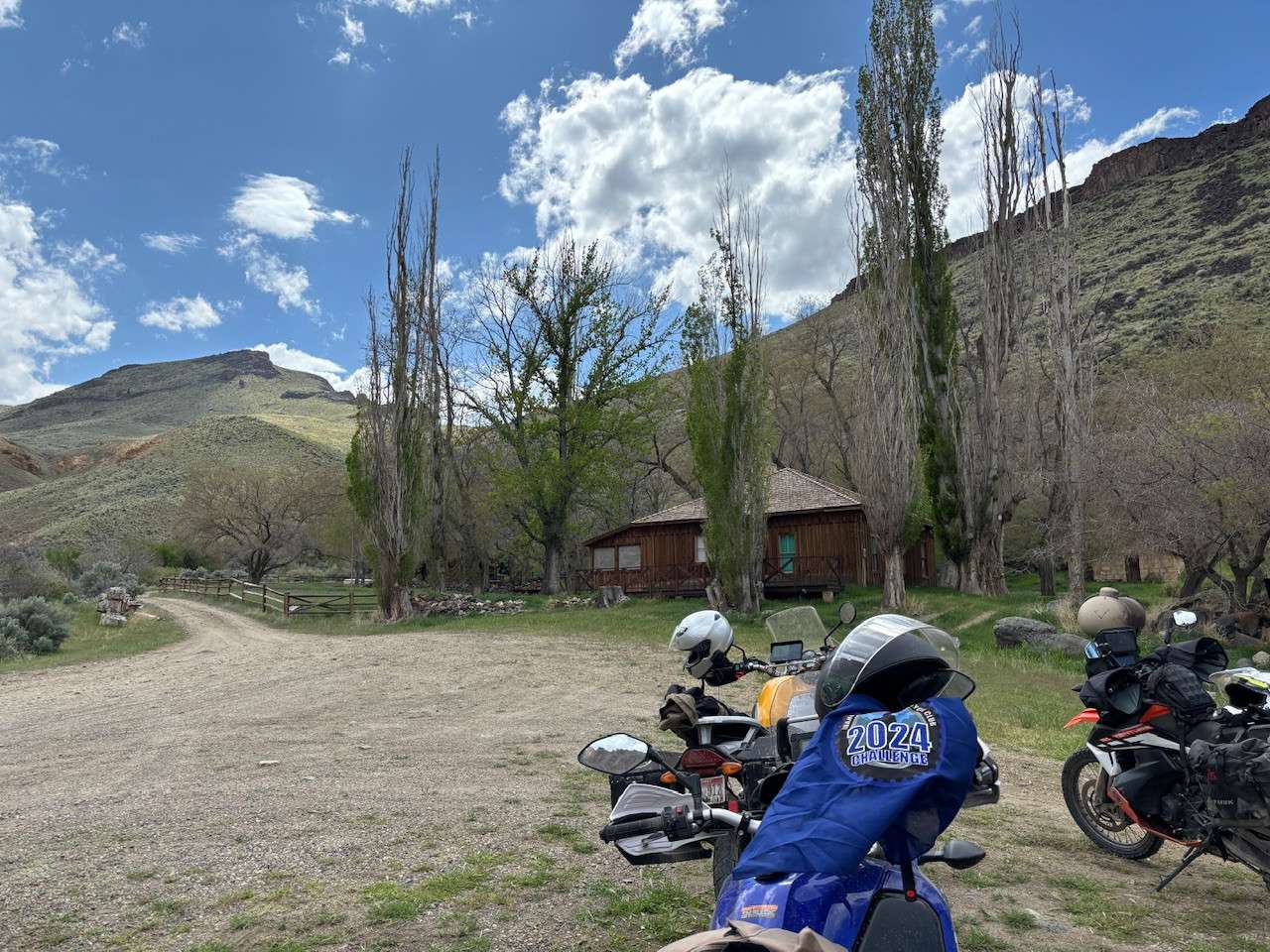
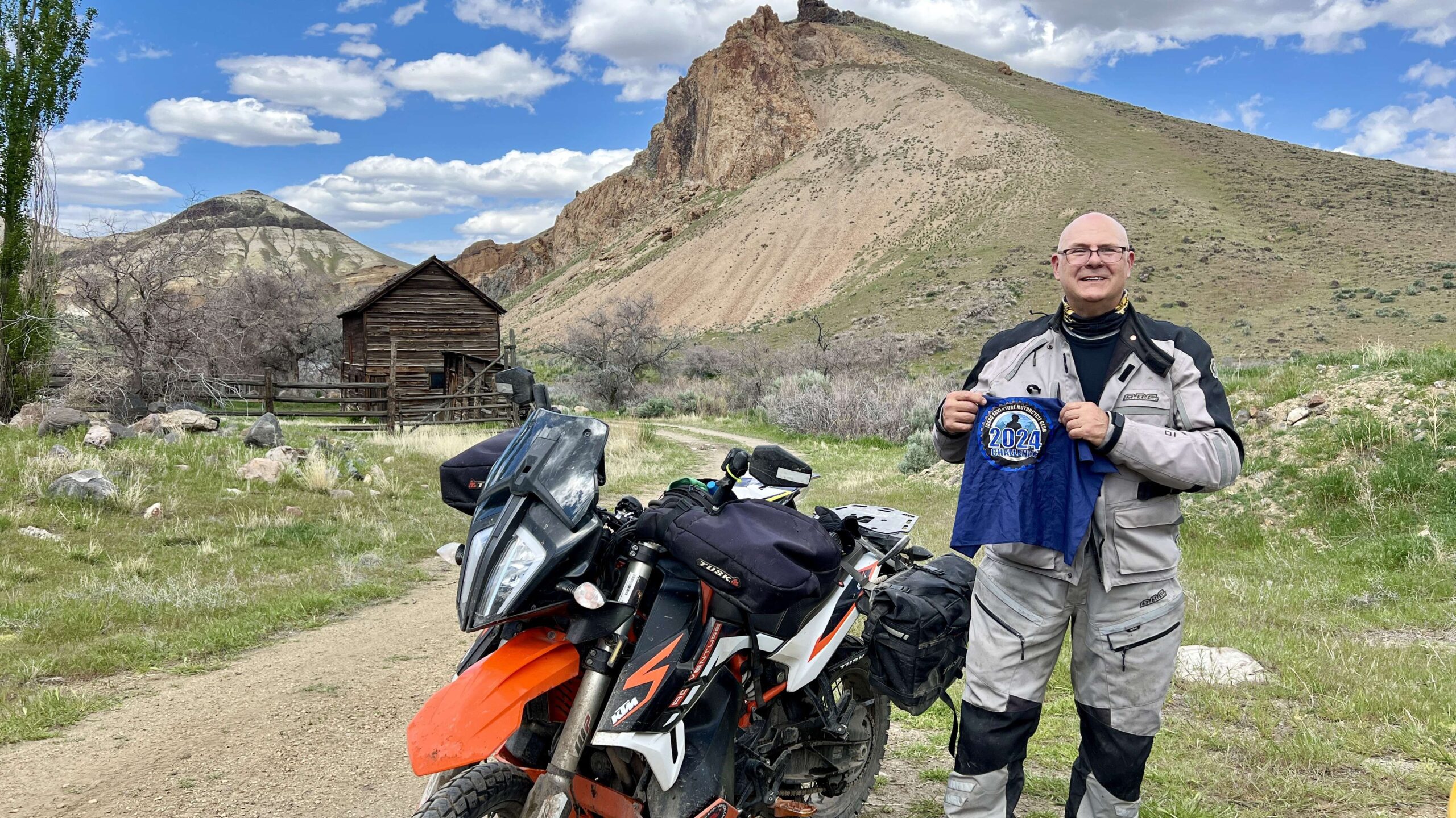
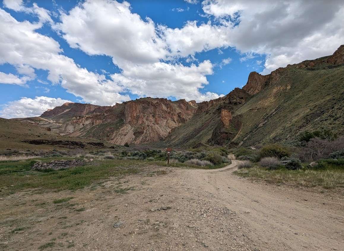
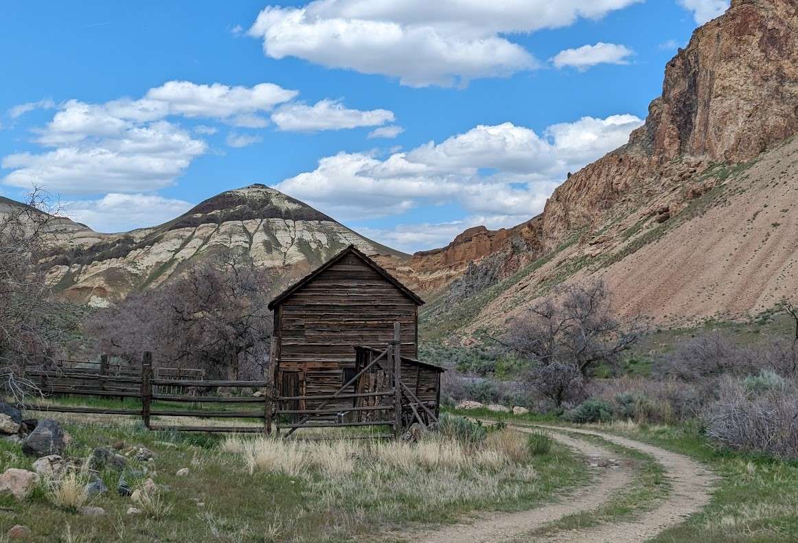
Nestled among cream and chocolate colored hills, barren red cliffs, and towering rock spires lays a secret oasis: the Birch Creek Historic Ranch. Established in the early 1900s, the ingenuity and determination of a Basque sheepherder and a West Virginia cattle rancher are still evident at the site today. Stone walls built in the Basque tradition still ascend the mesa. Remnants of a waterwheel hint at the lush alfalfa fields fed through the gravity irrigation system. Nineteen buildings and structures at the ranch contribute to the property’s designation as a historical rural landscape on the Department of the Interior’s National Register of Historic Places.
More Information
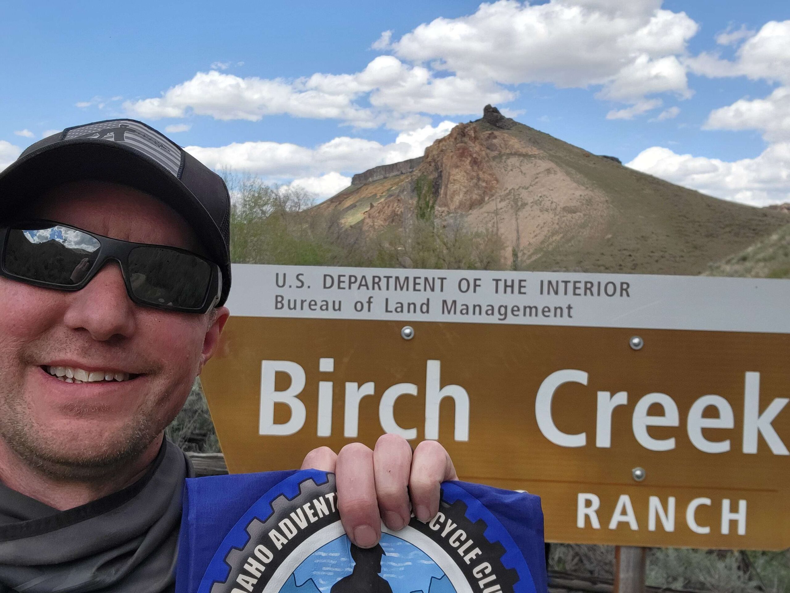
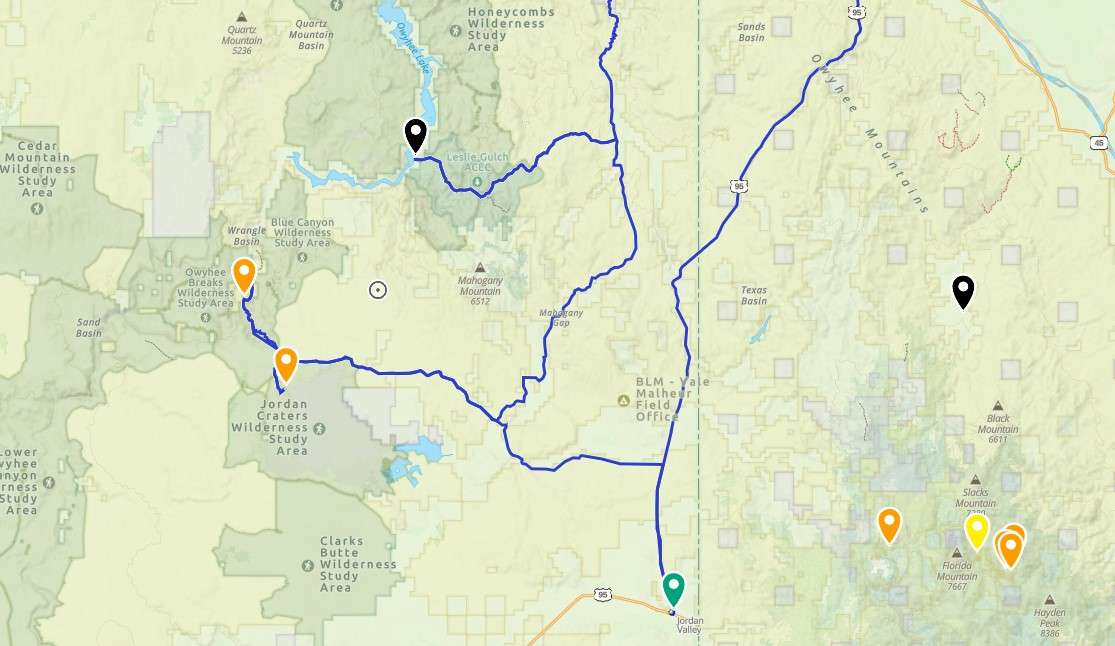
Coordinates: 43.21518, -117.50297
Elevation: 2722 ft
Difficulty: 3
What to Expect: No info
[reblex id=’779′]
Check In
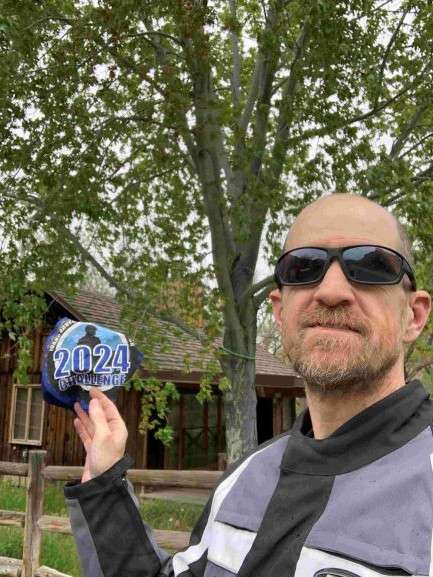
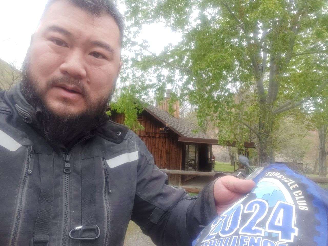
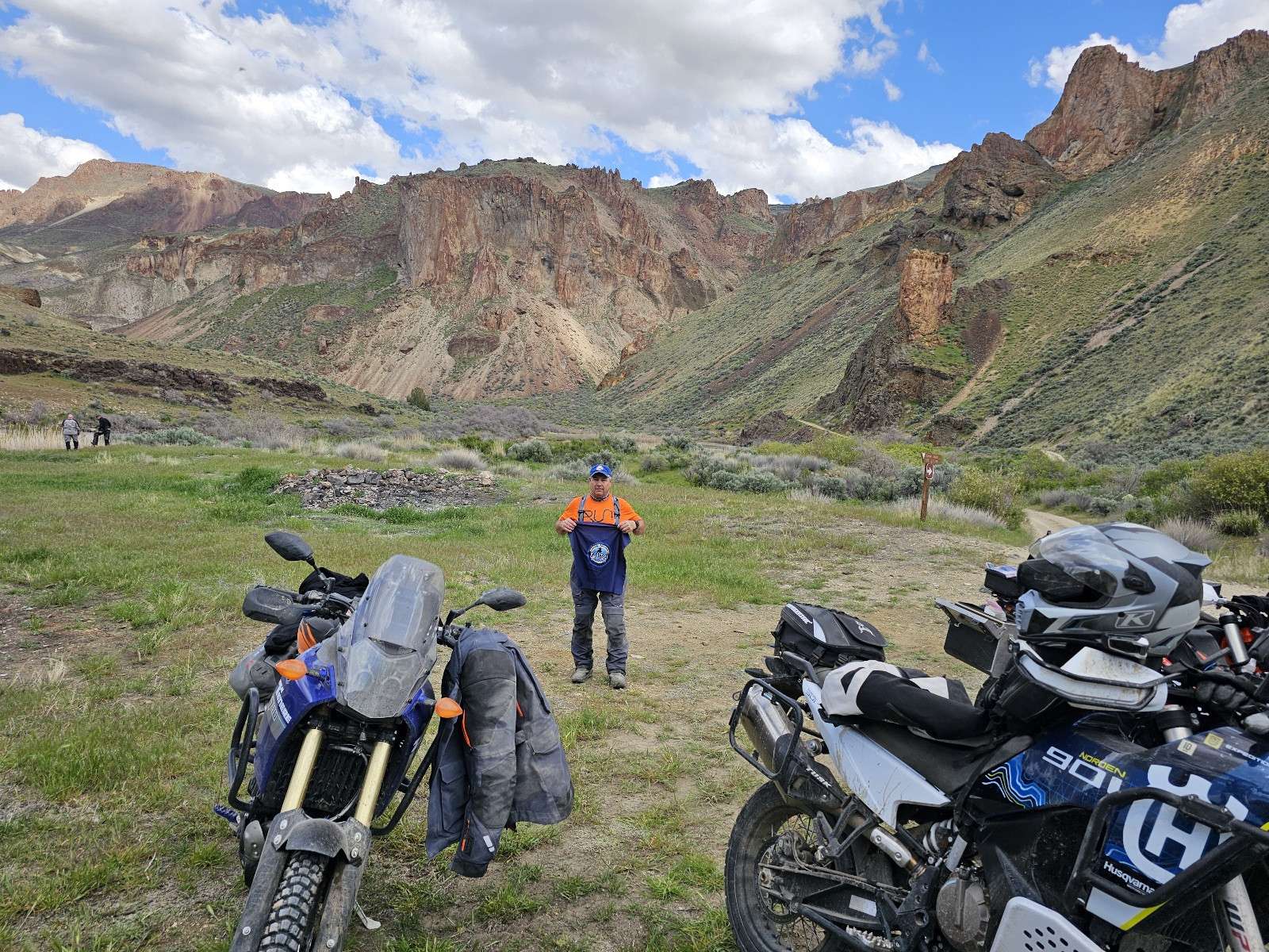
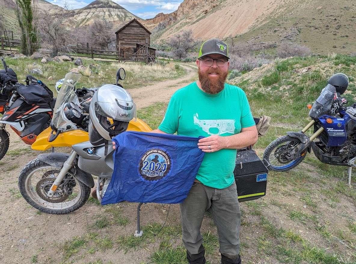
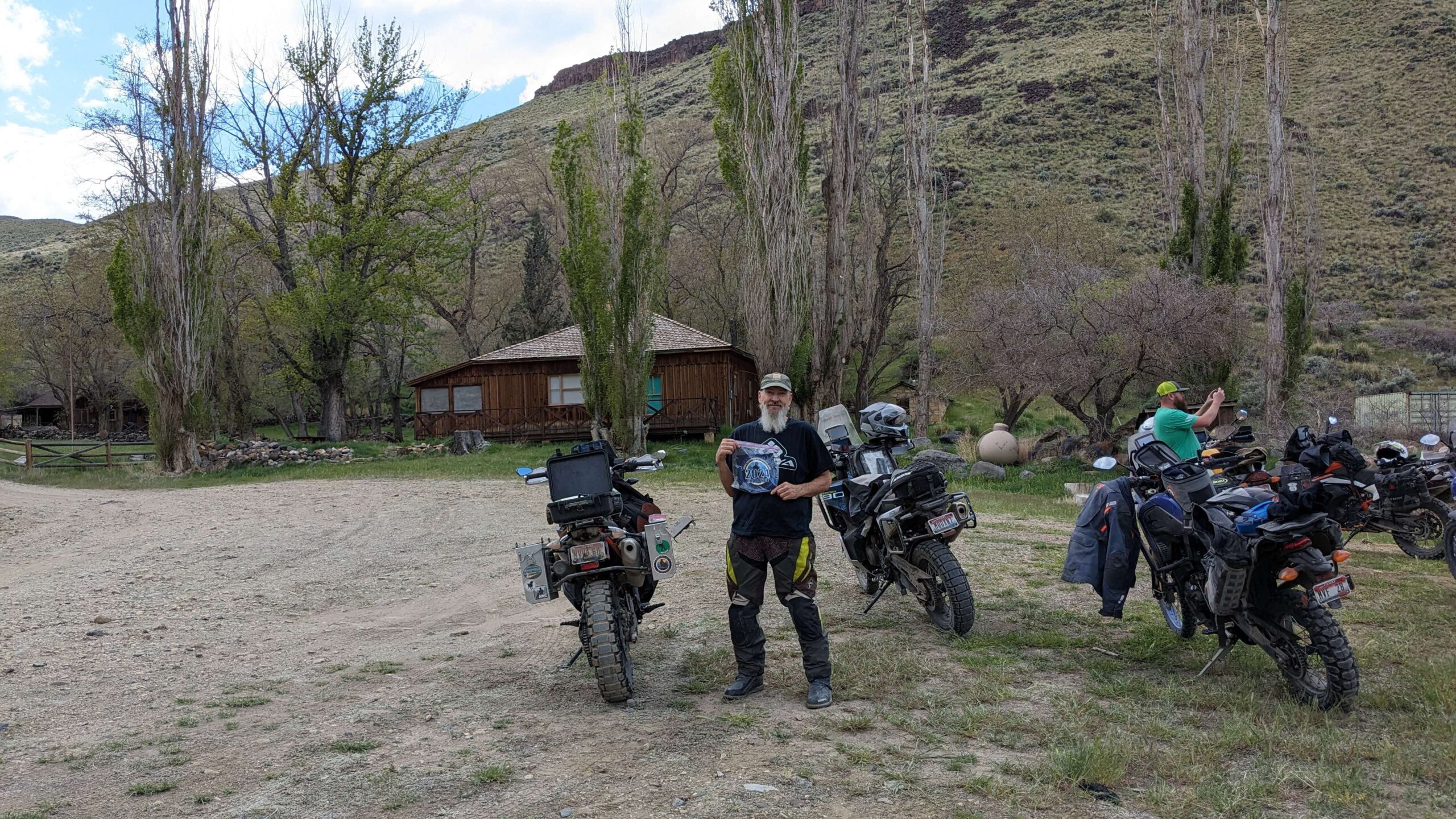
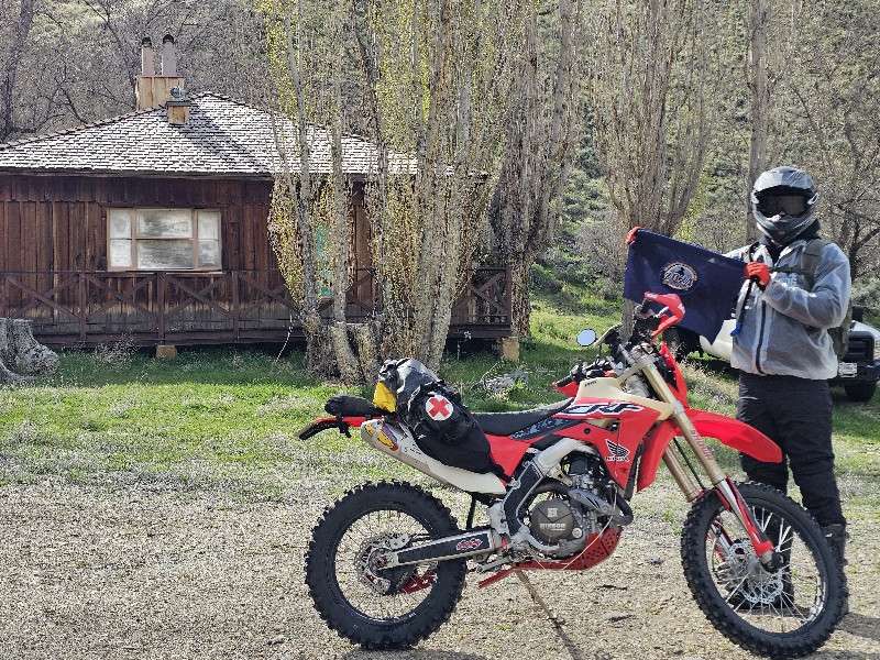
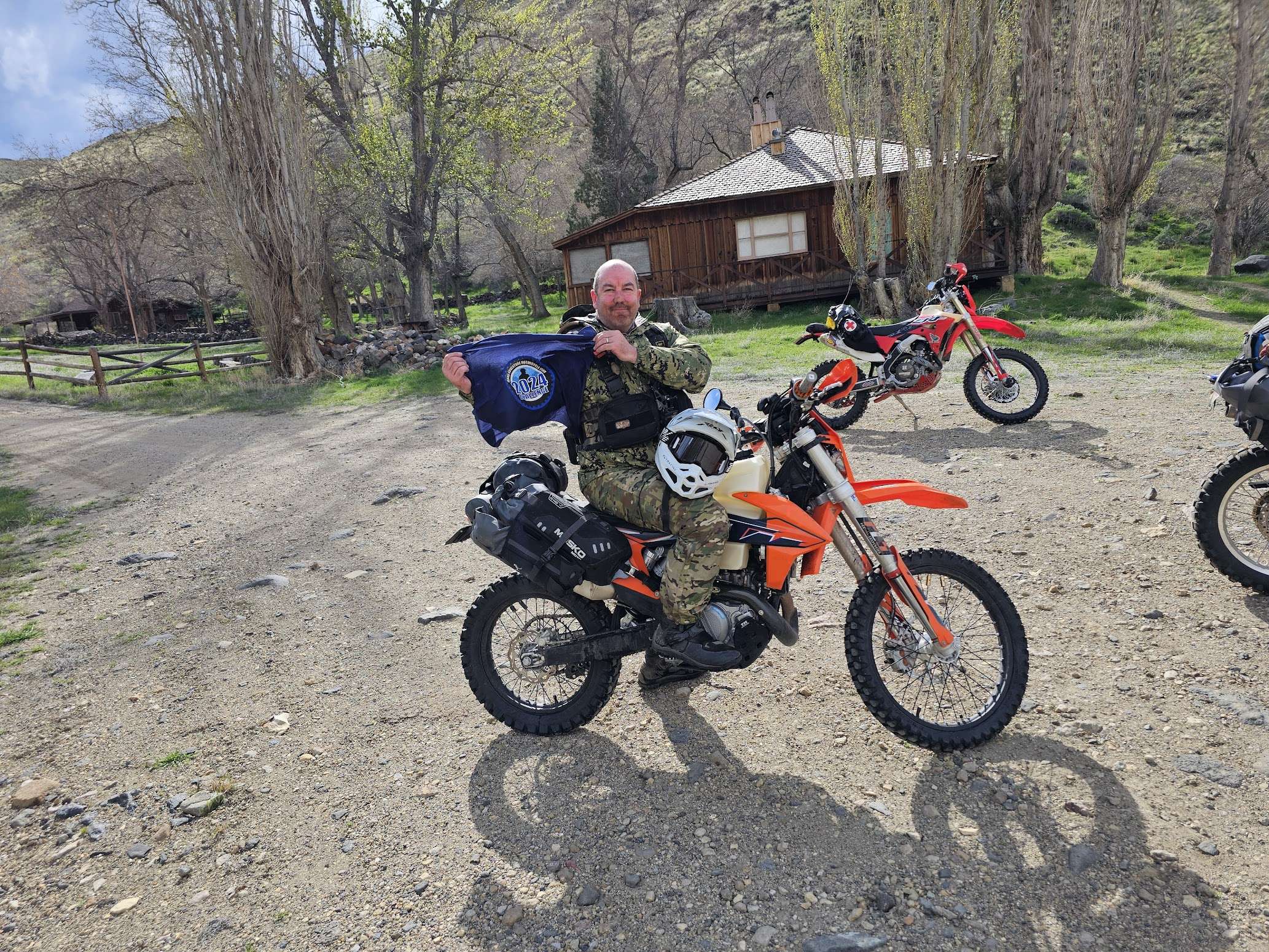
Use the form below to check in. Check-ins must include a photo of you or your bike at the challenge site with the 2024 bandanna. All participants must be registered IAMC Challenge Members. Leave a description of your ride and share road conditions — snow, water, obstacles, and tips for future riders are all appreciated.
Replying to another person's check-in is encouraged, but take care not to accidentally create your own check-in.
The stated difficulty is an estimate. Rating your experience helps future riders stay safe. You alone are responsible for the safety of your ride.
22 Check-Ins
Lots of great scenery coming and going. Gravel road has some ruts when you get closer. There were some water crossings, nothing real bad.


I took the day off to knock of several outstanding challenge sites. Rode the back country byway for the first time. Rained last night, roads soupy and slippy. I was 2-up with my wife. We had a great time.

Fun ride down to the ranch. Some spots are a bit dicey for big bikes. Just make sure you have some decent balance.


Saw a lot of critters on the way down and at this place. Sage Grouse, Rattlesnake, Bull Snake, Chukars, Quail, Dove, two Pronghorn, one buck Mule Deer in velvet (looking like he'd be big), 5-6 Mule Deer does.............Very cool place!! Water crossings still a thing. My friend Phillip ripped through them on his Z125 with 12" wheels!!


Jordan Creek/Blowout Road to the top of the Birch creek canyon is in perfect condition. Graded with zero washboard and one of the smoothest dirt roads I have been on in a long time. Road, starting from the mesa then down to the ranch, is starting to get chewed up. Numerous easy stream crossings. Great place to visit. Go early in the AM if possible to avoid the sweltering heat. It was 100+ when I dropped into the ranch.

Those mountains in the distance are beautiful, makes it kinda hard to keep your eyes on the road on the way down.


Yeah Chatty is right about the way in, plug bogs and stuck pickup trucks with Washington plates! Made for quite the adventure, but we made it!

Water crossings a plenty. Pretty steep in parts and for me at least easier going up than down.

Probably my favorite so far. I'll be going back with a mtn. bike at some point.
It was a neat ride with a lot more water crossings than I was expecting and some really big washouts.
Super fun ride down and back up with several water crossings and cows. Awesome views.
Edit: I forgot to add the picture, so I put it below in the replies.
Ow this is an awesome ride. Definitely more technical than the other rides I have done out here so far. Expect steep loos grades. A couple of sections of deep,ruts. A few water crossings.definitely glad I was on a mid weigh ADV bike

Rode in with Dan’s group on a beautiful and dry day. I’ve been riding my Tenere 700 for about a year and a strong background riding a mountain bike. The last 3 miles or so I thought got pretty technical for a new rider on a big adventure bike. Nothing I was not able to get through, but definitely had to remind myself to control my speed coming down the last hill. Had I dropped the bike on my own in the steep section it would have been an ordeal to get it back up. Overall though, great challenge for someone with some riding experience looking to push their riding past flat two track roads! Take your time, bring a friend!
I added a picture coming down the aforementioned hill!
Edit1: I also wanted to add that if you aren’t sure about your ability to access Birch Creek, head to the Teapot Crater (this check in) beforehand. I would say the access road is also a 3 due to some off camber sections of gravel road and some rocky bits. It is however, shorter and less steep. If you breeze through that then Birch Creek should be no problem. If it gives you issues, just know that I found Birch Creek access to be a higher difficulty level!
Birch creek is a cool spot. Hit it with Dan, Alex and a few others. Coming down always seems harder than up. Lots of UTV and rafters coming out.
Lots of history here and worth the effort. You'll want to ride on past the check-in point to the end of the road to see the waterwheel, raft takeout point, and river ford.
This may be one of my favorite locations yet.
We hit this one next after Leslie Gulch on Dan's ride. The drop into the canyon is beautiful. Once we got to the site we continued on another mile or so past to see a cool water wheel and more cabins.
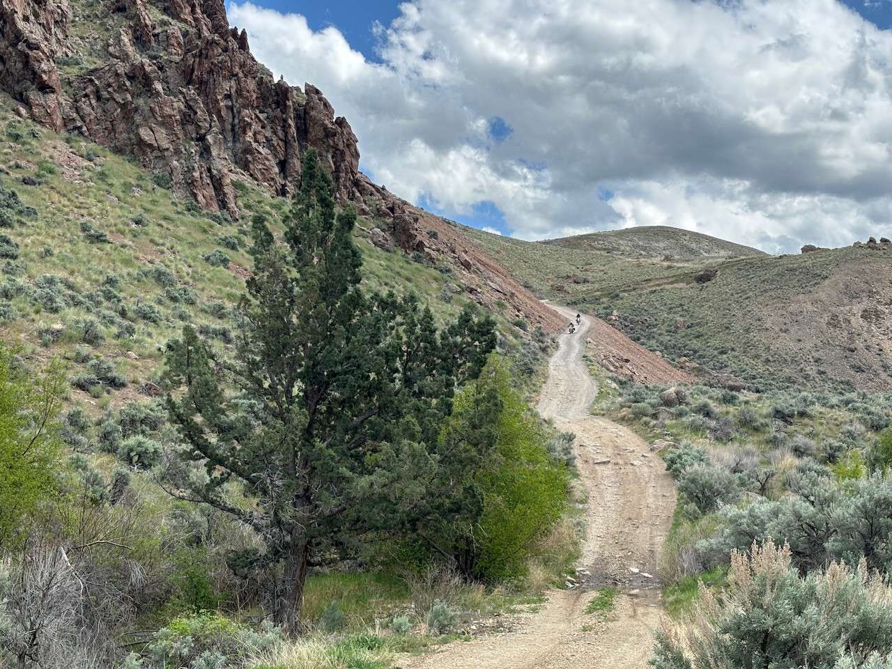
We came down Cutoff Road to Mahogany Gap Road. The roads were very rutty and not well maintained at all. The main road into the site, Blowout Reservoir Road is a mixed bag, with much of it being a 2 and some parts being a 2.5 to 3. The drop at the end is a solid 3 where you go from about 4500 feet to 2700 feet in about 4 miles. Keep in mind this could be a lot more difficult if everything was wet from a big rain. There was a moderate amount of traffic coming to and from this location on a Wed afternoon.
There are steep sections, loose gravel, rattlesnakes, and many water crossings. I made it on my large adventure bike, and I'm an intermediate rider. But it was a challenge. Still, this was easily my favorite spot of the ride.
GPX File attached.
you loose a lot of elevation quick dripping down in there. the flowers were in bloom and everything was green. great little hidden gem of a place. make sure to take the road to the end.
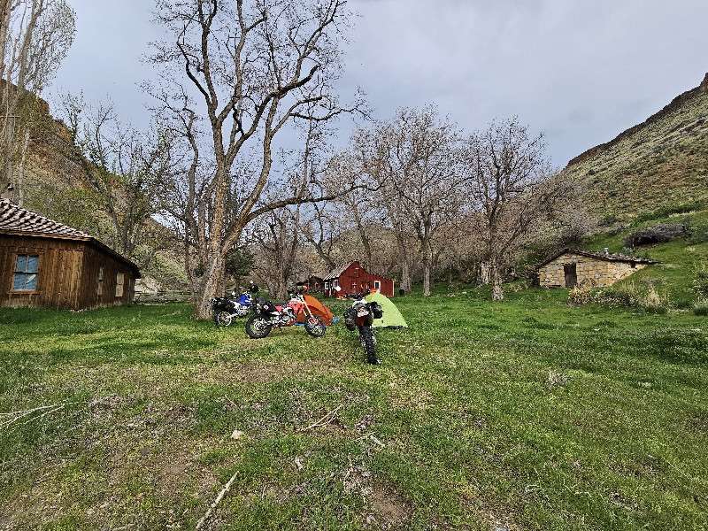
This was my favorite spot so far by a big margin. After riding succor creek/leslie gulch etc most of our first day of a two day trip, this was the first road/trails that offered some technical riding. Many water crossings on the way in, we fortunately just put on our rain gear due to the impending doom of thunderstorms all around us (none of which hit us!) so we were nice and dry when we reached the ranch for camp. The decent towards the river is awesome. Rocky, a little steep for a beginner, watery and stunningly beautiful. We camped on the grass and checked out the site were gone in the morning.
One of my favorite sites so far on the journey. There is quite a winding descent down to the ranch. Getting here involved a lot of water crossings, some ruts, and a section of rocks & water towards the bottom. I would rate it a 3.5 and would not recommend it for beginners. There is a campground 1 mile away from the ranch if you keep going down the trail as you pass it. We did see some vehicle traffic with trucks / trailers going down to the campsite to pick up rafters at a takeout. The grass may look inviting to lay down in but beware there are some goat heads. Incredible rock formations and the soothing sound of the river flowing by. Very peaceful!
A series of thunder storms with lightning were passing through on this evening 4/12 so we made camp there and headed out in the morning.
Lots of great scenery coming and going. Gravel road has some ruts when you get closer. There were some water crossings, nothing real bad.
I took the day off to knock of several outstanding challenge sites. Rode the back country byway for the first time. Rained last night, roads soupy and slippy. I was 2-up with my wife. We had a great time.
Fun ride down to the ranch. Some spots are a bit dicey for big bikes. Just make sure you have some decent balance.
Long, very fun descent. This is a good one.
Saw a lot of critters on the way down and at this place. Sage Grouse, Rattlesnake, Bull Snake, Chukars, Quail, Dove, two Pronghorn, one buck Mule Deer in velvet (looking like he’d be big), 5-6 Mule Deer does………….Very cool place!! Water crossings still a thing. My friend Phillip ripped through them on his Z125 with 12″ wheels!!
Jordan Creek/Blowout Road to the top of the Birch creek canyon is in perfect condition. Graded with zero washboard and one of the smoothest dirt roads I have been on in a long time. Road, starting from the mesa then down to the ranch, is starting to get chewed up. Numerous easy stream crossings. Great place to visit. Go early in the AM if possible to avoid the sweltering heat. It was 100+ when I dropped into the ranch.
Those mountains in the distance are beautiful, makes it kinda hard to keep your eyes on the road on the way down.
Lots of rafts on Sunday
Yeah Chatty is right about the way in, plug bogs and stuck pickup trucks with Washington plates! Made for quite the adventure, but we made it!
Water crossings a plenty. Pretty steep in parts and for me at least easier going up than down.
Probably my favorite so far. I’ll be going back with a mtn. bike at some point.
It was a neat ride with a lot more water crossings than I was expecting and some really big washouts.
Super fun ride down and back up with several water crossings and cows. Awesome views.
Edit: I forgot to add the picture, so I put it below in the replies.
Forgot to add the picture.
The ride down the canyon will keep you on your toes or off on the ground.
Ow this is an awesome ride. Definitely more technical than the other rides I have done out here so far. Expect steep loos grades. A couple of sections of deep,ruts. A few water crossings.definitely glad I was on a mid weigh ADV bike
Rode in with Dan’s group on a beautiful and dry day. I’ve been riding my Tenere 700 for about a year and a strong background riding a mountain bike. The last 3 miles or so I thought got pretty technical for a new rider on a big adventure bike. Nothing I was not able to get through, but definitely had to remind myself to control my speed coming down the last hill. Had I dropped the bike on my own in the steep section it would have been an ordeal to get it back up. Overall though, great challenge for someone with some riding experience looking to push their riding past flat two track roads! Take your time, bring a friend!
I added a picture coming down the aforementioned hill!
Edit1: I also wanted to add that if you aren’t sure about your ability to access Birch Creek, head to the Teapot Crater (this check in) beforehand. I would say the access road is also a 3 due to some off camber sections of gravel road and some rocky bits. It is however, shorter and less steep. If you breeze through that then Birch Creek should be no problem. If it gives you issues, just know that I found Birch Creek access to be a higher difficulty level!
Birch creek is a cool spot. Hit it with Dan, Alex and a few others. Coming down always seems harder than up. Lots of UTV and rafters coming out.
Lots of history here and worth the effort. You’ll want to ride on past the check-in point to the end of the road to see the waterwheel, raft takeout point, and river ford.
This may be one of my favorite locations yet.
We hit this one next after Leslie Gulch on Dan’s ride. The drop into the canyon is beautiful. Once we got to the site we continued on another mile or so past to see a cool water wheel and more cabins.
We came down Cutoff Road to Mahogany Gap Road. The roads were very rutty and not well maintained at all. The main road into the site, Blowout Reservoir Road is a mixed bag, with much of it being a 2 and some parts being a 2.5 to 3. The drop at the end is a solid 3 where you go from about 4500 feet to 2700 feet in about 4 miles. Keep in mind this could be a lot more difficult if everything was wet from a big rain. There was a moderate amount of traffic coming to and from this location on a Wed afternoon.
There are steep sections, loose gravel, rattlesnakes, and many water crossings. I made it on my large adventure bike, and I’m an intermediate rider. But it was a challenge. Still, this was easily my favorite spot of the ride.
GPX File attached.
you loose a lot of elevation quick dripping down in there. the flowers were in bloom and everything was green. great little hidden gem of a place. make sure to take the road to the end.
This was my favorite spot so far by a big margin. After riding succor creek/leslie gulch etc most of our first day of a two day trip, this was the first road/trails that offered some technical riding. Many water crossings on the way in, we fortunately just put on our rain gear due to the impending doom of thunderstorms all around us (none of which hit us!) so we were nice and dry when we reached the ranch for camp. The decent towards the river is awesome. Rocky, a little steep for a beginner, watery and stunningly beautiful. We camped on the grass and checked out the site were gone in the morning.
One of my favorite sites so far on the journey. There is quite a winding descent down to the ranch. Getting here involved a lot of water crossings, some ruts, and a section of rocks & water towards the bottom. I would rate it a 3.5 and would not recommend it for beginners. There is a campground 1 mile away from the ranch if you keep going down the trail as you pass it. We did see some vehicle traffic with trucks / trailers going down to the campsite to pick up rafters at a takeout. The grass may look inviting to lay down in but beware there are some goat heads. Incredible rock formations and the soothing sound of the river flowing by. Very peaceful!
A series of thunder storms with lightning were passing through on this evening 4/12 so we made camp there and headed out in the morning.
Comments are closed.