
46 – Old Wees Ranch
No Description
More Information
None
Coordinates: 43.28171, -116.40845
Elevation: 2300 ft
Difficulty: 4
What to Expect: No info
[reblex id=’779′]
Check In
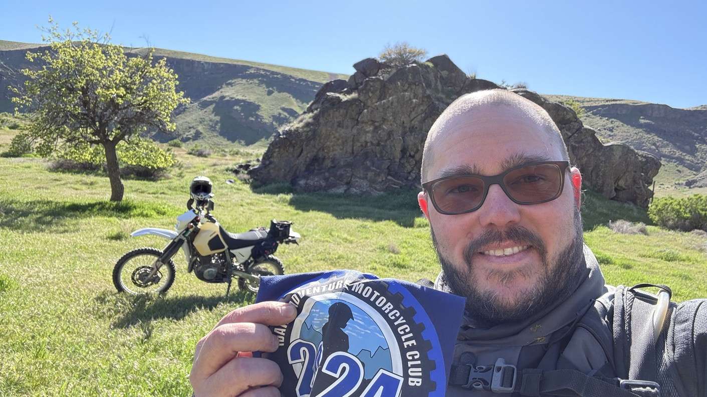
Use the form below to check in. Check-ins must include a photo of you or your bike at the challenge site with the 2024 bandanna. All participants must be registered IAMC Challenge Members. Leave a description of your ride and share road conditions — snow, water, obstacles, and tips for future riders are all appreciated.
Replying to another person's check-in is encouraged, but take care not to accidentally create your own check-in.
The stated difficulty is an estimate. Rating your experience helps future riders stay safe. You alone are responsible for the safety of your ride.
14 Check-Ins
I took the day off to knock of several outstanding challenge sites. Rode the back country byway for the first time. Rained last night, roads soupy and slippy. I was 2-up with my wife. We had a great time.


Bit of a trek. We went in from Murphy Flat Rd, Sinker Butte Rd. Take the graded road before the solar farm, follow it to the left turn after the downhill section then follow the path upstream. As mentioned it's a bit rocky before the cattle grid, pretty easy after. It was really hot out there today.

I pushed the bike over the dam to get to this one. The recent rain has messed up the road getting into this one, but the road is in decent shape still. later in the year this road is going to get bad with deep silt.

It took me a while to figure out the best way to get to this, but I recommend you take Murphy Flat road, turn left onto Sinker Butte road, then take the second right onto the first decent looking dirt road. Follow that (stay on the best graded road) all the way down to just above the Swan Falls Dam, then take the ranch road downstream. Lots of moondust, and a really rocky patch across a dry stream bed definitely adds a pucker factor.

Easy sailing until in wasn't. Rock gardens, off camber pitches, sand, ruts and a bit of moon dust added to the challenge as you accessed this site. Watch for the hidden rocks!
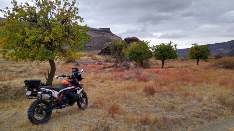
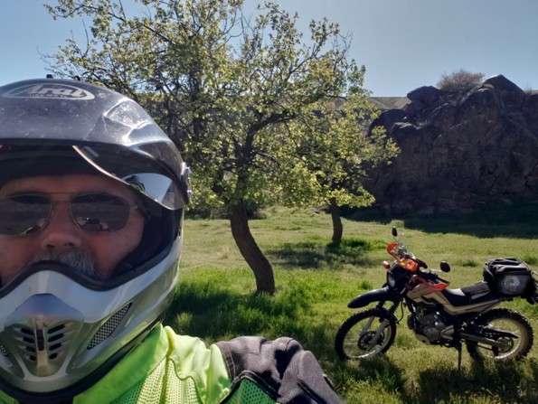
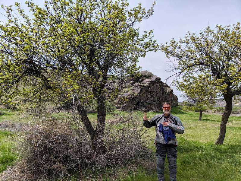
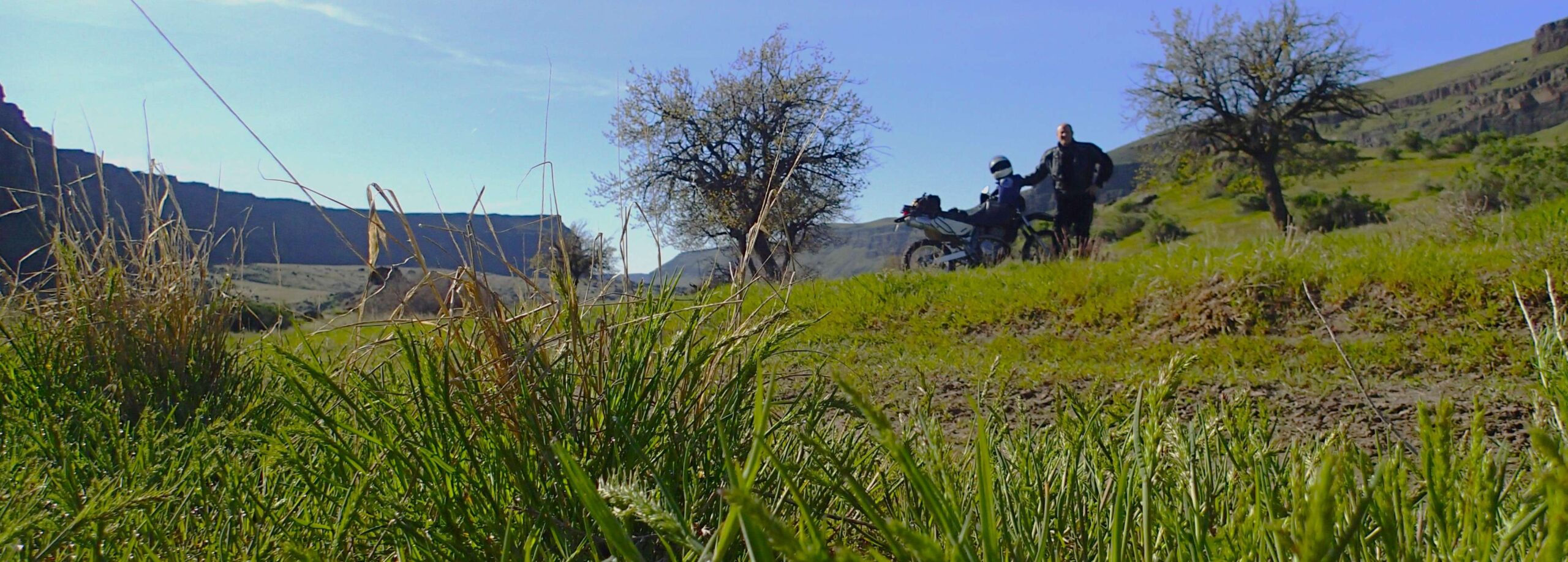
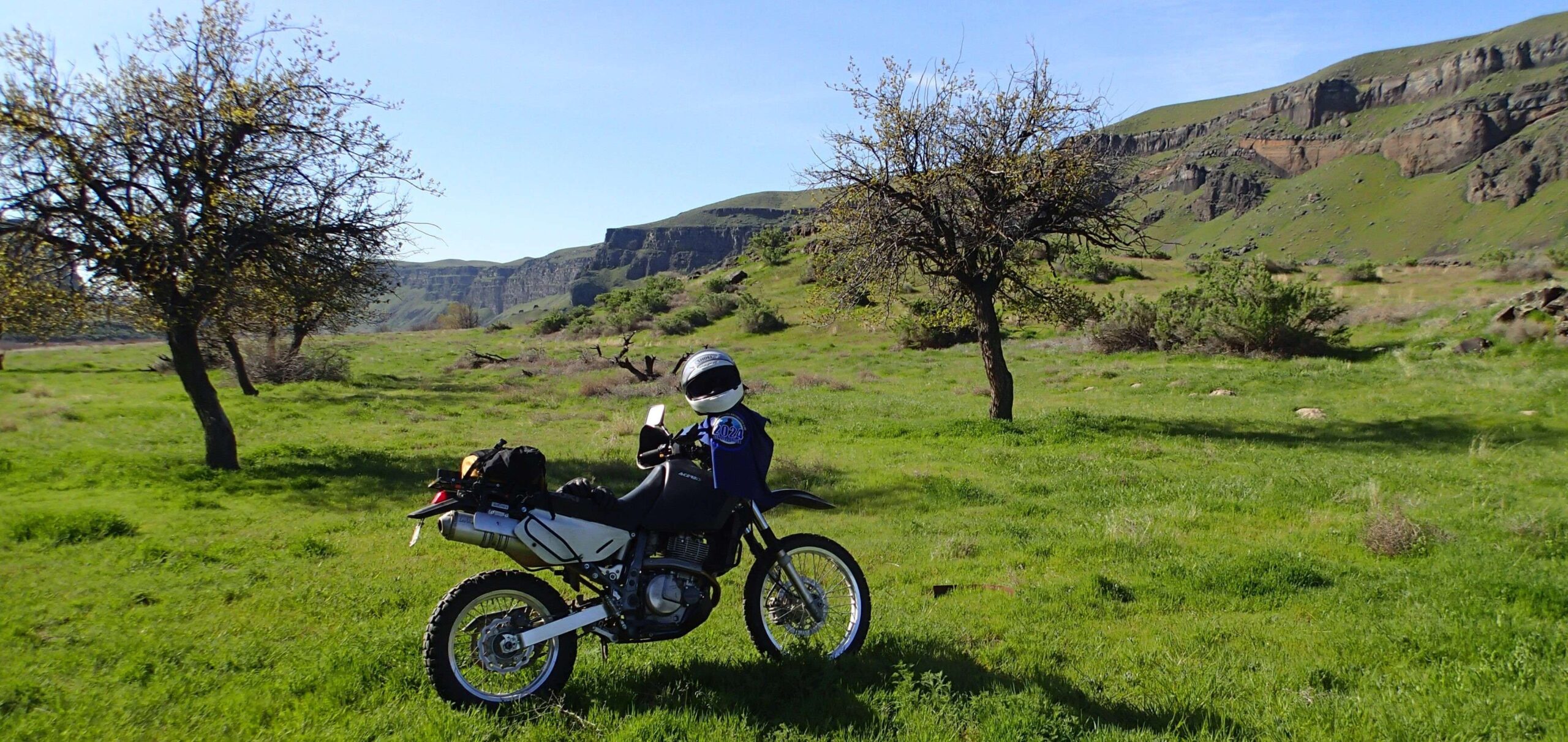
Really a beautiful and interesting area, especially this time of year. Green grasses and a brilliant sky.


First time into this area. . Hwy 78, Murphy Flat Rd, to river trail was smooth sailing. Two track into site, after dropping down from the bluff, was fun. A few rocky spots, occasional ruts, and soft dirt. Windy so no dust to worry about for my riding partner or myself. Larger ADV bikes (GS and 1290s) will need to take it slow and easy through the few rocky sections and occasional rut as you can easily get pinballed off the trail if you don't pick the proper line.

Fun ride a little rocky and sandy. Good roads up till the last few miles. There were a lot of little gnat type bugs flying around today. Had to keep the visor down.
Steep in places with rocks, sand, and deep ruts. Also for good measure, it includes slick moon dust and a challenging washout just upriver from the cattle guard. After the cattle guard it's smooth sailing. It's a handful on a twin-cylinder ADV bike.
I'd echo everyone else's comments that have posted prior to me.....bike size....690 = Fun. Big Bike (1250) = suck. I chose properly today with the 690 and had no regrets. Most of the road in is hard-pack smooth gravel. The last 3 miles from the turnoff by the dam could be divided into "north of the cattle guard" and "south of the cattle guard". South of the cattle guard (the first part) had a stretch of rutted sand that I hated (I hate sand anyway) and a couple of rocky sections North of the cattle guard was really nice two-track.
One other thing......this site is not remote at all (in a sense). The whole Swan Falls encampment is right across the river. I want to see one of us load their bike in a boat and float across to hit this point! That would be epic.
The ride from 78 down to the river was smooth, fast, and easy. I'd rate it a 2 only because some if it was not paved. The last 3 or so miles along the river, I'd rate a 4. Being a slow fat guy, I wouldn't want to take anything bigger than my DR650 out there. Sand, ruts, and rocks. There was no mud when I went through, but any water and it would have been very slippery.
For an old fart like me this is a solid class 4 ride jmo... there is no way l would ever attempt to take my beast 1200 in here, at least not alone... the 2 fiddy was just right for this stretch... sand, rock gardens, off camber and some steep sections...
This is my $150.00 Challenge Point.
I screwed up and rode off with my USWE hydration pack on the rear rack of my TW. I realized my mistake about 7 miles later and rode back to the Rabbit Creek Trail Head & Staging Area - but it was too late. Someone had decided that they needed water more than me.
I almost decided to load up and head home, but since I failed to reach the point earlier in the week (although I could see it - about 200 feet below me), I chose to press on.
Pavement and good, graded-dirt roads take you most of the way in. The last 3.5 miles are an old two-track trail that isn't regularly used. There's plenty of sand, rocks, and ruts. I could have done it on my GS, but there would have been a lot more swearing. Those seven miles are why I rate this one a 3.
NOTE: The two-track section will be impassable by motorcycle if it's recently rained.
.GPX file attached.
I came in Murphy Flat road. Stayed on the most used roads heading to Swan Falls Dam. At the dam head down stream until Wees. The road to the dam is easy. The road along the river has some rocks, mud and ruts.
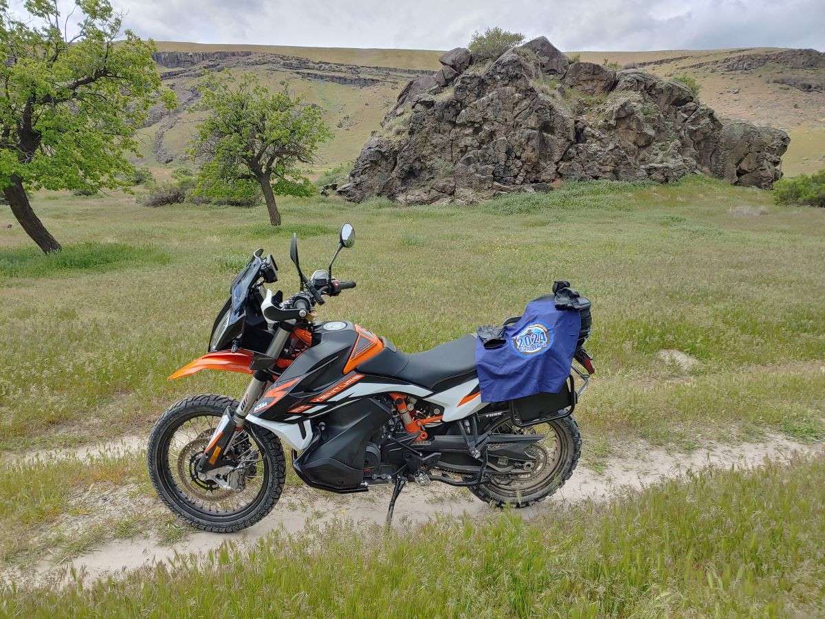
April is a great time to visit. Nice and green and cool.
I took the day off to knock of several outstanding challenge sites. Rode the back country byway for the first time. Rained last night, roads soupy and slippy. I was 2-up with my wife. We had a great time.
really hot in the valley
Bit of a trek. We went in from Murphy Flat Rd, Sinker Butte Rd. Take the graded road before the solar farm, follow it to the left turn after the downhill section then follow the path upstream. As mentioned it’s a bit rocky before the cattle grid, pretty easy after. It was really hot out there today.
I pushed the bike over the dam to get to this one. The recent rain has messed up the road getting into this one, but the road is in decent shape still. later in the year this road is going to get bad with deep silt.
It took me a while to figure out the best way to get to this, but I recommend you take Murphy Flat road, turn left onto Sinker Butte road, then take the second right onto the first decent looking dirt road. Follow that (stay on the best graded road) all the way down to just above the Swan Falls Dam, then take the ranch road downstream. Lots of moondust, and a really rocky patch across a dry stream bed definitely adds a pucker factor.
Easy sailing until in wasn’t. Rock gardens, off camber pitches, sand, ruts and a bit of moon dust added to the challenge as you accessed this site. Watch for the hidden rocks!
Really a beautiful and interesting area, especially this time of year. Green grasses and a brilliant sky.
First time into this area. . Hwy 78, Murphy Flat Rd, to river trail was smooth sailing. Two track into site, after dropping down from the bluff, was fun. A few rocky spots, occasional ruts, and soft dirt. Windy so no dust to worry about for my riding partner or myself. Larger ADV bikes (GS and 1290s) will need to take it slow and easy through the few rocky sections and occasional rut as you can easily get pinballed off the trail if you don’t pick the proper line.
Fun ride a little rocky and sandy. Good roads up till the last few miles. There were a lot of little gnat type bugs flying around today. Had to keep the visor down.
Steep in places with rocks, sand, and deep ruts. Also for good measure, it includes slick moon dust and a challenging washout just upriver from the cattle guard. After the cattle guard it’s smooth sailing. It’s a handful on a twin-cylinder ADV bike.
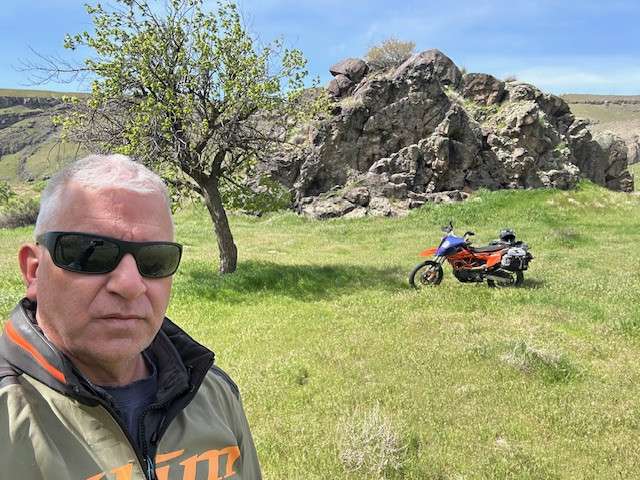
Attaching a pic.
I’d echo everyone else’s comments that have posted prior to me…..bike size….690 = Fun. Big Bike (1250) = suck. I chose properly today with the 690 and had no regrets. Most of the road in is hard-pack smooth gravel. The last 3 miles from the turnoff by the dam could be divided into “north of the cattle guard” and “south of the cattle guard”. South of the cattle guard (the first part) had a stretch of rutted sand that I hated (I hate sand anyway) and a couple of rocky sections North of the cattle guard was really nice two-track.
One other thing……this site is not remote at all (in a sense). The whole Swan Falls encampment is right across the river. I want to see one of us load their bike in a boat and float across to hit this point! That would be epic.
The ride from 78 down to the river was smooth, fast, and easy. I’d rate it a 2 only because some if it was not paved. The last 3 or so miles along the river, I’d rate a 4. Being a slow fat guy, I wouldn’t want to take anything bigger than my DR650 out there. Sand, ruts, and rocks. There was no mud when I went through, but any water and it would have been very slippery.
For an old fart like me this is a solid class 4 ride jmo… there is no way l would ever attempt to take my beast 1200 in here, at least not alone… the 2 fiddy was just right for this stretch… sand, rock gardens, off camber and some steep sections…
This is my $150.00 Challenge Point.
I screwed up and rode off with my USWE hydration pack on the rear rack of my TW. I realized my mistake about 7 miles later and rode back to the Rabbit Creek Trail Head & Staging Area – but it was too late. Someone had decided that they needed water more than me.
I almost decided to load up and head home, but since I failed to reach the point earlier in the week (although I could see it – about 200 feet below me), I chose to press on.
Pavement and good, graded-dirt roads take you most of the way in. The last 3.5 miles are an old two-track trail that isn’t regularly used. There’s plenty of sand, rocks, and ruts. I could have done it on my GS, but there would have been a lot more swearing. Those seven miles are why I rate this one a 3.
NOTE: The two-track section will be impassable by motorcycle if it’s recently rained.
.GPX file attached.
I came in Murphy Flat road. Stayed on the most used roads heading to Swan Falls Dam. At the dam head down stream until Wees. The road to the dam is easy. The road along the river has some rocks, mud and ruts.
April is a great time to visit. Nice and green and cool.
Comments are closed.