Description
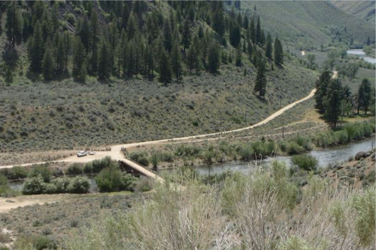
Danskin Bridge is a key access point on the South Fork of the Boise River in Elmore County, Idaho, often used as a boat launch for rafting and fishing. It sits in a remote area offering 19 miles of roadless access downstream to Neal Bridge, popular for scenic floats and trout fishing, with potential for challenging whitewater rapids.
More Information
Coordinates: 43.404965, -115.565809
Elevation: 3661 ft
Difficulty: 2
What to Expect:
Check In
Use the form below to check in. Check-ins must include a photo of you or your bike at the challenge site with the 2026 bandanna. All participants must be registered IAMC Challenge Members. Leave a description of your ride and share road conditions — snow, water, obstacles, and tips for future riders are all appreciated.
Replying to another person's check-in is encouraged, but take care not to accidentally create your own check-in.
The stated difficulty is an estimate. Rating your experience helps future riders stay safe. You alone are responsible for the safety of your ride.