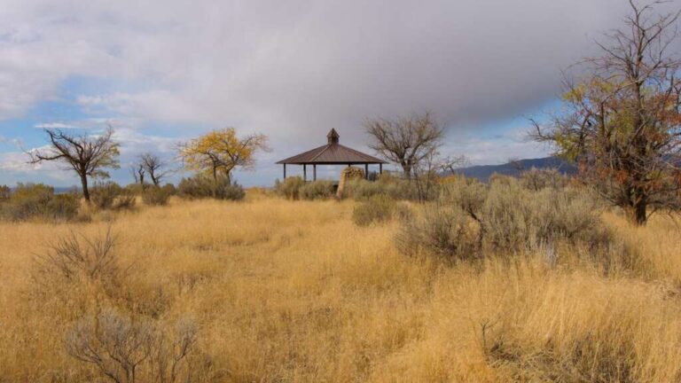

06 – Bonneville Point
[From the BLM Website] Stand in the same spot where Captain Benjamin Bonneville and his expedition party overlooked the valley he named Les Bois, site of the city that today bears the same name Boise. The view takes in the entire Treasure Valley. The site is also an access point for the Oregon Trail and a place to hike, picnic, and view wildlife. A mountain bike trail to Lucky Peak Reservoir also runs nearby.
More Information
https://www.blm.gov/visit/bonneville-point
https://www.nps.gov/places/000/bonneville-point.htm
Coordinates: 43.491693, -116.040236
Elevation: 3868 ft
Difficulty: 2
What to Expect: No info
[reblex id=’779′]
Check In
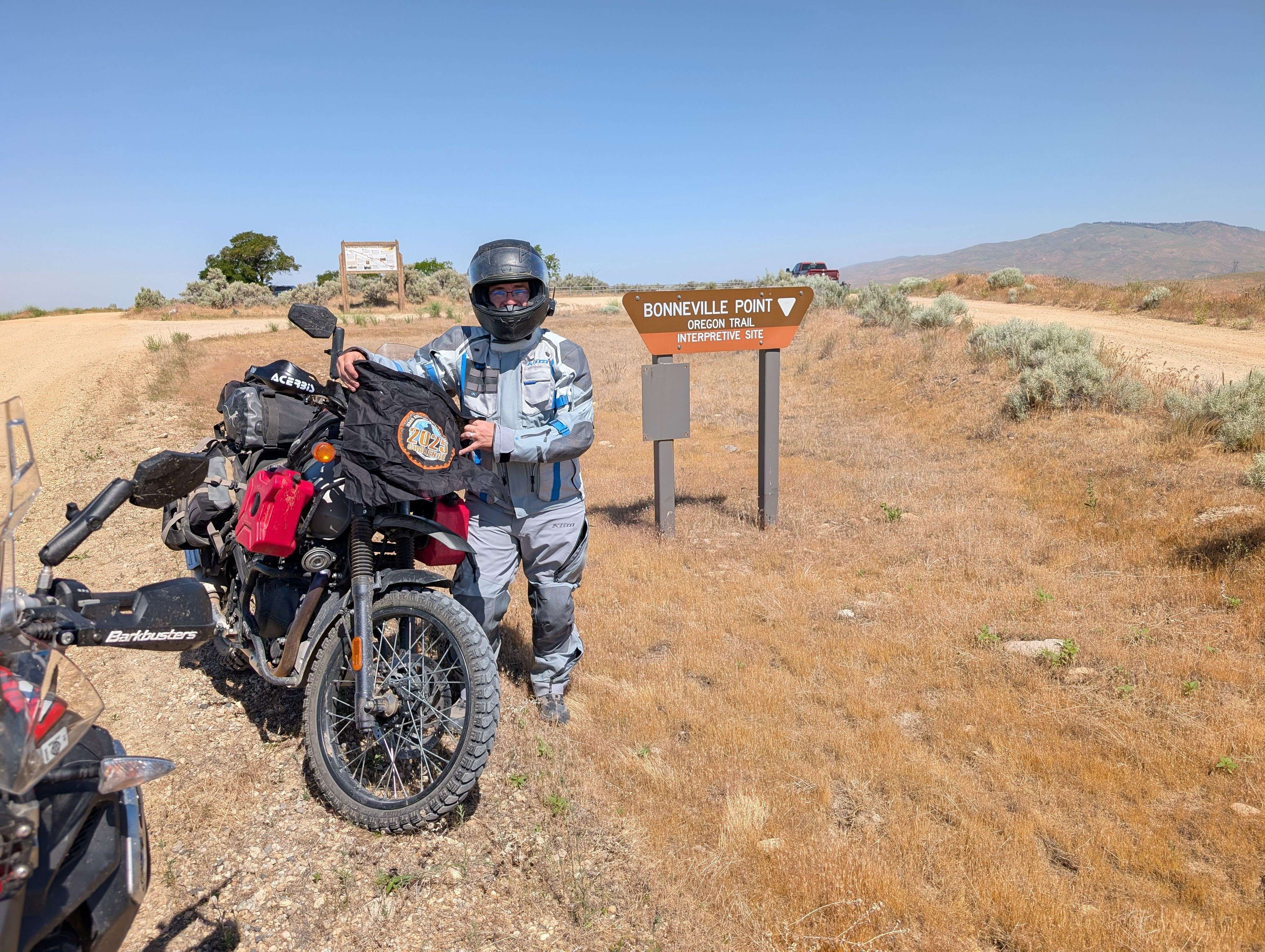
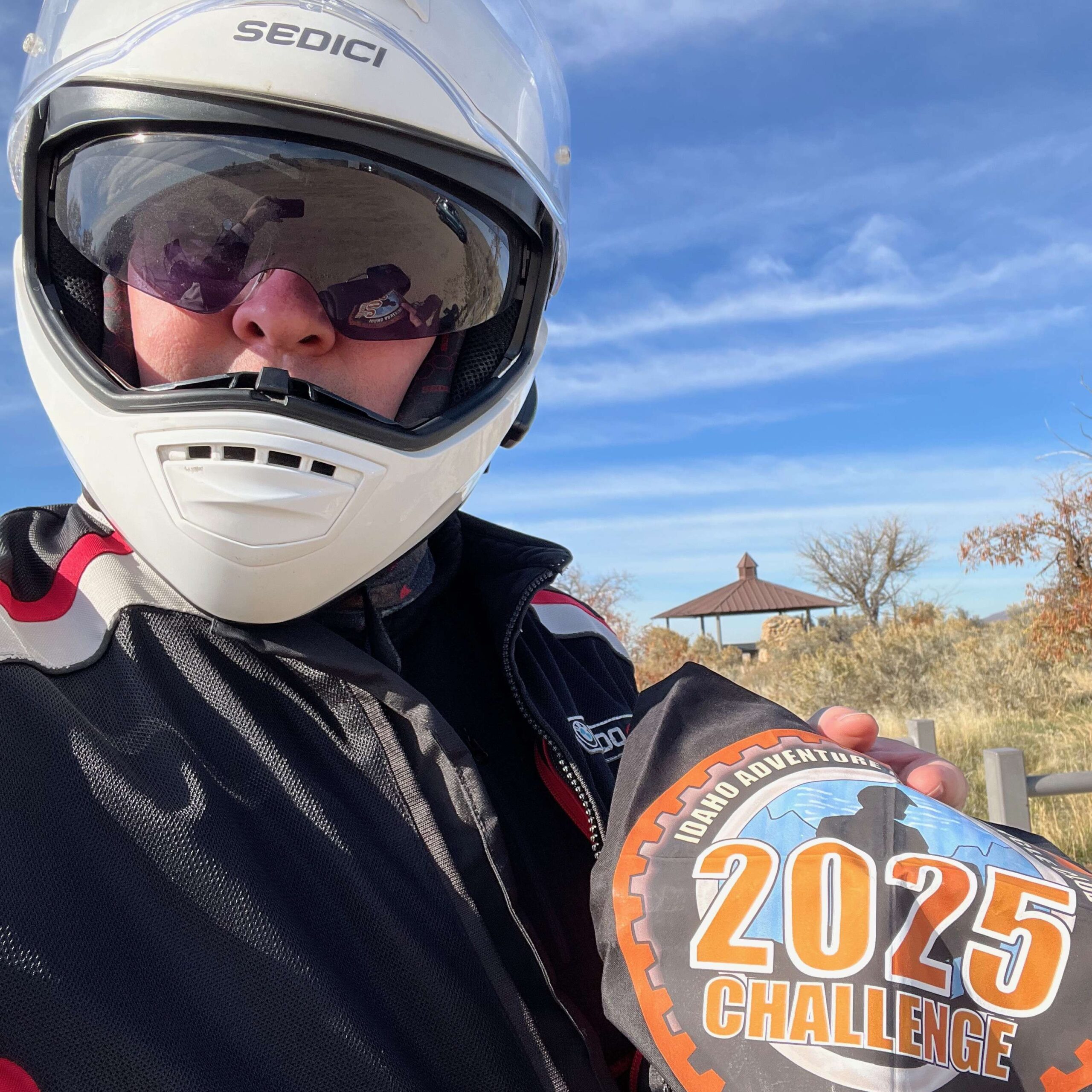
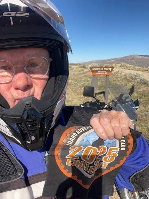
Use the form below to check in. Check-ins must include a photo of you or your bike at the challenge site with the 2025 bandanna. All participants must be registered IAMC Challenge Members. Leave a description of your ride and share road conditions — snow, water, obstacles, and tips for future riders are all appreciated.
Replying to another person's check-in is encouraged, but take care not to accidentally create your own check-in.
The stated difficulty is an estimate. Rating your experience helps future riders stay safe. You alone are responsible for the safety of your ride.
31 Check-Ins
I came here with my late Grandfather when I was a kid for the first time. Great memories.
Always heard the story about 'Les Bois', but didn't realize it was here.

Rode up via Blacks Creek road and down the old Oregon trail road. Wasn’t too bad going down. Lots of ruts and some loose rock.

My first ride out after a front tire blowout a couple months ago👍🏻
Quick ride from SE Boise. Took the Oregon Trail up from behind Micron. Moon dust at the start, rocks, ruts, and hills the rest.
May 3rd. Started early that morning to catch up with the group on the Sam's Poker Run. This is where I caught up with the group


Haven't been up here since mountain biking here 30 yrs ago. Still a nice view. Sure a lot of change down in that there valley.

Hit up this location yesterday. Rode the Oregon trail back to Boise - it's a 2+ difficulty depending on conditions.


Difficulty is a 1 to get to the challenge site but extends to a 2 if you keep going past and take the trail all the way to the backside of Micron. Just stay on the main route and easy to navigate. Would definitely be a 3 with any amount of mud.

Been here a few times. I took the time to read the information this time. Seems strang that they would take the wagons along the foothills instead of the plains
Beautiful spot! I've got to come back and wander around here sometime.
First stop on the Sam's Prairie Poker Run ride.


This was the first stop for our Prairie ride. I don't think I have ever been here, but it's a cool little spot. I'll have to bring the family here sometime.
Easy gravel, no problem even on a big bike.

Best site of the day. Easy riding with about a mile of gravel at the end. Good views and cool to read about. Definitely windy at the top though.

Rode up from the sub division behind Micron, lots of ruts and some loose rocky parts but the same as late season last year IMO. Went down the back side to Lucky State Park and made it a loop going over Shaw Mt., found a bit of snow and ice over there on the East side of Shaw.

It’s a short ride from Boise up to the point with a convoy of gravel trucks for me along the way. Great little ride and I was able to explore some of the trails adjacent to the summit. Great views of the city at the top.

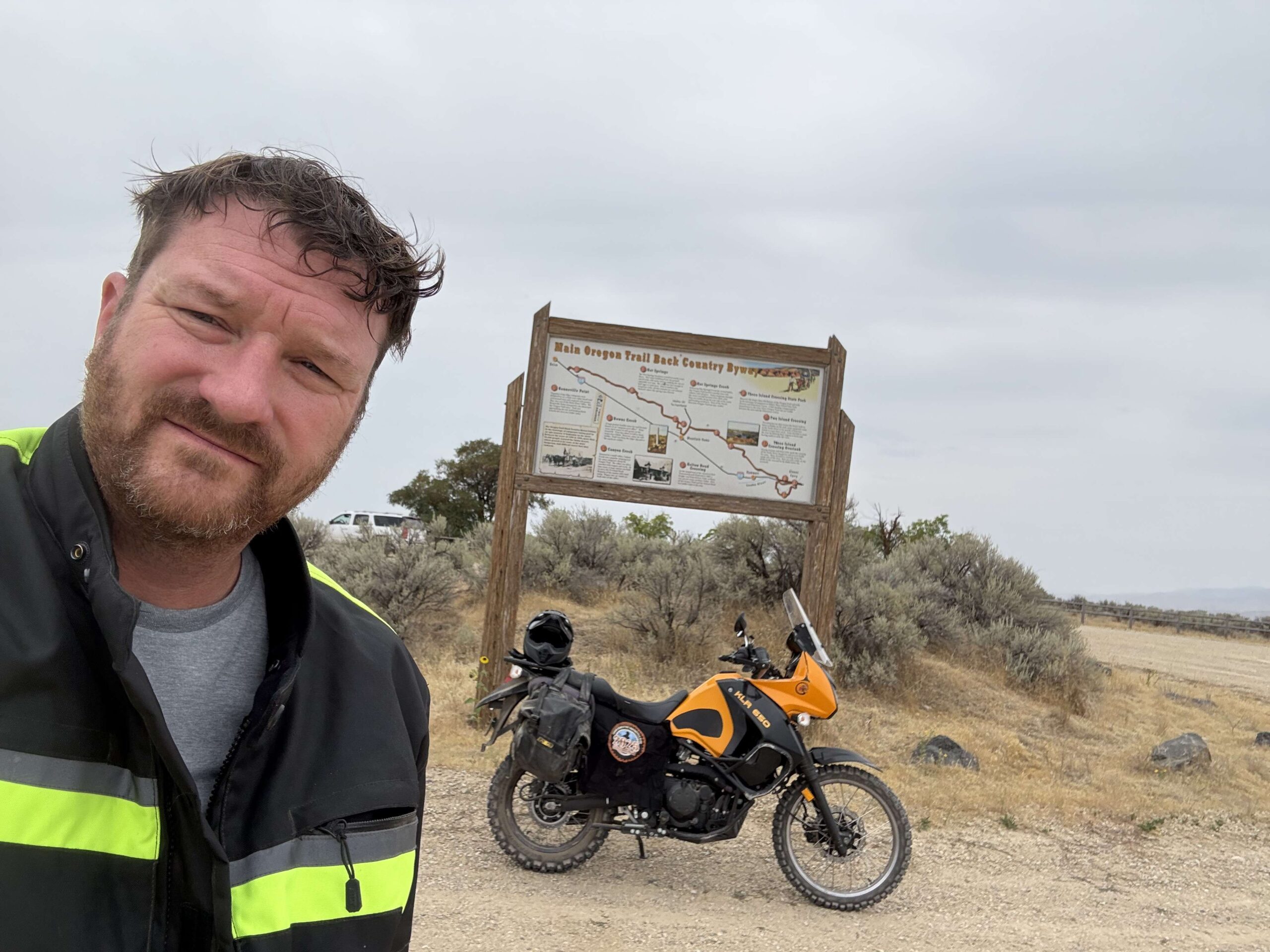
First of three points for the day and man it was cold! I included two photos, one "on the pin" and one next to the Bonneville Point sign at entrance to the site itself. There is more to explore up there on The Point.....is it possible to go northwest from the site and get down to the subdivisions that are east of Micron? On a warmer day I might find out.......


Easy ride up. First stop of the day with FW190Pilot. It was cold this morning!

Just getting back into town as a storm rolls in from the west. Access from the freeway is paved for the first 1.5 miles, the next 2 miles are compact gravel. Access from the Micron side is washed out; loose rocks; plenty of ruts; and STEEP in places.

I came here with my late Grandfather when I was a kid for the first time. Great memories.
Always heard the story about ‘Les Bois’, but didn’t realize it was here.
A beautiful day for a fall ride.
The start of a 3 site loop
Rode up via Blacks Creek road and down the old Oregon trail road. Wasn’t too bad going down. Lots of ruts and some loose rock.
My first ride out after a front tire blowout a couple months ago👍🏻
Quick ride from SE Boise. Took the Oregon Trail up from behind Micron. Moon dust at the start, rocks, ruts, and hills the rest.
Dirt was washboard but not bad
May 3rd. Started early that morning to catch up with the group on the Sam’s Poker Run. This is where I caught up with the group
Rode here with Chatty and Special Ed
easy ride up
Lunch hour ride…lots of gravel trucks on Kuna Mora Rd.
Haven’t been up here since mountain biking here 30 yrs ago. Still a nice view. Sure a lot of change down in that there valley.
Hit up this location yesterday. Rode the Oregon trail back to Boise – it’s a 2+ difficulty depending on conditions.
Nice view of the valley into Boise!
Dirt road was dry and hard packed so not difficult. Beautiful day.
Difficulty is a 1 to get to the challenge site but extends to a 2 if you keep going past and take the trail all the way to the backside of Micron. Just stay on the main route and easy to navigate. Would definitely be a 3 with any amount of mud.
Been here a few times. I took the time to read the information this time. Seems strang that they would take the wagons along the foothills instead of the plains
Forgot the photo
Beautiful spot! I’ve got to come back and wander around here sometime.
First stop on the Sam’s Prairie Poker Run ride.
Met the Sam’s group ride at this spot. Great ride and group.
Hit Bonneville point on our way out of town from Blacks Creek Road.
Nice View. Nicely updated interpretive site.
nice ride, we ended up with 10 riders today.
Quick stop during the Saturday ride.
This was the first stop for our Prairie ride. I don’t think I have ever been here, but it’s a cool little spot. I’ll have to bring the family here sometime.
Easy gravel, no problem even on a big bike.
Best site of the day. Easy riding with about a mile of gravel at the end. Good views and cool to read about. Definitely windy at the top though.
Rode up from the sub division behind Micron, lots of ruts and some loose rocky parts but the same as late season last year IMO. Went down the back side to Lucky State Park and made it a loop going over Shaw Mt., found a bit of snow and ice over there on the East side of Shaw.
It’s a short ride from Boise up to the point with a convoy of gravel trucks for me along the way. Great little ride and I was able to explore some of the trails adjacent to the summit. Great views of the city at the top.
First of three points for the day and man it was cold! I included two photos, one “on the pin” and one next to the Bonneville Point sign at entrance to the site itself. There is more to explore up there on The Point…..is it possible to go northwest from the site and get down to the subdivisions that are east of Micron? On a warmer day I might find out…….
Definitely possible.
First site for the day. This was my pick-your-own last year.
Easy ride up. First stop of the day with FW190Pilot. It was cold this morning!
Just getting back into town as a storm rolls in from the west. Access from the freeway is paved for the first 1.5 miles, the next 2 miles are compact gravel. Access from the Micron side is washed out; loose rocks; plenty of ruts; and STEEP in places.
Comments are closed.