

15 – Toy Pass
Description
More Information
Additional Info
Coordinates: 42.903922, -116.546853
Elevation: 5875 ft
Difficulty: 2
What to Expect: No info
[reblex id=’779′]
Check In
Use the form below to check in. Check-ins must include a photo of you or your bike at the challenge site with the 2025 bandanna. All participants must be registered IAMC Challenge Members. Leave a description of your ride and share road conditions — snow, water, obstacles, and tips for future riders are all appreciated.
Replying to another person's check-in is encouraged, but take care not to accidentally create your own check-in.
The stated difficulty is an estimate. Rating your experience helps future riders stay safe. You alone are responsible for the safety of your ride.
16 Check-Ins
Last site of the season. Great year. Now time for maintenance.
Really beautiful ride to the top. I came in from the East after hitting Our Lady Queen of Heaven. The ride up is a pretty easy 2, with a couple of minor switchbacks. I averaged about 35 mph most of the way, and I ride pretty slow on gravel.
When I got to the top it was getting cold (Nov 16th) and super windy. It's kinda hard to put on a jacket when it's blowing so hard. Glad no one was there to watch me struggle with it.
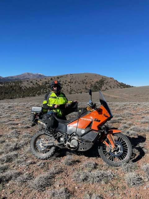
My dog came with me. (if you look close at my flag you can see his hair)


Took FW190 pilot’s advice and climbed the hill just east of the fence. Fantastic views.
Fourth stop of the day in early June – perfect weather for a ride along the Snake River watershed. Hit seven sites on a 260 mile loop.
Nice view at the top looking into Oregon.
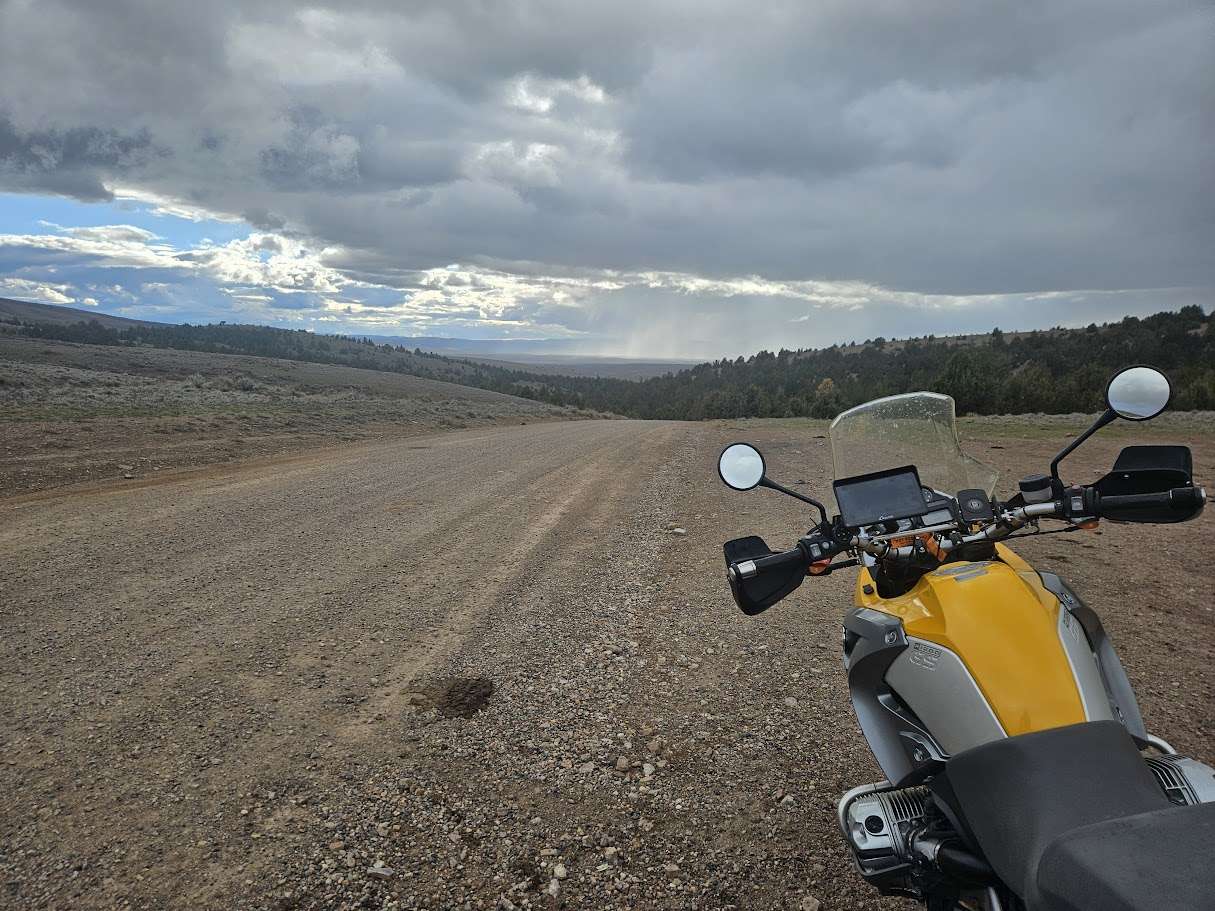
The road is a bit loose in the gravel. The Anabrus simplex was on the road toward the top third of the pass.

Made a big loop from wagontown cemetery and caught this one the way back, seemed like an extremely long ride to get back to here. Last one for the day

13 ish miles past challenge site 15 (Our Lady). It was blowing a hurricane when I arrived, so I didn't go up to either lookout.

Gravel road, not too bad, we stopped and turned around with a few miles left. The road was looking rockier than we wanted to chance...

Stop four of four on Memorial Day with ChillyPhilly. We went to the top of the eastern hill (mound, hump, mountain, whatever it's called) last year and the view is spectacular. Highly recommend if you haven't been. Take the two-track that's on the north side of the fence line. This very small portion is a 3+ on a big bike (for me at least)...fairly easy on a smaller bike like 700 Tenere or below. This year we stopped at the cattle guard and got the picture. Someone thoughtfully put an American flag on the cattle guard structure. The road up from Oreana is a 2, very nice graded gravel/dirt road. YMMV


I went east at the cattle guard to get a overview look. 2nd of 4 for the day.

Road was in pretty good condition, some sharp rocks as others have mentioned. At the top we took the trail past the cattle guard on the right that had some pretty interesting surface that looked like dirt and felt like sand some butt puckering ensued. On the way back down just before coming back into Oreana ended up behind some guys pulling livestock trailers that were kicking up a ton of dust. Had to make some sketchy passes to avoid being completely blind.

For me, this ride was harder than a 2, maybe a 2.5, and we stopped and turned around before we got to Toy Pass. This check-in shouldn't count, but I want to share my experience as a new-ish rider. I nearly ran over two bull snakes and one rattlesnake, and the road was covered in Mormon crickets. Most of the way, the gravel road was pretty good, but as it got higher and more twisty, the rocks were sharper, and I got pretty nervous. I don't know if you can see it in the attached photo, but all of the brown specks on the road are crickets. I think we only had three miles to go when we turned around, and maybe things would have gotten easier, but I was too scared to find out.

Crews are improving the gravel road with new gravel over some of the rougher spots. Overall, it's an easy ride with great views.


Went in from Oreana, enjoyed a beautiful day in the desert. Road was still “closed for winter”, but the Owyhee County road crew said we could do our thing. Lots of sharp, loose rocks, but the crew was taking care of that stuff. Challenging, but beautiful ride.

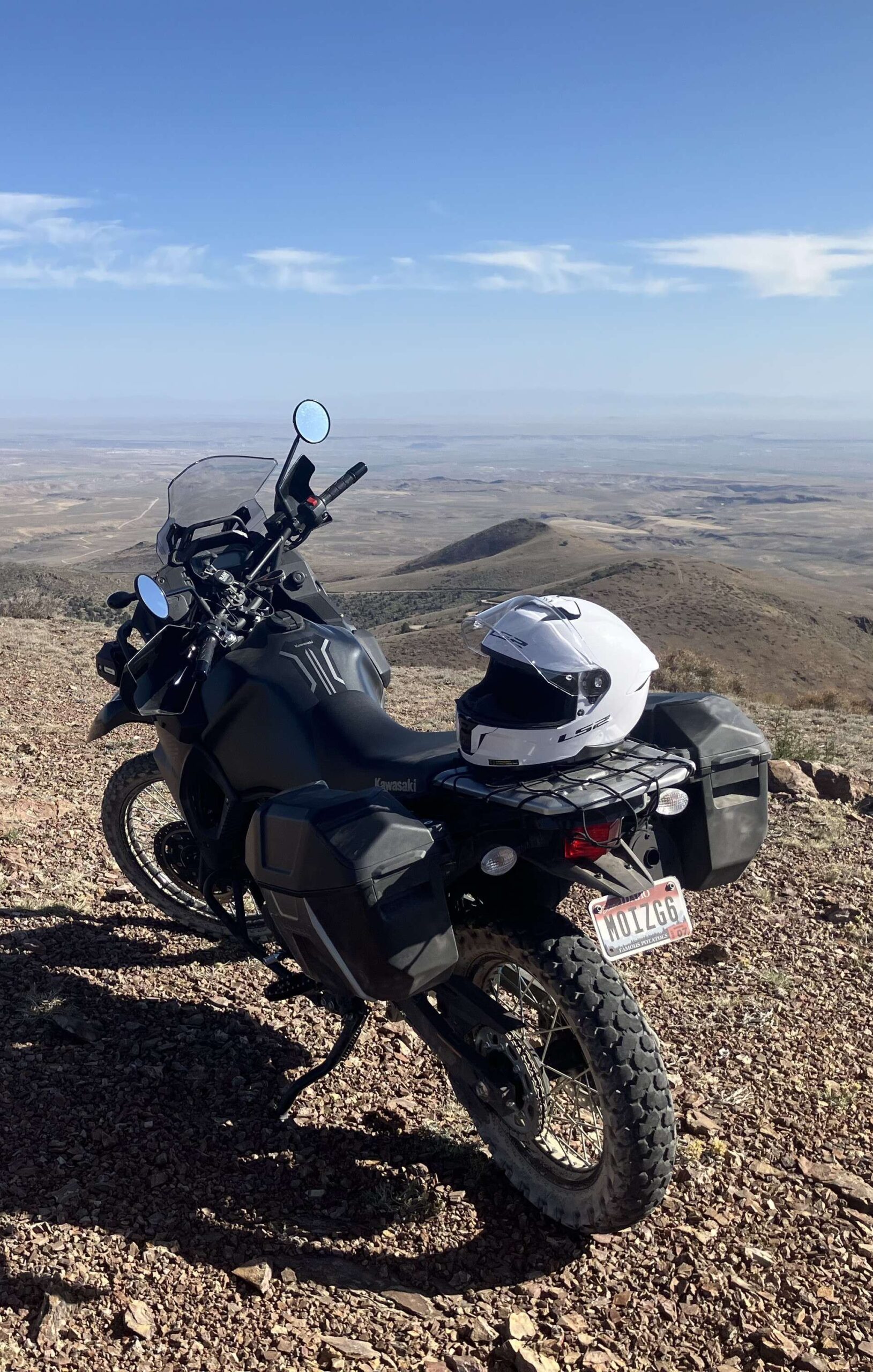
9th site for the day. I wasn't sure if Toy Pass would be open. It was too close to site 14 not to try. There was a "Road Closed Due to Winter Conditions" sign heading up Bachman Grade Rd, but it was clear all the way up to the pass. I took the obligatory picture at the coordinates, and then took the very short trail up to the top of the hill directly west to check out the view and snap another picture.


Last site of the season. Great year. Now time for maintenance.
Really beautiful ride to the top. I came in from the East after hitting Our Lady Queen of Heaven. The ride up is a pretty easy 2, with a couple of minor switchbacks. I averaged about 35 mph most of the way, and I ride pretty slow on gravel.
When I got to the top it was getting cold (Nov 16th) and super windy. It’s kinda hard to put on a jacket when it’s blowing so hard. Glad no one was there to watch me struggle with it.
My dog came with me. (if you look close at my flag you can see his hair)
Took FW190 pilot’s advice and climbed the hill just east of the fence. Fantastic views.
Fourth stop of the day in early June – perfect weather for a ride along the Snake River watershed. Hit seven sites on a 260 mile loop.
Nice view at the top looking into Oregon.
The road is a bit loose in the gravel. The Anabrus simplex was on the road toward the top third of the pass.
Made a big loop from wagontown cemetery and caught this one the way back, seemed like an extremely long ride to get back to here. Last one for the day
13 ish miles past challenge site 15 (Our Lady). It was blowing a hurricane when I arrived, so I didn’t go up to either lookout.
Gravel road, not too bad, we stopped and turned around with a few miles left. The road was looking rockier than we wanted to chance…
Stop four of four on Memorial Day with ChillyPhilly. We went to the top of the eastern hill (mound, hump, mountain, whatever it’s called) last year and the view is spectacular. Highly recommend if you haven’t been. Take the two-track that’s on the north side of the fence line. This very small portion is a 3+ on a big bike (for me at least)…fairly easy on a smaller bike like 700 Tenere or below. This year we stopped at the cattle guard and got the picture. Someone thoughtfully put an American flag on the cattle guard structure. The road up from Oreana is a 2, very nice graded gravel/dirt road. YMMV
Beautiful area, wish I had more time to check out all the roads.
I went east at the cattle guard to get a overview look. 2nd of 4 for the day.
Road was in pretty good condition, some sharp rocks as others have mentioned. At the top we took the trail past the cattle guard on the right that had some pretty interesting surface that looked like dirt and felt like sand some butt puckering ensued. On the way back down just before coming back into Oreana ended up behind some guys pulling livestock trailers that were kicking up a ton of dust. Had to make some sketchy passes to avoid being completely blind.
For me, this ride was harder than a 2, maybe a 2.5, and we stopped and turned around before we got to Toy Pass. This check-in shouldn’t count, but I want to share my experience as a new-ish rider. I nearly ran over two bull snakes and one rattlesnake, and the road was covered in Mormon crickets. Most of the way, the gravel road was pretty good, but as it got higher and more twisty, the rocks were sharper, and I got pretty nervous. I don’t know if you can see it in the attached photo, but all of the brown specks on the road are crickets. I think we only had three miles to go when we turned around, and maybe things would have gotten easier, but I was too scared to find out.
You made a good faith attempt, we can count it. 😉 Thanks for the feedback letting other rides know what to expect, it’s very helpful.
Crews are improving the gravel road with new gravel over some of the rougher spots. Overall, it’s an easy ride with great views.
Fun road
Went in from Oreana, enjoyed a beautiful day in the desert. Road was still “closed for winter”, but the Owyhee County road crew said we could do our thing. Lots of sharp, loose rocks, but the crew was taking care of that stuff. Challenging, but beautiful ride.
9th site for the day. I wasn’t sure if Toy Pass would be open. It was too close to site 14 not to try. There was a “Road Closed Due to Winter Conditions” sign heading up Bachman Grade Rd, but it was clear all the way up to the pass. I took the obligatory picture at the coordinates, and then took the very short trail up to the top of the hill directly west to check out the view and snap another picture.
Thanks for the knowledge on the snow level. ChillyPhilly showed me that overlook last year and it is a must-do for me this year when I eventually get there.
Comments are closed.