

21 – Hells Canyon Dam
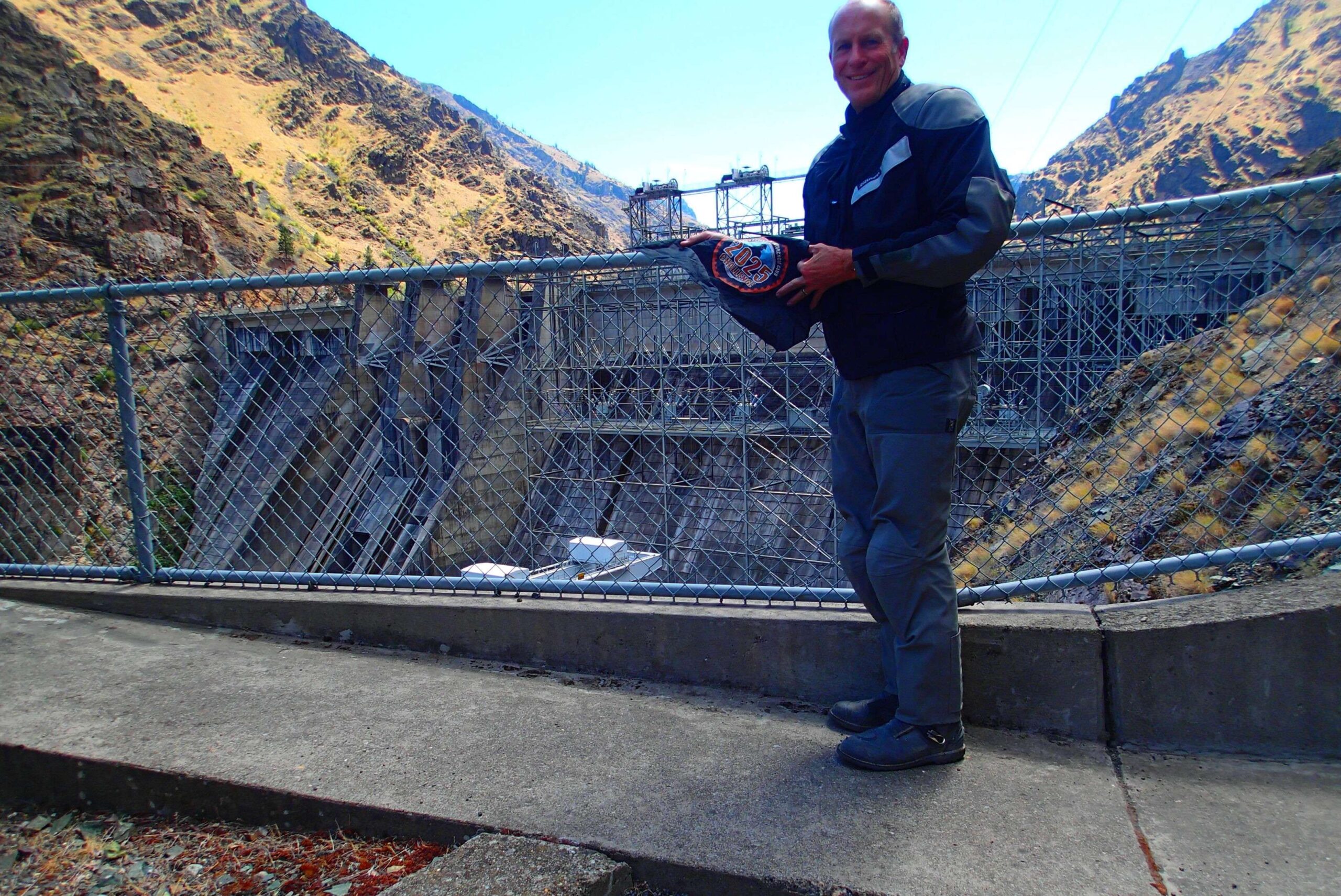
Hells Canyon Dam, the third and final hydroelectric dam in the Hells Canyon Project, is a concrete gravity dam located on the Snake River along the Idaho-Oregon border, impounding Hells Canyon Reservoir. [1, 2, 3]
Key Features and Details: [1, 2]
- Location: Mile 247.0 of the Snake River, on the IdahoOregon border. [1, 2]
- Purpose: Part of the Hells Canyon Project, which aims to generate electricity, create reservoirs for irrigation and flood control. [1, 4]
- Construction: Completed in 1967 by Idaho Power Company as the last of three hydroelectric dams in the Hells Canyon Complex. [1, 4]
- Other Dams in the Complex: Brownlee Dam and Oxbow Dam. [1, 3, 4]
- Height: Approximately 350 feet tall. [2]
- Switchyard: The switchyard is built directly on the face of the dam due to the rugged terrain of the canyon. [2]
- Hells Canyon Creek Visitor Center: Located right below the dam, offering information about the area and its history. [3]
- Recreation: The area offers opportunities for fishing in the Hells Creek Reservoir and scenic views of the Snake River. [3, 5]
- Part of the Hells Canyon Scenic Byway: The dam is a major site off the Hells Canyon Scenic Byway. [1]
Generative AI is experimental.
More Information
[1] https://traveloregon.com/things-to-do/destinations/parks-forests-wildlife-areas/hells-canyon-dam/
[2] https://www.youtube.com/watch?v=GKGp_DF8MK8
[3] https://www.allmccall.com/hells_canyon/hells_canyon_dam.php
[4] https://hellscanyon.tours/2024/06/12/a-look-at-the-history-of-hells-canyons-dam-system/
[5] https://www.fs.usda.gov/recarea/wallowa-whitman/recarea/?recid=51941
Coordinates: 45.243033, -116.701713
Elevation: 2270 ft
Difficulty: 1
What to Expect: No info
[reblex id=’779′]
Check In
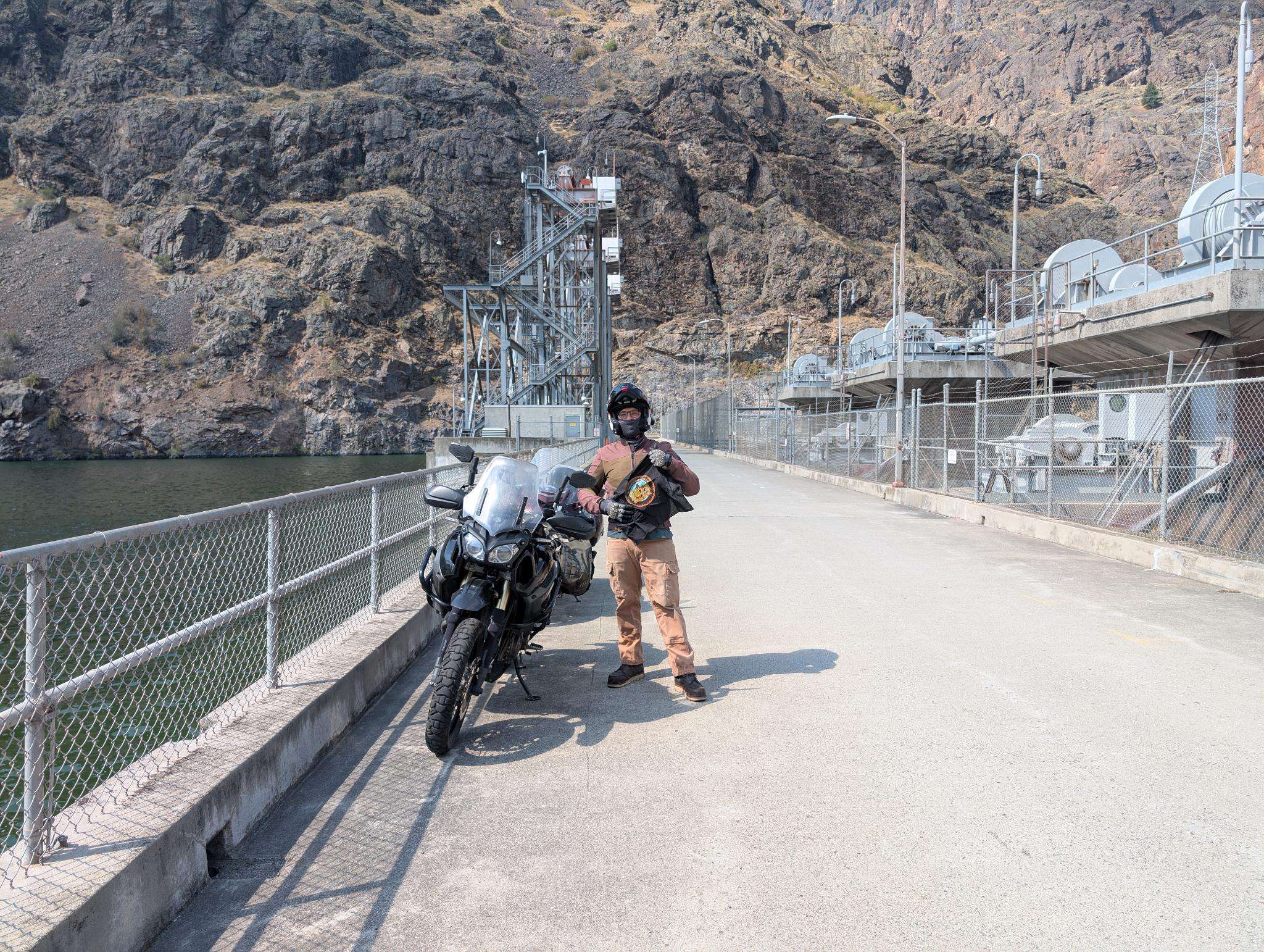
Use the form below to check in. Check-ins must include a photo of you or your bike at the challenge site with the 2025 bandanna. All participants must be registered IAMC Challenge Members. Leave a description of your ride and share road conditions — snow, water, obstacles, and tips for future riders are all appreciated.
Replying to another person's check-in is encouraged, but take care not to accidentally create your own check-in.
The stated difficulty is an estimate. Rating your experience helps future riders stay safe. You alone are responsible for the safety of your ride.
11 Check-Ins


Easily the hottest ride I have ever one. 110+ temperatures on the day I did it. But still BEAUFITUL.

A quick stop along the 2025 scooter cannonball route. 2 birds, one stone. We saw a bear cub on the road on the way out to the dam. Great ride!

Fun paved road with outstanding views. It was 30 degrees wormer at the dam compared to Kinney Point.

Dont stash your bananas in the same box as your tire irons if riding washboards.

nice and cool today, I took Kleindschmidt Grade in and out of this one.

Got a late start yesterday, and enjoyed an evening ride out to the dam. Not a lot of traffic, so it was actually quite relaxing.

I came in from Baker City before it got to hot. This the 1st of 2 sites during our 420 mile loop today.

I dropped into the canyon via Kleindschmidt Grade. It's just waking up and recovering from last year's fire. Everything is so green -- get it while the gettin's good!!

Got this one a while back just forgot to post.
Fun road!
Hot out there today. 110+
Easily the hottest ride I have ever one. 110+ temperatures on the day I did it. But still BEAUFITUL.
A quick stop along the 2025 scooter cannonball route. 2 birds, one stone. We saw a bear cub on the road on the way out to the dam. Great ride!
Fun paved road with outstanding views. It was 30 degrees wormer at the dam compared to Kinney Point.
Dont stash your bananas in the same box as your tire irons if riding washboards.
nice and cool today, I took Kleindschmidt Grade in and out of this one.
Got a late start yesterday, and enjoyed an evening ride out to the dam. Not a lot of traffic, so it was actually quite relaxing.
I came in from Baker City before it got to hot. This the 1st of 2 sites during our 420 mile loop today.
I dropped into the canyon via Kleindschmidt Grade. It’s just waking up and recovering from last year’s fire. Everything is so green — get it while the gettin’s good!!
Comments are closed.