
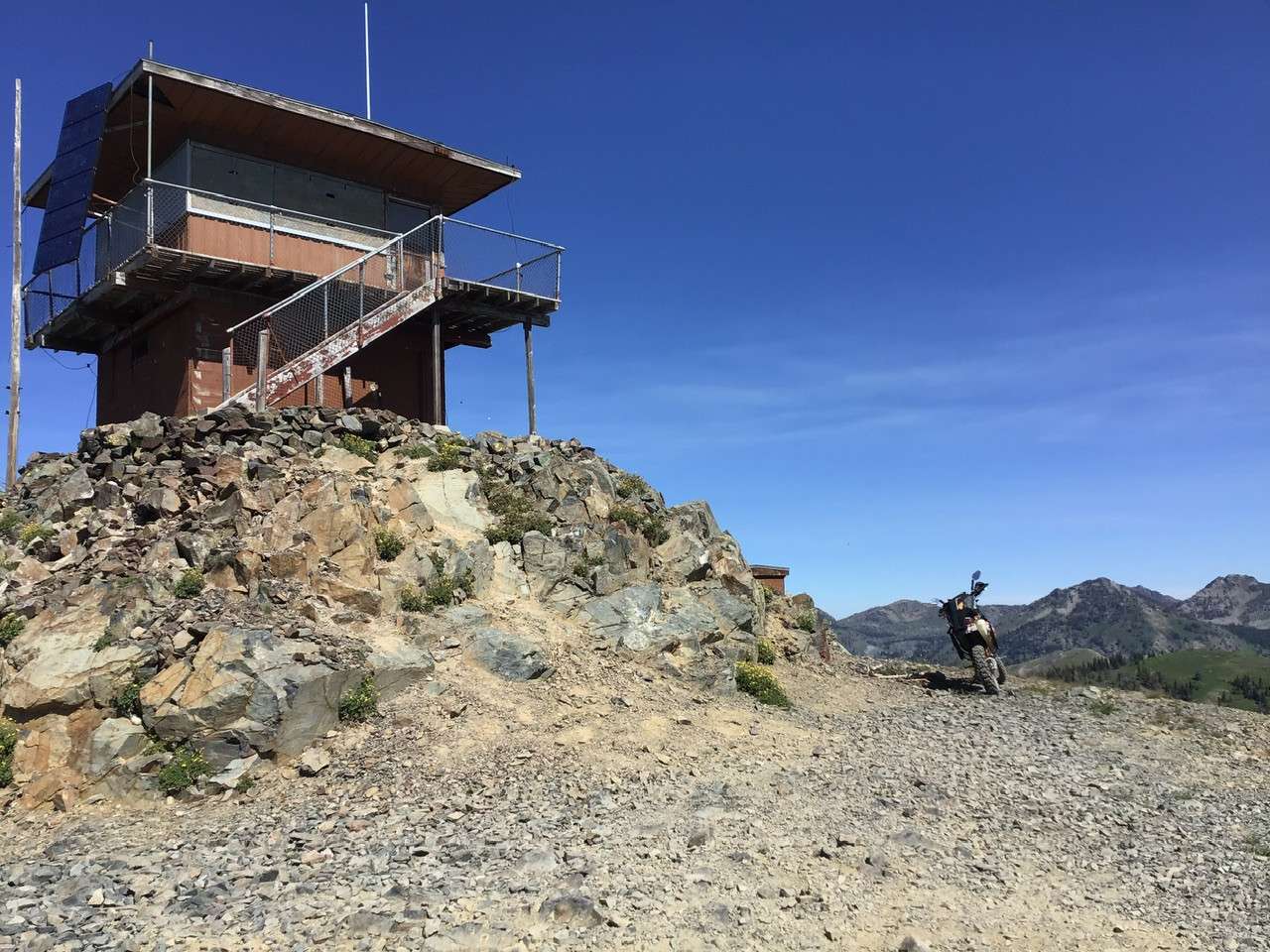
24 – Smith Mountain Lookout
Description
More Information
Additional Info
Coordinates: 45.134228, -116.579189
Elevation: 7999 ft
Difficulty: 3
What to Expect: No info
[reblex id=’779′]
Check In
Use the form below to check in. Check-ins must include a photo of you or your bike at the challenge site with the 2025 bandanna. All participants must be registered IAMC Challenge Members. Leave a description of your ride and share road conditions — snow, water, obstacles, and tips for future riders are all appreciated.
Replying to another person's check-in is encouraged, but take care not to accidentally create your own check-in.
The stated difficulty is an estimate. Rating your experience helps future riders stay safe. You alone are responsible for the safety of your ride.
9 Check-Ins
Riding to the lookout is very challenging, especially when you get caught in a rock slide.
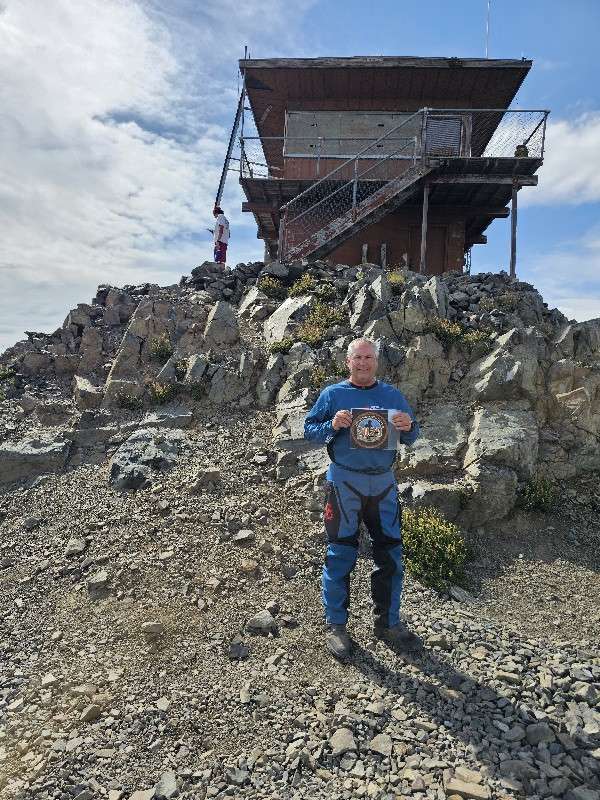
It rained all night, rocks were a little slippery. the clouds were socked in, no view.
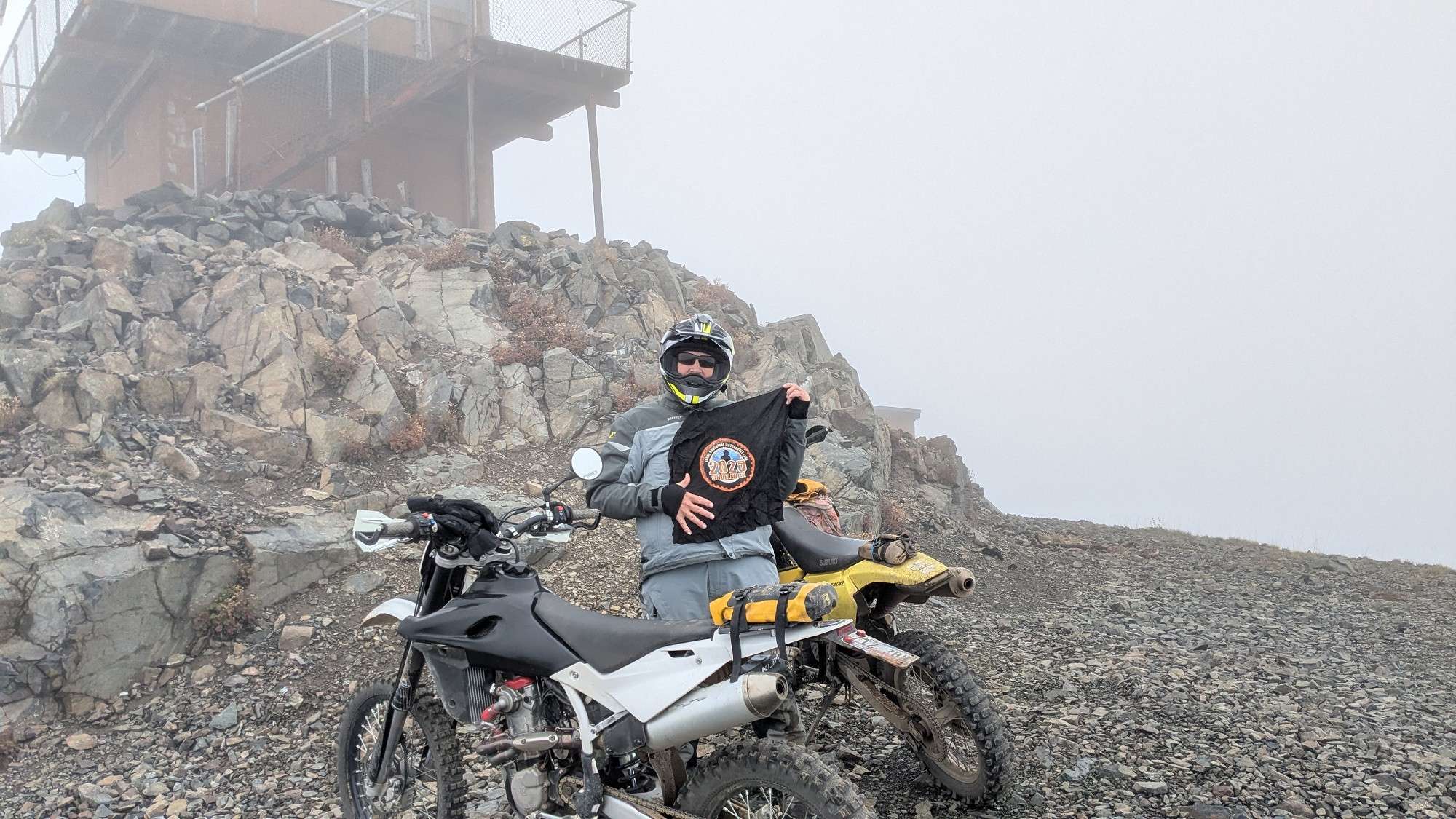
Was a whiteout for last mile. Made it to lookout and rain commenced while I took photo. A bit slippery bouncing off rocks coming down. 4 today usually a three.

That was a very difficult climb on the GS. I turned around at the switchback just below the lookout and was fortunate to escape that step rocky climb without a crash.
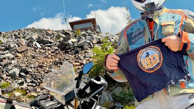
Parked at the green posts along with some 4-wheelers. Hiked up the last bit with a nice family.

It gets really rocky on the last part and there's not much room at the top to turn around. I struggled on my beta, so it would be a nightmare on anything much bigger. If you're aiming for the top, stop at the old gateposts at the last switchback and walk up from there - ~100 yards. It's a 3 to the last swichback, 4 to the top.
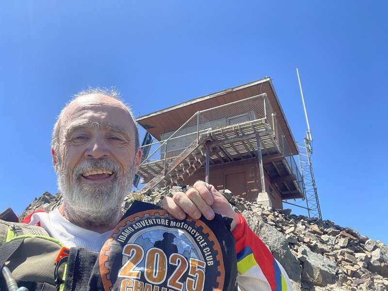

Made it just to the base of the turnoff. Feel free to check in down here. The ride was a heavy 2 with some light 3 mixed in. Overall it wasn't bad, but as per the usual arrangement it gets harder near the top. There is a pretty hard section right near the end that I didn't attempt on the 1200. This area is a heavy 3 and maybe a light 4. I would have continued if I was on my DRZ.


I must have made 6 attempts before get around all of those snow drifts! Deep, and facing north.
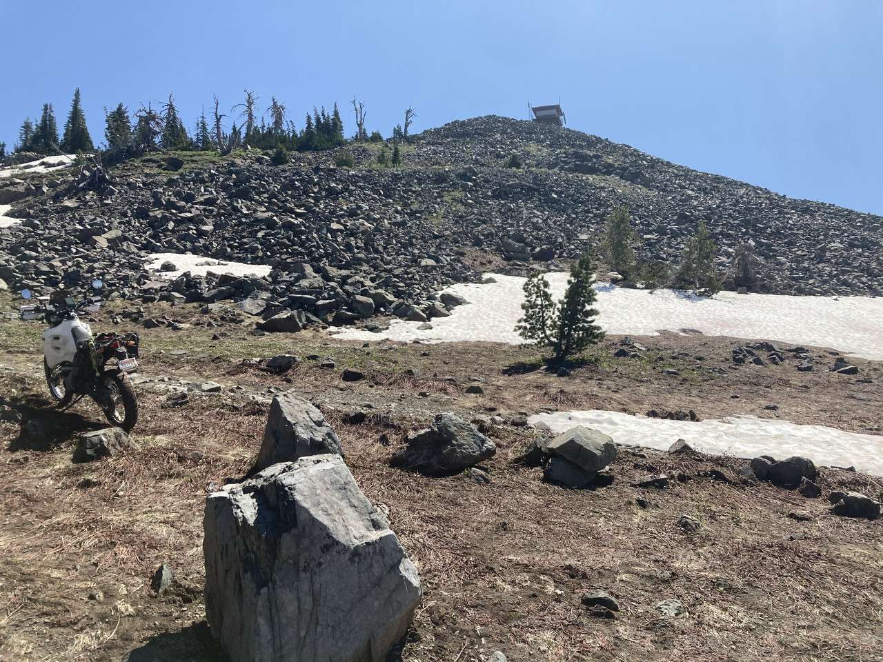
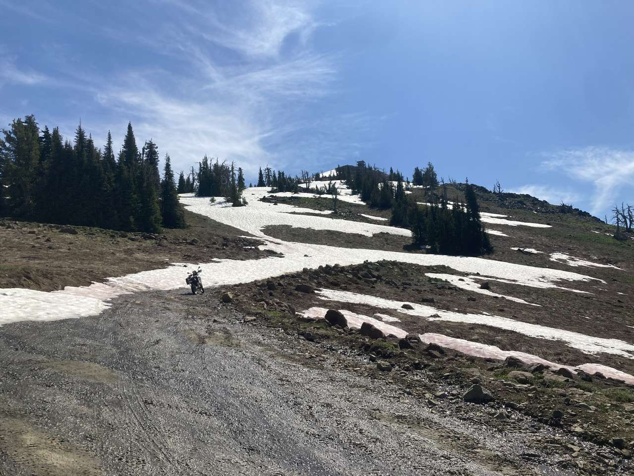

All but the last half mile or so is a level two, the rest of the way up is a 3. There is still one last snow drift right at the top, blocking access with the bike. It was so close, I just walked the rest of the way up.

Riding to the lookout is very challenging, especially when you get caught in a rock slide.
It rained all night, rocks were a little slippery. the clouds were socked in, no view.
Was a whiteout for last mile. Made it to lookout and rain commenced while I took photo. A bit slippery bouncing off rocks coming down. 4 today usually a three.
That was a very difficult climb on the GS. I turned around at the switchback just below the lookout and was fortunate to escape that step rocky climb without a crash.
Parked at the green posts along with some 4-wheelers. Hiked up the last bit with a nice family.
It gets really rocky on the last part and there’s not much room at the top to turn around. I struggled on my beta, so it would be a nightmare on anything much bigger. If you’re aiming for the top, stop at the old gateposts at the last switchback and walk up from there – ~100 yards. It’s a 3 to the last swichback, 4 to the top.
Made it just to the base of the turnoff. Feel free to check in down here. The ride was a heavy 2 with some light 3 mixed in. Overall it wasn’t bad, but as per the usual arrangement it gets harder near the top. There is a pretty hard section right near the end that I didn’t attempt on the 1200. This area is a heavy 3 and maybe a light 4. I would have continued if I was on my DRZ.
I must have made 6 attempts before get around all of those snow drifts! Deep, and facing north.
All but the last half mile or so is a level two, the rest of the way up is a 3. There is still one last snow drift right at the top, blocking access with the bike. It was so close, I just walked the rest of the way up.
Comments are closed.