
25 – Black Lake Campground
From USDA Website:
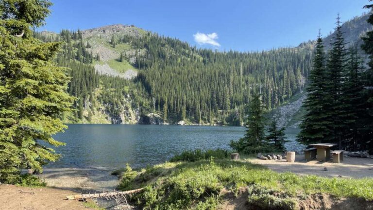
This Black Lake Campground is a rustic facility with only 4 designated tent sites. Located on the edge of Black Lake and adjacent to the Hells Canyon Wilderness, the site is popular for visitors wanting a truly ‘off-the-beaten-path’ recreational experience. The access road to the campground is steep and rough, and is not recommended for RVs, trailers or low clearance vehicles.
This site provides access to Black Lake- Horse Heaven Trail #214 and Six Lakes Basin Trail #218 which enter the Hells Canyon Wilderness from the southeast.
More Information
https://www.fs.usda.gov/recarea/wallowa-whitman/recarea/?recid=51743
Coordinates: 45.189426, -116.561312
Elevation: 7222 ft
Difficulty: 3
What to Expect: No info
[reblex id=’779′]
Check In
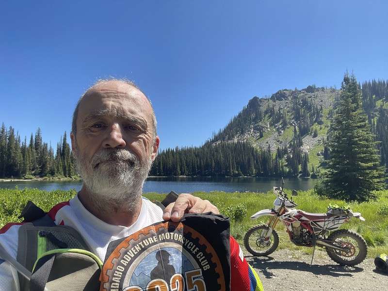
Use the form below to check in. Check-ins must include a photo of you or your bike at the challenge site with the 2025 bandanna. All participants must be registered IAMC Challenge Members. Leave a description of your ride and share road conditions — snow, water, obstacles, and tips for future riders are all appreciated.
Replying to another person's check-in is encouraged, but take care not to accidentally create your own check-in.
The stated difficulty is an estimate. Rating your experience helps future riders stay safe. You alone are responsible for the safety of your ride.
8 Check-Ins
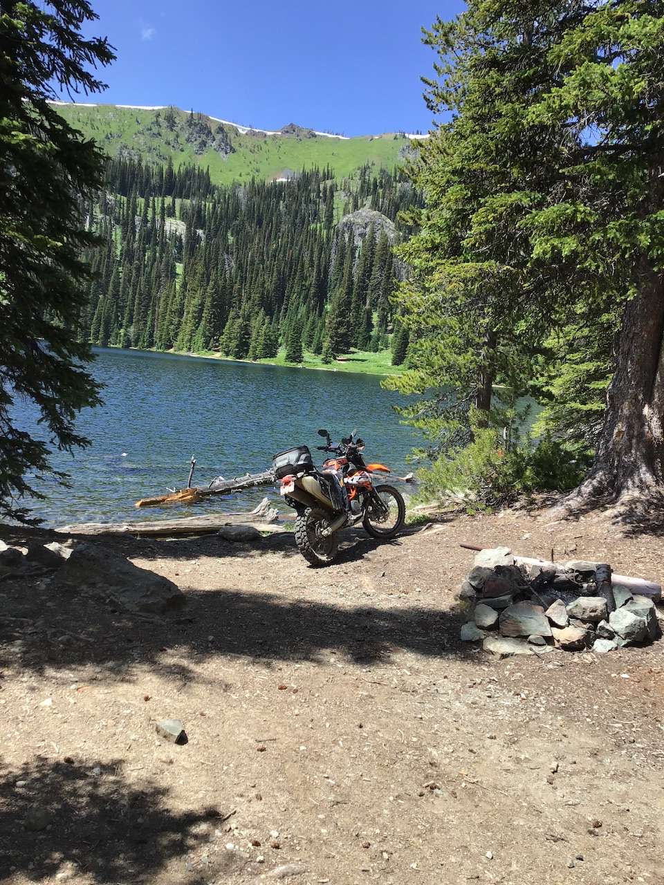
Love going to Black Lake. This day in August was great with the exception of a few rain storms. Would recommend this ride

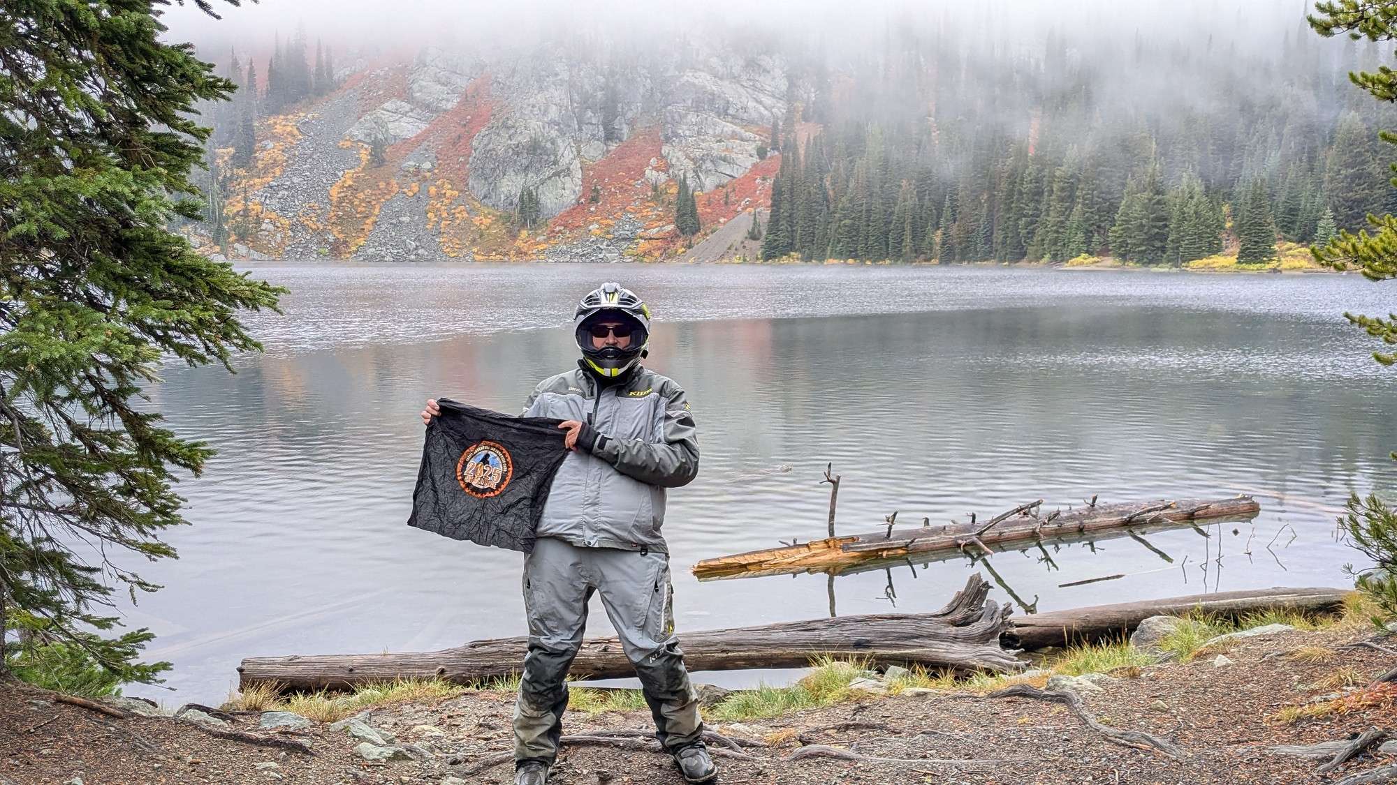
Wet and soggy today, good ride though. like Cuprum H said nice fall colors.
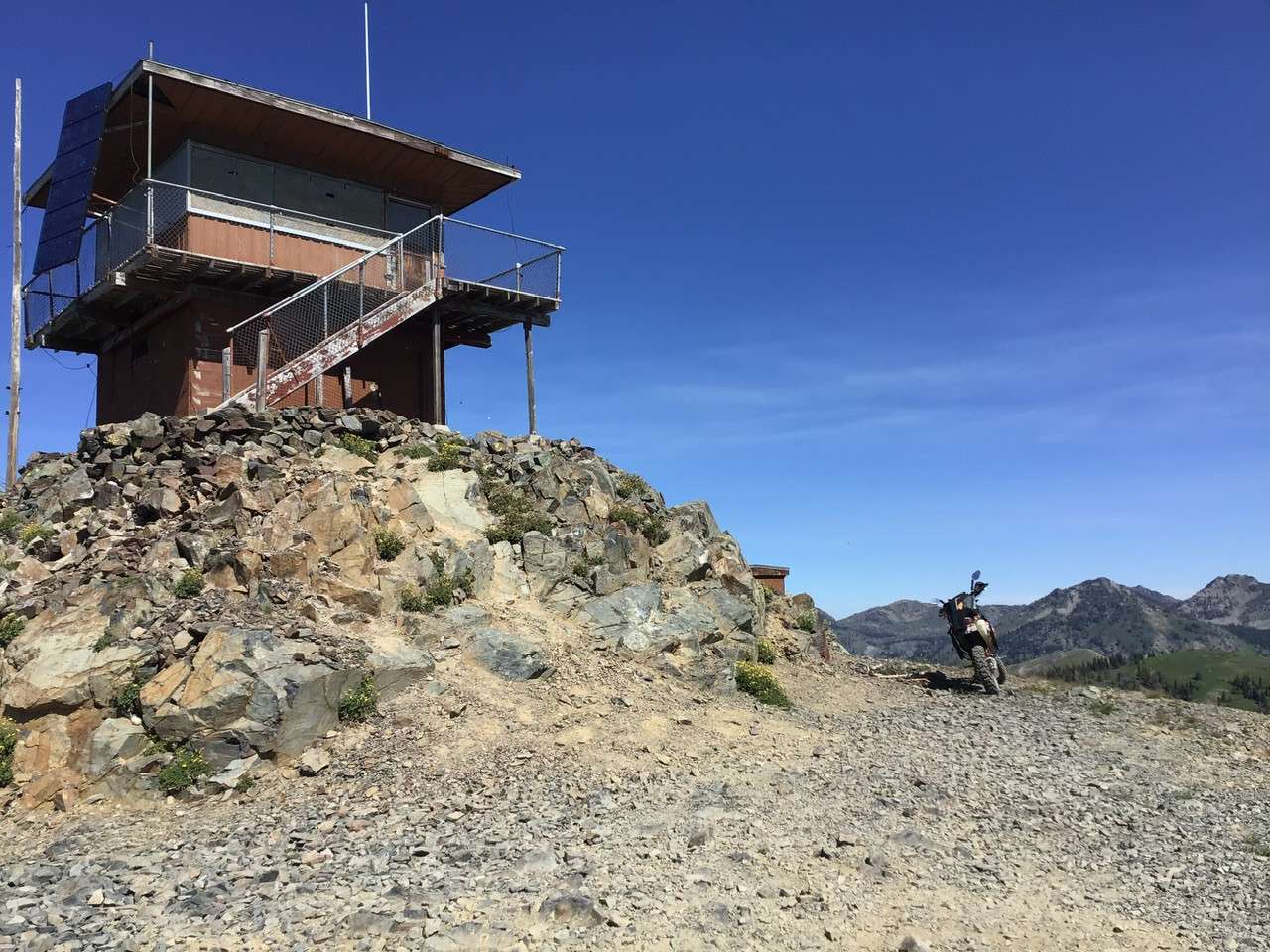
At Smith mountain in rain I decided to continue. Most incredible site from high dive I have seen with fall colors. Was going to photo on the way out but storm socked in. Good news was I had Black Lake to myself! First time since the seventies.

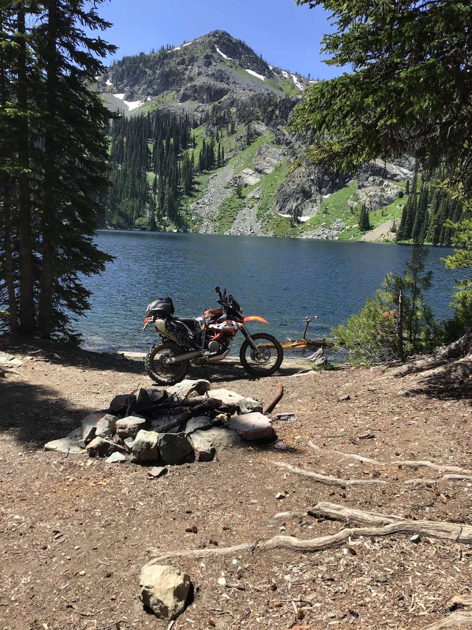
Most of the road to Black Lake rates a 2 but there are a few lose rocky steep sections that make it a 3. It is 20 miles from Cuprum to Black Lake with incredible views the whole way. It's worth the trip.
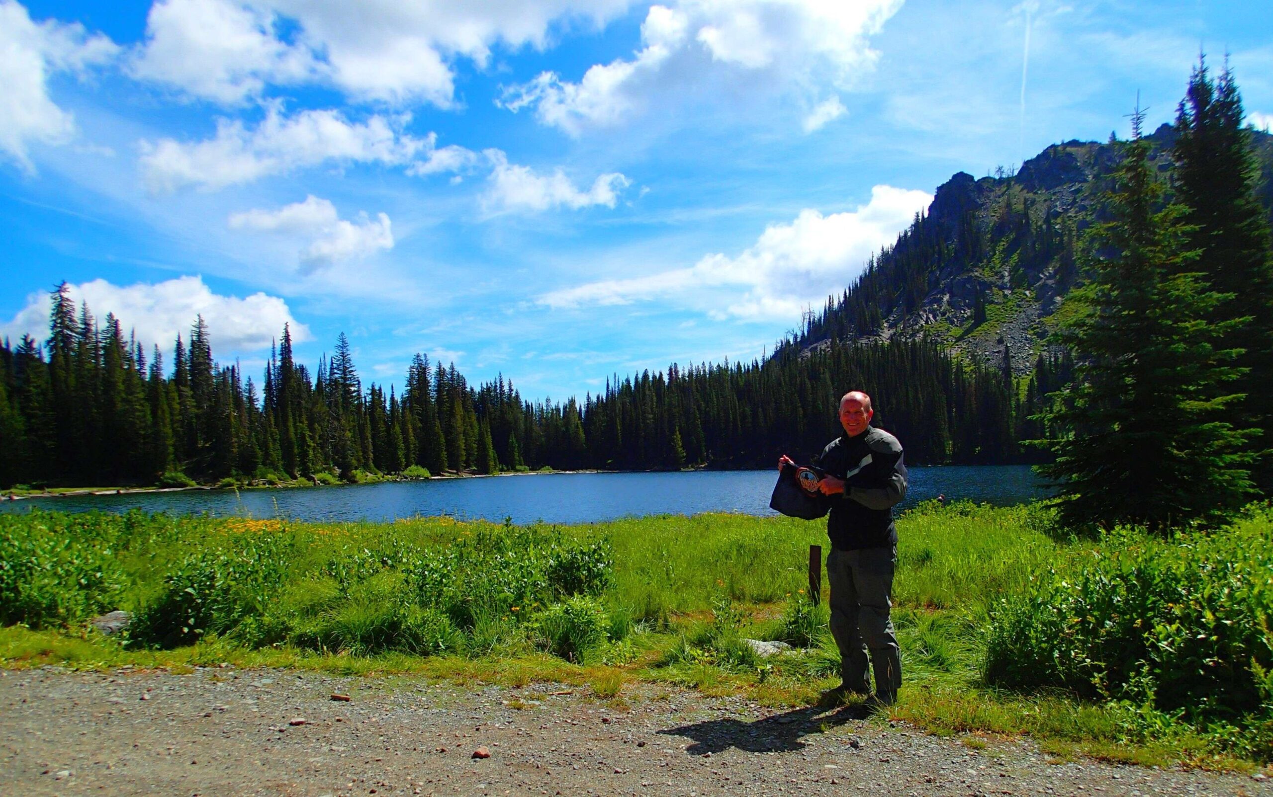
Gorgeous up there. Last little bit makes it a 3. You could definitely get a big G up here, but it might not be fun.
My final check-in, after several attempts at Kinney Point, and then nuns to Smith Mountain on June 10; 19; 30 and July 14!
some of the rocky road is plenty challenging.
Went as far as I felt safe, I was still a few miles out (45.14342, -116.56996). Still too much snow. The picture makes the path look wider then it is. There was almost no room left on the trail for about 30-40 feet along the snow bank. It widened to about 2 feet after that, so it was tempting to keep going. But if anything went wrong, it would have gone very wrong... steep drop-off. I wasn't risking it while out alone. The trail was a level 2 up to this point, but I'll mark it a 3 to match the description. Forgot to pull out my bandana.

Love going to Black Lake. This day in August was great with the exception of a few rain storms. Would recommend this ride
Wet and soggy today, good ride though. like Cuprum H said nice fall colors.
At Smith mountain in rain I decided to continue. Most incredible site from high dive I have seen with fall colors. Was going to photo on the way out but storm socked in. Good news was I had Black Lake to myself! First time since the seventies.
Most of the road to Black Lake rates a 2 but there are a few lose rocky steep sections that make it a 3. It is 20 miles from Cuprum to Black Lake with incredible views the whole way. It’s worth the trip.
Nice lake
Gorgeous up there. Last little bit makes it a 3. You could definitely get a big G up here, but it might not be fun.
My final check-in, after several attempts at Kinney Point, and then nuns to Smith Mountain on June 10; 19; 30 and July 14!
some of the rocky road is plenty challenging.
Went as far as I felt safe, I was still a few miles out (45.14342, -116.56996). Still too much snow. The picture makes the path look wider then it is. There was almost no room left on the trail for about 30-40 feet along the snow bank. It widened to about 2 feet after that, so it was tempting to keep going. But if anything went wrong, it would have gone very wrong… steep drop-off. I wasn’t risking it while out alone. The trail was a level 2 up to this point, but I’ll mark it a 3 to match the description. Forgot to pull out my bandana.
Comments are closed.