
51 – Pick Your Own Site
This one is up to you! Pick a site that is special to you, go there, and post it here! Be sure to mention where you went, how to get there, and why you like it! If you really want to impress, be sure to make it into a group ride! Happy trails!
More Information
No Additional Info
Coordinates: ????
Elevation: ???? ft
Difficulty: 1-5
What to Expect: No info
[reblex id=’779′]
Check In
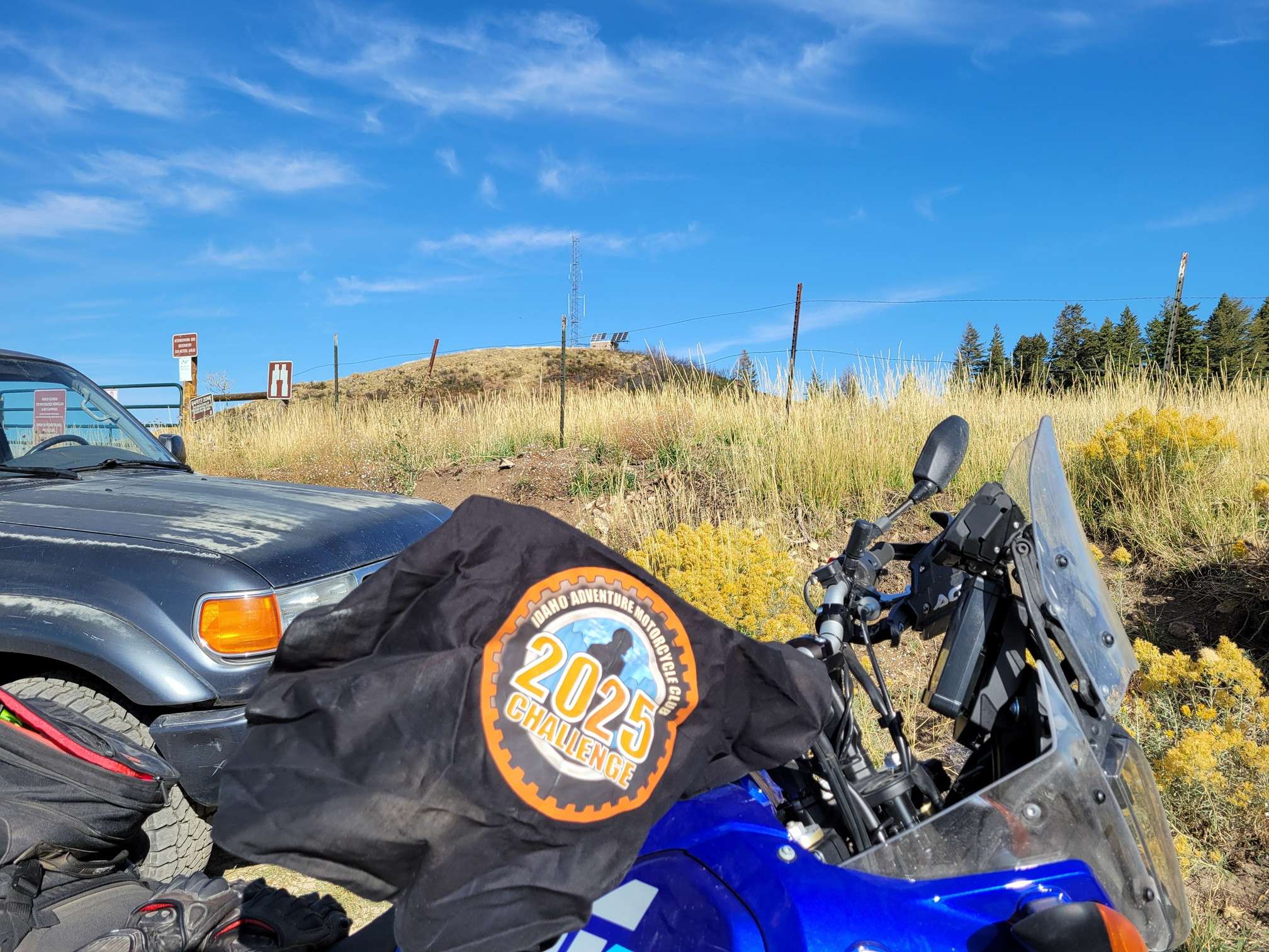
Use the form below to check in. Check-ins must include a photo of you or your bike at the challenge site with the 2025 bandanna. All participants must be registered IAMC Challenge Members. Leave a description of your ride and share road conditions — snow, water, obstacles, and tips for future riders are all appreciated.
Replying to another person's check-in is encouraged, but take care not to accidentally create your own check-in.
The stated difficulty is an estimate. Rating your experience helps future riders stay safe. You alone are responsible for the safety of your ride.
22 Check-Ins
This is on the forest road north of Fairfield. It was a great day for a ride, the weather was perfect. This was just a spot that had a great view.
Had my first accident and only came out with a concussion. Gear definitely saves me from breaking bones, and I learned a lot about loose gravel after a long day in the saddle. This was right past the Cayon Creek Station marker.
I rode up to the top of Lucky Peak entering from Highway 21 and passing by the Boise WMA Archery Range. This ride was probably not quite a 3 (I'm not totally sure what makes a 3), but it was definitely at least a 2.5. Fun ride, and it kept my attention focused for sure 🙂

This trail drops into the canyon. I have only made it down a few miles. Opportunity for adventure but not solo. Picture is of trailhead 1/2 mile past Kinney Point.

Here are three pick-your-own sites that I enjoyed this summer, all in one post: Pinehurst Church, Robie Creek/Rocky Canyon road, and the Sacred Mountain Monastery. There were some ruts on Robie Creek road, but other than that, all were pretty easy 2's.

Stumbled into this cute little place when I was exploring around McCall. It's at 44.730699, -116.047776.
Normally I'd pick an obscure site, but I liked this one because it kills two birds with one stone. First, the museum; second it is across the street from the Y-Inn. Pretty good start to the day - try the stacked breakfast.

This is Peck Mountain, an old lookout site near Council (44.86228, -116.61096). It's one of my favorite spots to hike in the shoulder seasons as it's close to home. It opens for motorized access from May to September. The short two-track to the top is a fun challenge on a small dual sport or mountain bike.


Random ride day where I explored the Magic Valley. Finally got my Minidoka and Hagerman stickers. Also saw some great videos at each place and had meaningful conversations with the rangers at each place. Saw the Evel Knievel launch ramp site and Shoshone Falls as well. Highly recommend making both a stop if you are in the Twin area.
So Appleton School is my pick 'em site for now. It's between Hagerman and Wendell. Road rating is a 1. Coordinates are 42.72357 -114.61722. According to OnX, this is private property belonging to Jerome Resources LLC, which the internet describes as a bio-gas company. Not sure what an old school has to do with bio-gas but whatever. There was no sign of life in the school (boarded up and broken windows).....there is a structure on the south side of it that appears to be a residence but I don't think they have anything to do with Jerome Resources.
Anyway, I may change this with something more cool but I figure I'd get it posted in case I forget.


We rode from Lava Hot Springs to Bear Lake and found a couple fun side roads to explored on our way back. We stopped at the North Beach, then drove down to Fish Haven, Garden City, and the South Beach.


Porthill, ID. Thought this was worthy because it's the farthest I can get from my house and still be in Idaho. Also it's the end of, or for me the start of, the Idaho BDR.

44.057304,-115.947421
Great looking old barn at the Cross Timber Ranch

GPS 44.72486, -118.81175
Nice paved route along the Middle Fork of the John Day River with a cool private re-created western town in Galena, Oregon. it's amazing what the owner built there.

Higbey Cave, which is south of Boise, out by the National Guard firing range, there is now a steel grate blocking access, but it used to be open, and it was spectacular. A cooled lava tube that was well defined, and I swear it was 1/3 to 1/2 mile long. They say it is unsafe to be in there, which is too bad. It was a great cave to experience. Ride out there is about 10 miles past the end of the pavement, with dirt road sections, two-track and sandy single track.

This is a place near Hampton, Oregon we rode to on a family outing recently. If you are passing through you can do this on a GS or large adventure bike with intermediate skills. We met some HAM operations at the top doing some DX'ing which was cool. It's off of Highway 20 about 20 miles east of Brothers. Search from "Hampton Butte" and you should be able to find it.
Elevation 6352 feet, coordinates are 43.77434, -120.28207. We took the most direct route from Highway 20.


Not a destination point but Black Sands is a good stop along highway 78 for a pit stop.
N42° 55.810' W115° 58.254'
Elevation 2501ft

My first time to Hemingway Butte OHV park. This pick was from a ways up the trail/road from the parking area. My skills are improving!

On my way down to Mountain Home from Anderson Ranch Dam, I took a dirt road detour to the Rattlesnake Station Marker specifically to come look at this hole in the ground, Eureka Cave (43.12273, -115.57425). I'm not a climber, so without a ladder, I wasn't exploring past the rim. I local showed up on a side-by-side, and was telling me this cave went on for a long ways. I'll take his word for it. The way I took was pretty rutted off the main dirt road and I had to dodge lots of those unpredictable baby cows.

Deer Flat National Wildlife Refuge (Lake Lowell Loop). GPS coordinates 43.56129 N, 116.66156 W.
One of my favorite local rides that begins just off Hwy 45 and Lake Shore Drive in Nampa, ID. This loop takes you around the backside of Lake Lowell and around the Deer Flat National Refuge and eventually on to the marina area and hiking trails. Riders enjoy minimal traffic and very few stop signs while riding around the lake. I like to stop at the marina area and take in the sights while enjoying a quick snack or beverage. While traveling around the lake, I have observed wildlife that includes: deer, coyotes, eagles, hawks, and wild turkeys to boot!

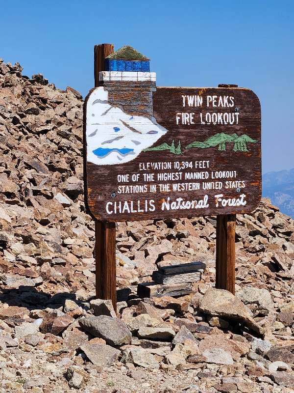
Twin peaks fire lookout
This is on the forest road north of Fairfield. It was a great day for a ride, the weather was perfect. This was just a spot that had a great view.
Had my first accident and only came out with a concussion. Gear definitely saves me from breaking bones, and I learned a lot about loose gravel after a long day in the saddle. This was right past the Cayon Creek Station marker.
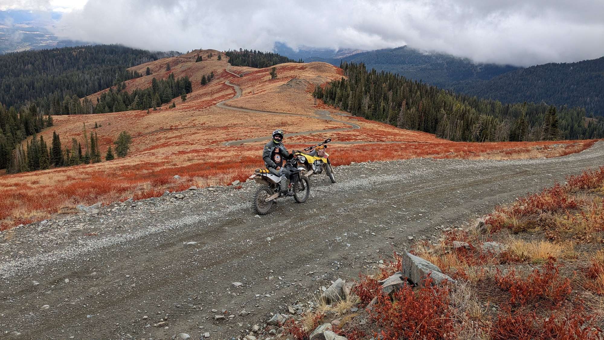
not a set point, just a beautiful view with an awesome road
I rode up to the top of Lucky Peak entering from Highway 21 and passing by the Boise WMA Archery Range. This ride was probably not quite a 3 (I’m not totally sure what makes a 3), but it was definitely at least a 2.5. Fun ride, and it kept my attention focused for sure 🙂
This trail drops into the canyon. I have only made it down a few miles. Opportunity for adventure but not solo. Picture is of trailhead 1/2 mile past Kinney Point.
Here are three pick-your-own sites that I enjoyed this summer, all in one post: Pinehurst Church, Robie Creek/Rocky Canyon road, and the Sacred Mountain Monastery. There were some ruts on Robie Creek road, but other than that, all were pretty easy 2’s.
Stumbled into this cute little place when I was exploring around McCall. It’s at 44.730699, -116.047776.
Damn, forgot the picture again
Normally I’d pick an obscure site, but I liked this one because it kills two birds with one stone. First, the museum; second it is across the street from the Y-Inn. Pretty good start to the day – try the stacked breakfast.
This is Peck Mountain, an old lookout site near Council (44.86228, -116.61096). It’s one of my favorite spots to hike in the shoulder seasons as it’s close to home. It opens for motorized access from May to September. The short two-track to the top is a fun challenge on a small dual sport or mountain bike.
Not sure if this counts!
Random ride day where I explored the Magic Valley. Finally got my Minidoka and Hagerman stickers. Also saw some great videos at each place and had meaningful conversations with the rangers at each place. Saw the Evel Knievel launch ramp site and Shoshone Falls as well. Highly recommend making both a stop if you are in the Twin area.
So Appleton School is my pick ’em site for now. It’s between Hagerman and Wendell. Road rating is a 1. Coordinates are 42.72357 -114.61722. According to OnX, this is private property belonging to Jerome Resources LLC, which the internet describes as a bio-gas company. Not sure what an old school has to do with bio-gas but whatever. There was no sign of life in the school (boarded up and broken windows)…..there is a structure on the south side of it that appears to be a residence but I don’t think they have anything to do with Jerome Resources.
Anyway, I may change this with something more cool but I figure I’d get it posted in case I forget.
Slight edit……..it’s between Wendell and Jerome, south of the interstate.
We rode from Lava Hot Springs to Bear Lake and found a couple fun side roads to explored on our way back. We stopped at the North Beach, then drove down to Fish Haven, Garden City, and the South Beach.
Porthill, ID. Thought this was worthy because it’s the farthest I can get from my house and still be in Idaho. Also it’s the end of, or for me the start of, the Idaho BDR.
44.057304,-115.947421
Great looking old barn at the Cross Timber Ranch
GPS 44.72486, -118.81175
Nice paved route along the Middle Fork of the John Day River with a cool private re-created western town in Galena, Oregon. it’s amazing what the owner built there.
Higbey Cave, which is south of Boise, out by the National Guard firing range, there is now a steel grate blocking access, but it used to be open, and it was spectacular. A cooled lava tube that was well defined, and I swear it was 1/3 to 1/2 mile long. They say it is unsafe to be in there, which is too bad. It was a great cave to experience. Ride out there is about 10 miles past the end of the pavement, with dirt road sections, two-track and sandy single track.
This is a place near Hampton, Oregon we rode to on a family outing recently. If you are passing through you can do this on a GS or large adventure bike with intermediate skills. We met some HAM operations at the top doing some DX’ing which was cool. It’s off of Highway 20 about 20 miles east of Brothers. Search from “Hampton Butte” and you should be able to find it.
Elevation 6352 feet, coordinates are 43.77434, -120.28207. We took the most direct route from Highway 20.
Not a destination point but Black Sands is a good stop along highway 78 for a pit stop.
N42° 55.810′ W115° 58.254′
Elevation 2501ft
My first time to Hemingway Butte OHV park. This pick was from a ways up the trail/road from the parking area. My skills are improving!
On my way down to Mountain Home from Anderson Ranch Dam, I took a dirt road detour to the Rattlesnake Station Marker specifically to come look at this hole in the ground, Eureka Cave (43.12273, -115.57425). I’m not a climber, so without a ladder, I wasn’t exploring past the rim. I local showed up on a side-by-side, and was telling me this cave went on for a long ways. I’ll take his word for it. The way I took was pretty rutted off the main dirt road and I had to dodge lots of those unpredictable baby cows.
Hey Justin, this is a really cool site! I saved the waypoint. I hope it’s a checkpoint for us next year.
Deer Flat National Wildlife Refuge (Lake Lowell Loop). GPS coordinates 43.56129 N, 116.66156 W.
One of my favorite local rides that begins just off Hwy 45 and Lake Shore Drive in Nampa, ID. This loop takes you around the backside of Lake Lowell and around the Deer Flat National Refuge and eventually on to the marina area and hiking trails. Riders enjoy minimal traffic and very few stop signs while riding around the lake. I like to stop at the marina area and take in the sights while enjoying a quick snack or beverage. While traveling around the lake, I have observed wildlife that includes: deer, coyotes, eagles, hawks, and wild turkeys to boot!
Comments are closed.