
05 – Pickles Butte Overlook
From Idaho Climbing Guide:
Pickles Butte is the highest point in Canyon County. Consequently, this peak is on a lot of peakbaggers’ lists. There are exceptional views of the Owyhee Mountains from the summit. The butte is located southwest of Nampa on land owned by the county. The county landfill is located on the butte’s North Slopes. A paved road leads to the landfill and a rough 4WD road leads the remaining distance to the summit. Use Google maps for driving directions. USGS Givens Hot Springs
More Information
Coordinates: 43.490480, -116.715877
Elevation: 3061 ft
Difficulty: 2
What to Expect: No info
[reblex id=’779′]
Check In
Use the form below to check in. Check-ins must include a photo of you or your bike at the challenge site with the 2025 bandanna. All participants must be registered IAMC Challenge Members. Leave a description of your ride and share road conditions — snow, water, obstacles, and tips for future riders are all appreciated.
Replying to another person's check-in is encouraged, but take care not to accidentally create your own check-in.
The stated difficulty is an estimate. Rating your experience helps future riders stay safe. You alone are responsible for the safety of your ride.
37 Check-Ins
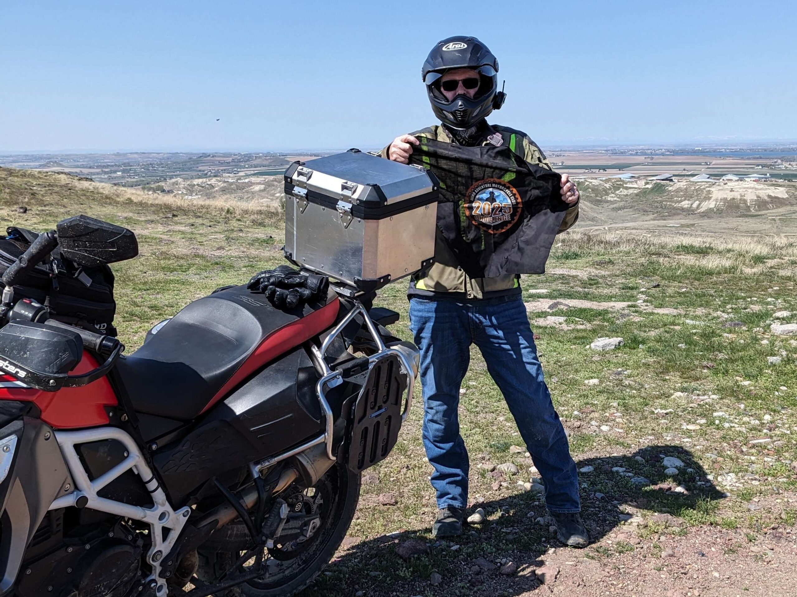
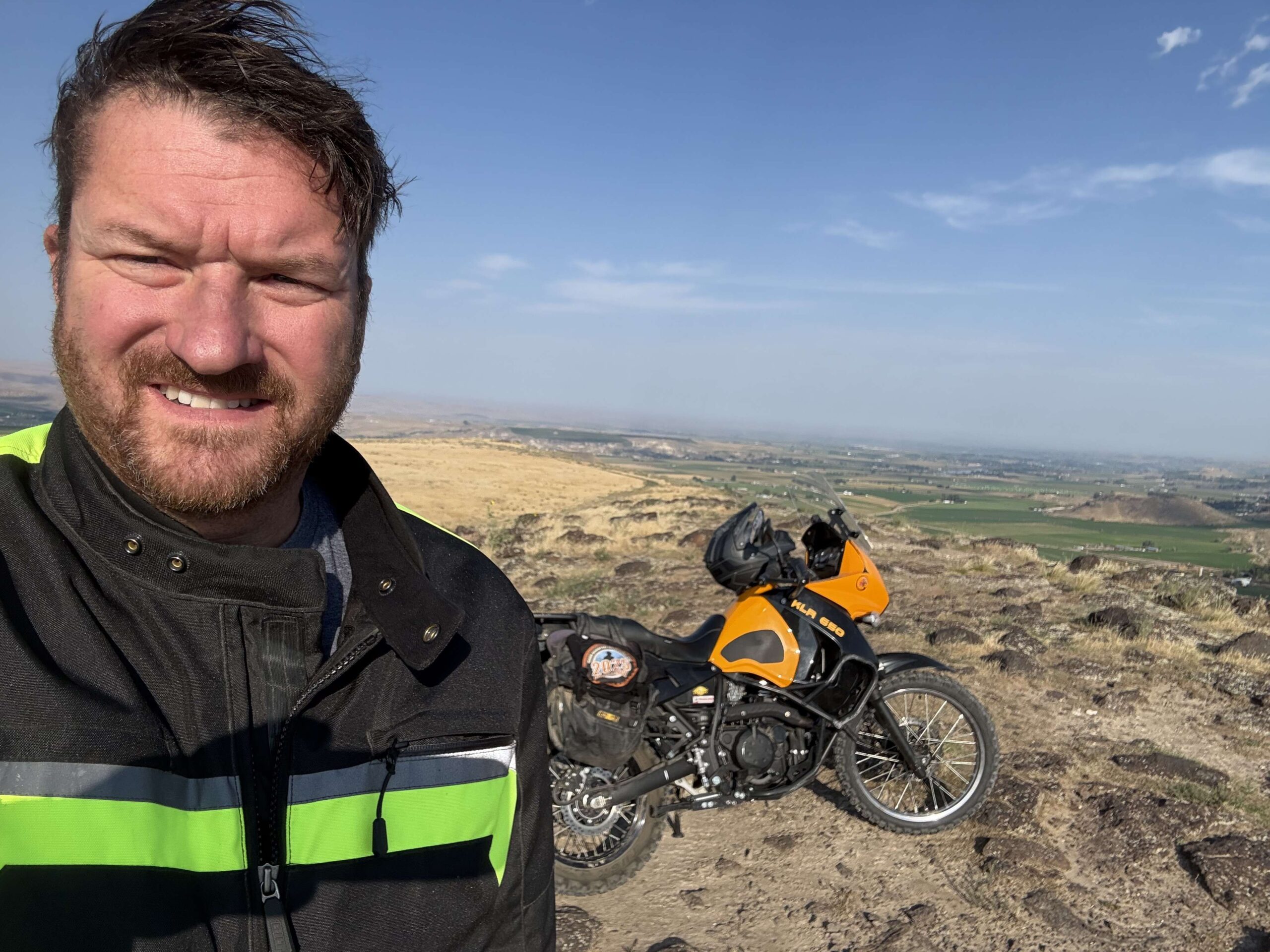
Rode to this site on April 13. It was my first time up there. Beautiful day for a ride to get the season started.
I ignored the road closed sign to ride out onto the Butte and to the overlook. The landfill nearby seems to be pretty busy. Not sure why they put up the road closed sign...
One of my favorite places. I fly RC sailplanes here so pretty familiar with the butte. I rode around awhile then went up the west side. On the way out decided to try the east road up. I stalled about 3/4 of the way up, but managed to get the bike upright and going again. I think the west side is a 2 but the east side is likely a 3? I’m not experienced enough to say!
Tricky to get to. Google took me to the dirt bike trails. Found you have to go around to Missouri to the landfill entrance. Continue past and follow the dirt trail. I didn't know there was a trail around to the left to get up, so I took the steep one straight ahead, very sketchy for me, lol!


We came in from the north, off of Deer Flat road, passing an OHV park to come to a fence. It looked like we could take some level 3 dirt bike trails if we wanted to make it all the way to the butte from there, but I'm not a level 3 rider so we snapped a photo from the fence.

Came in from the south. The last pitch was steep and loose enough on the beast that I bumped it to a 3. The western route may be more benign. Otherwise an oddly busy area with garbage trucks and giant guns blazing from the shooting range.

If heading in from the south side near the range, there's a kind of hidden dirt track near the fence. Take that and once over the hill, take the obvious gray gravel track.

Was more of a challenge than I could muster on the new bike with street tires, had to walk the last 100 feet or so. A little too steep and loose.


Caught this site with Alex Crane, along with good taco's. Agree with others that this is a level 2 difficulty.

Tiger still has street tires so gave the KLX some love. Rocky and rutted road if you go up the dump side it’s kinda steep and loose but not too bad.

FE701LR went for a ride yesterday, and after getting some tacos at Muy Buenos (highly recommend) we headed to pickles butte. Many folks rate this as a 2, but remember, you should be able to do a 2 in a mini van. This was more of an easy 3. You can handle it on a big bike, just take your time. I've also attached the way we got in. There may be an easier way, but this this wasn't too bad. Plenty of rocks and a bit of sand, but doable


It was windy. That coupled with the trash blowing around made this my least favorite place to go.


Came from the south side and wandered around a bit before heading to the GPS cords.


One of my favorite places to just go and chill out. There is usually a nice breeze coming up the slope, and its a popular spot for paragliders and hang gliders to launch just west of the highest point and use the ridge lift to gain altitude.

A little late to post, but I went a couple of weekends ago with my stepdad. Going up the east side, I had my first dump on the bike ever! Learned a lot about large loose rock on a steep incline and how to and not to approach it. This was our first stop of six challenge spots.


The road next to the shooting range is open. It is a bumpy ride if you go to the edge of the overlook. I think I hit all the rocks. My little stowaway/joyrider did great holding on to my sleeve. Saw one bull snake and a few dirt bikes on the trails. Left on the road next to the dump.


Couple fun little trails to practice off road skills. Decent view from the top

We went through the more difficult entrance and encountered some soft, sandy, and rocky terrain. Some steep hills but otherwise a fun ride to the top. It was very windy for most of our trip today.

Came in from Missouri Ave. A little rocky, but not bad. Nice view, but very windy

Access is from the South side east of the shooting range. This would be hard if it's muddy but dry I call it a 2. Great view from here.


I entered the OHV park from Missouri Ave, snapped a few pictures from the Butte, and exited on the Dear Flat Rd side.


An easy ride right to the ORV Park, a fun place to ride trails, or explore grass fields. Plenty of hillclimbs to hone those skills.

Had a fun adventure today with Ride-n-hike today! We took a few wrong turns heading to the Butte from the main parking lots (where my kiddos were riding) and ended up on some sandy trails! I took my Scrambler 1200XE on the first adventure on the hardest terrain I’ve taken it on, and managed to keep it up. We regrouped, I switched to my son’s Kawasaki KLX 300, checked some maps again and decided to head out to the main road and entered the trail to the Butte from the Dump entrance. It looks like there are multiple ways to get up there depending on your skill/comfort level.
Trail was a mix of sand, dirt, gravel and lava rock. We took the winding trail to the left of the first Butte and worked our way up to both sides of the Butte. It was very pretty up there!
I’d agree that it was a 2 rating. A few ruts and bumps on the dirt section and some rocks in the pathway but doable.
Will upload some video on my YouTube channel. Exploring Like A Mother since I’m not sure how to add video and picture here!
https://youtu.be/E8-ItYnPV_0

Great ride today with ExploringLikeAMother. We both challenged ourselves on a few spots off the primary route but kept the bikes upright (barely)!

Neat overlook! I definitely recommend approaching from the South road if you're in the mood for an easier path.

Heard about Pickle Butte for a long time... never been there.....box checked. Interesting OHV park on the north side of it. Good shooting range on the south side of it. What more could a guy want? (I know, I know, don't answer that!!). The point where the pin is isn't the highest point, but like chillyphilly said, the highest point has the best view of the dump (ha!).

I can’t say I have ever been to this summit or even knew it existed. The easiest access we found was from the south side next to the shooting range. The access from the landfill (east) side looked a little rougher, but doable.
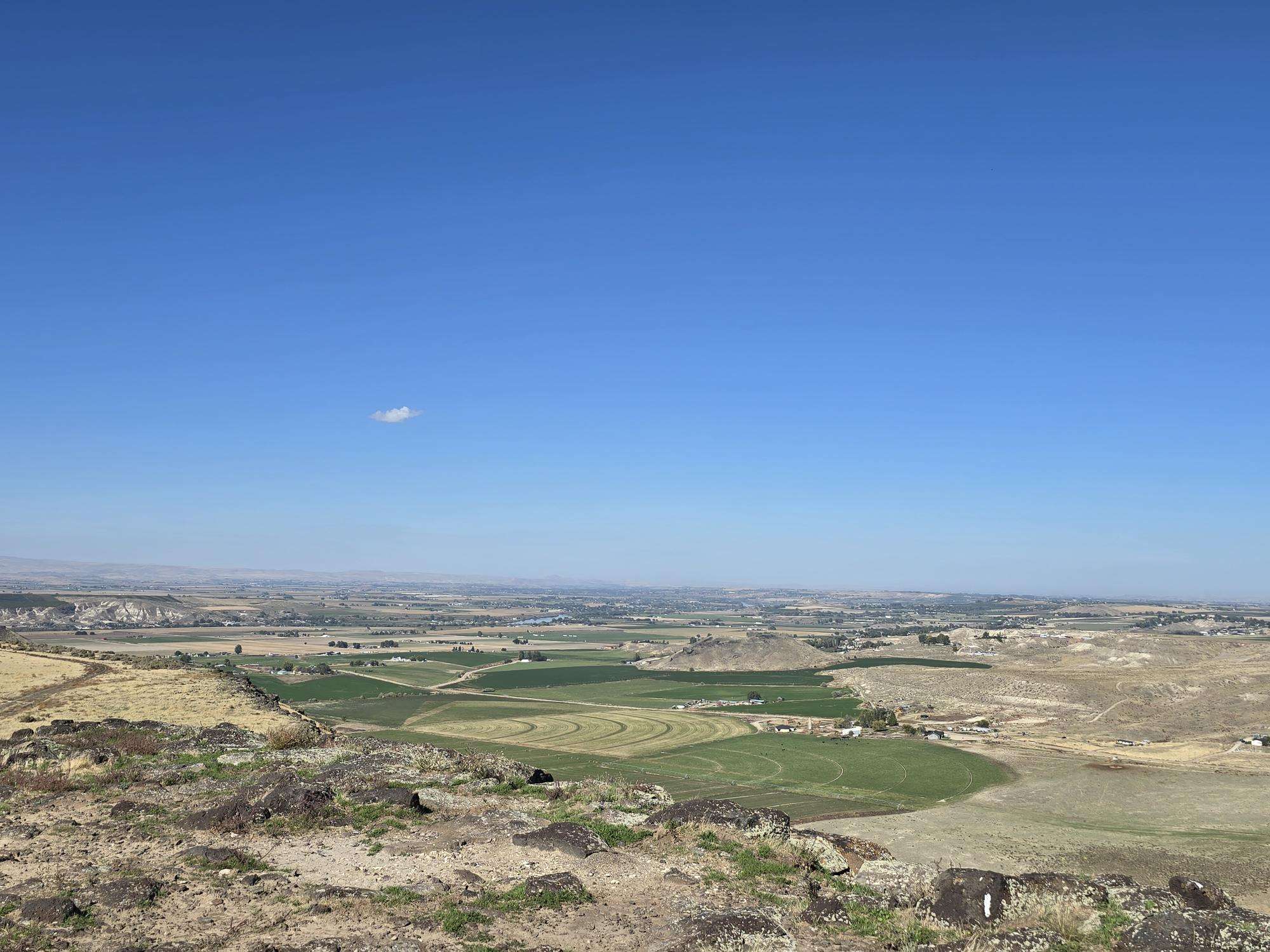
There are two lookout points which “Y” at the highest part of the butte. The west side is more picturesque, with the north overlooking Lake Lowell and the south the Owyhees. The east overlook towers over the landfill, so if you’re into that type of backdrop, I guess that is the place to go. 🤷♂️

Rode to this site on April 13. It was my first time up there. Beautiful day for a ride to get the season started.
Stopped at the OHV area today.
I ignored the road closed sign to ride out onto the Butte and to the overlook. The landfill nearby seems to be pretty busy. Not sure why they put up the road closed sign…
One of my favorite places. I fly RC sailplanes here so pretty familiar with the butte. I rode around awhile then went up the west side. On the way out decided to try the east road up. I stalled about 3/4 of the way up, but managed to get the bike upright and going again. I think the west side is a 2 but the east side is likely a 3? I’m not experienced enough to say!
Forgot photo
Tricky to get to. Google took me to the dirt bike trails. Found you have to go around to Missouri to the landfill entrance. Continue past and follow the dirt trail. I didn’t know there was a trail around to the left to get up, so I took the steep one straight ahead, very sketchy for me, lol!
Never been here before. Beautiful, hot summery Saturday.
Ditto Mrs. Dunn’s comments
We came in from the north, off of Deer Flat road, passing an OHV park to come to a fence. It looked like we could take some level 3 dirt bike trails if we wanted to make it all the way to the butte from there, but I’m not a level 3 rider so we snapped a photo from the fence.
Came in from the south. The last pitch was steep and loose enough on the beast that I bumped it to a 3. The western route may be more benign. Otherwise an oddly busy area with garbage trucks and giant guns blazing from the shooting range.
If heading in from the south side near the range, there’s a kind of hidden dirt track near the fence. Take that and once over the hill, take the obvious gray gravel track.
Was more of a challenge than I could muster on the new bike with street tires, had to walk the last 100 feet or so. A little too steep and loose.
Nice view of OHV park.
Caught this site with Alex Crane, along with good taco’s. Agree with others that this is a level 2 difficulty.
Tiger still has street tires so gave the KLX some love. Rocky and rutted road if you go up the dump side it’s kinda steep and loose but not too bad.
FE701LR went for a ride yesterday, and after getting some tacos at Muy Buenos (highly recommend) we headed to pickles butte. Many folks rate this as a 2, but remember, you should be able to do a 2 in a mini van. This was more of an easy 3. You can handle it on a big bike, just take your time. I’ve also attached the way we got in. There may be an easier way, but this this wasn’t too bad. Plenty of rocks and a bit of sand, but doable
That definitely easier than going up the dump side
It was windy. That coupled with the trash blowing around made this my least favorite place to go.
Didn’t know this was here, I spent a bit of time riding around.
Came from the south side and wandered around a bit before heading to the GPS cords.
Good view, Keep head down due to shooting range.
lot to see from up here
Wow what a view
One of my favorite places to just go and chill out. There is usually a nice breeze coming up the slope, and its a popular spot for paragliders and hang gliders to launch just west of the highest point and use the ridge lift to gain altitude.
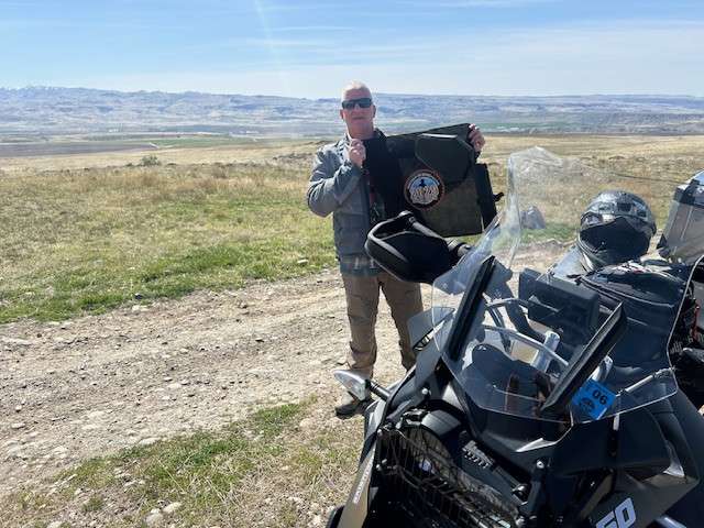
A little late to post, but I went a couple of weekends ago with my stepdad. Going up the east side, I had my first dump on the bike ever! Learned a lot about large loose rock on a steep incline and how to and not to approach it. This was our first stop of six challenge spots.
The road next to the shooting range is open. It is a bumpy ride if you go to the edge of the overlook. I think I hit all the rocks. My little stowaway/joyrider did great holding on to my sleeve. Saw one bull snake and a few dirt bikes on the trails. Left on the road next to the dump.
Came in from the dump. Just one hill.
Couple fun little trails to practice off road skills. Decent view from the top
We went through the more difficult entrance and encountered some soft, sandy, and rocky terrain. Some steep hills but otherwise a fun ride to the top. It was very windy for most of our trip today.
Came in from Missouri Ave. A little rocky, but not bad. Nice view, but very windy
Access is from the South side east of the shooting range. This would be hard if it’s muddy but dry I call it a 2. Great view from here.
Dill not sweet….a little soft in spots too.
I entered the OHV park from Missouri Ave, snapped a few pictures from the Butte, and exited on the Dear Flat Rd side.
An easy ride right to the ORV Park, a fun place to ride trails, or explore grass fields. Plenty of hillclimbs to hone those skills.
Had a fun adventure today with Ride-n-hike today! We took a few wrong turns heading to the Butte from the main parking lots (where my kiddos were riding) and ended up on some sandy trails! I took my Scrambler 1200XE on the first adventure on the hardest terrain I’ve taken it on, and managed to keep it up. We regrouped, I switched to my son’s Kawasaki KLX 300, checked some maps again and decided to head out to the main road and entered the trail to the Butte from the Dump entrance. It looks like there are multiple ways to get up there depending on your skill/comfort level.
Trail was a mix of sand, dirt, gravel and lava rock. We took the winding trail to the left of the first Butte and worked our way up to both sides of the Butte. It was very pretty up there!
I’d agree that it was a 2 rating. A few ruts and bumps on the dirt section and some rocks in the pathway but doable.
Will upload some video on my YouTube channel. Exploring Like A Mother since I’m not sure how to add video and picture here!
https://youtu.be/E8-ItYnPV_0
Great ride today with ExploringLikeAMother. We both challenged ourselves on a few spots off the primary route but kept the bikes upright (barely)!
What a fun adventure! Can’t wait for more!
Neat overlook! I definitely recommend approaching from the South road if you’re in the mood for an easier path.
Heard about Pickle Butte for a long time… never been there…..box checked. Interesting OHV park on the north side of it. Good shooting range on the south side of it. What more could a guy want? (I know, I know, don’t answer that!!). The point where the pin is isn’t the highest point, but like chillyphilly said, the highest point has the best view of the dump (ha!).
I can’t say I have ever been to this summit or even knew it existed. The easiest access we found was from the south side next to the shooting range. The access from the landfill (east) side looked a little rougher, but doable.
There are two lookout points which “Y” at the highest part of the butte. The west side is more picturesque, with the north overlooking Lake Lowell and the south the Owyhees. The east overlook towers over the landfill, so if you’re into that type of backdrop, I guess that is the place to go. 🤷♂️
Wow, bonus points for taking the Ducati with road tires up there!
It was either that or park it at the bottom and hike up, and I don’t like walking that much🤣
Comments are closed.