

04 – Map Rock
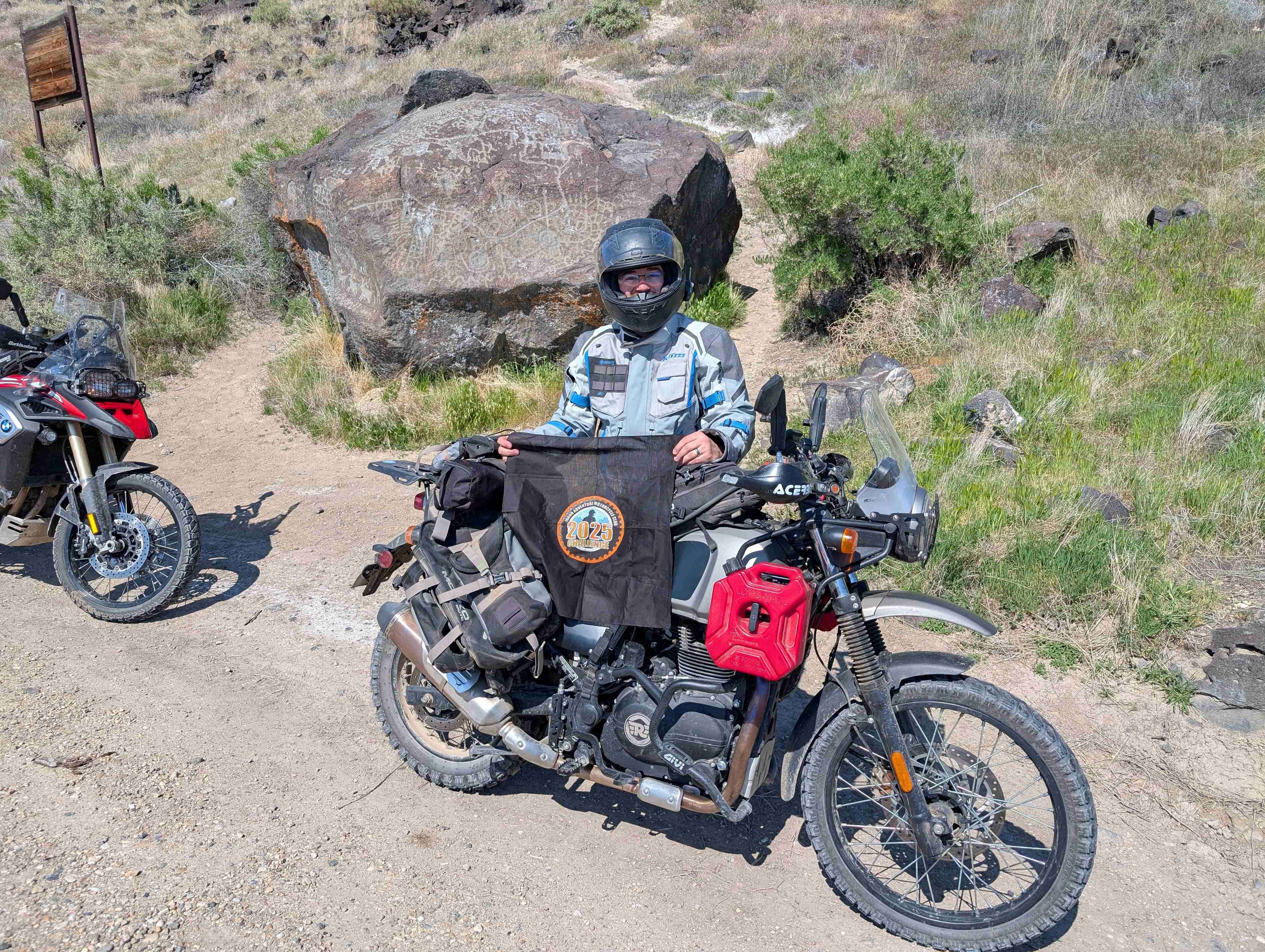
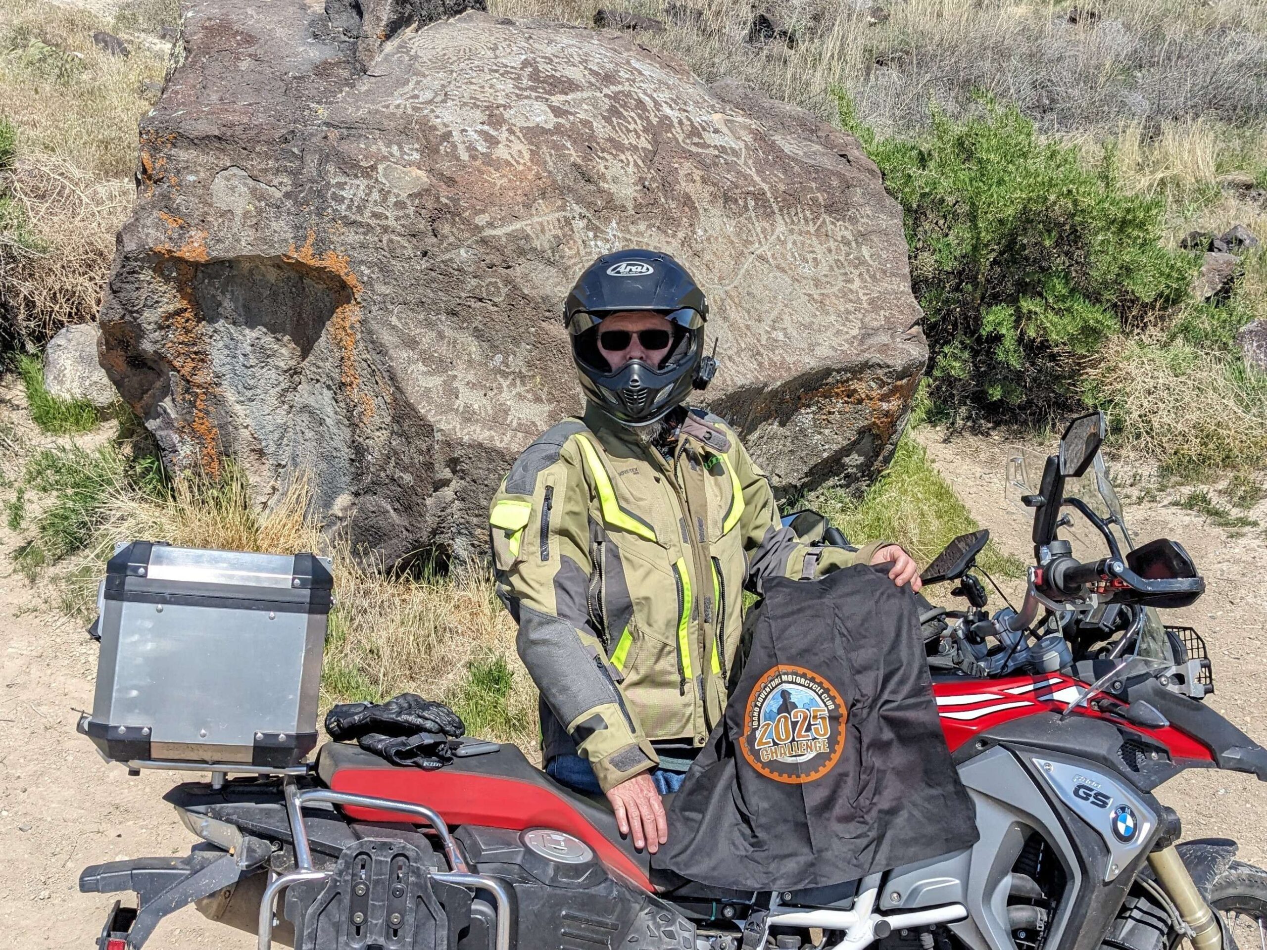
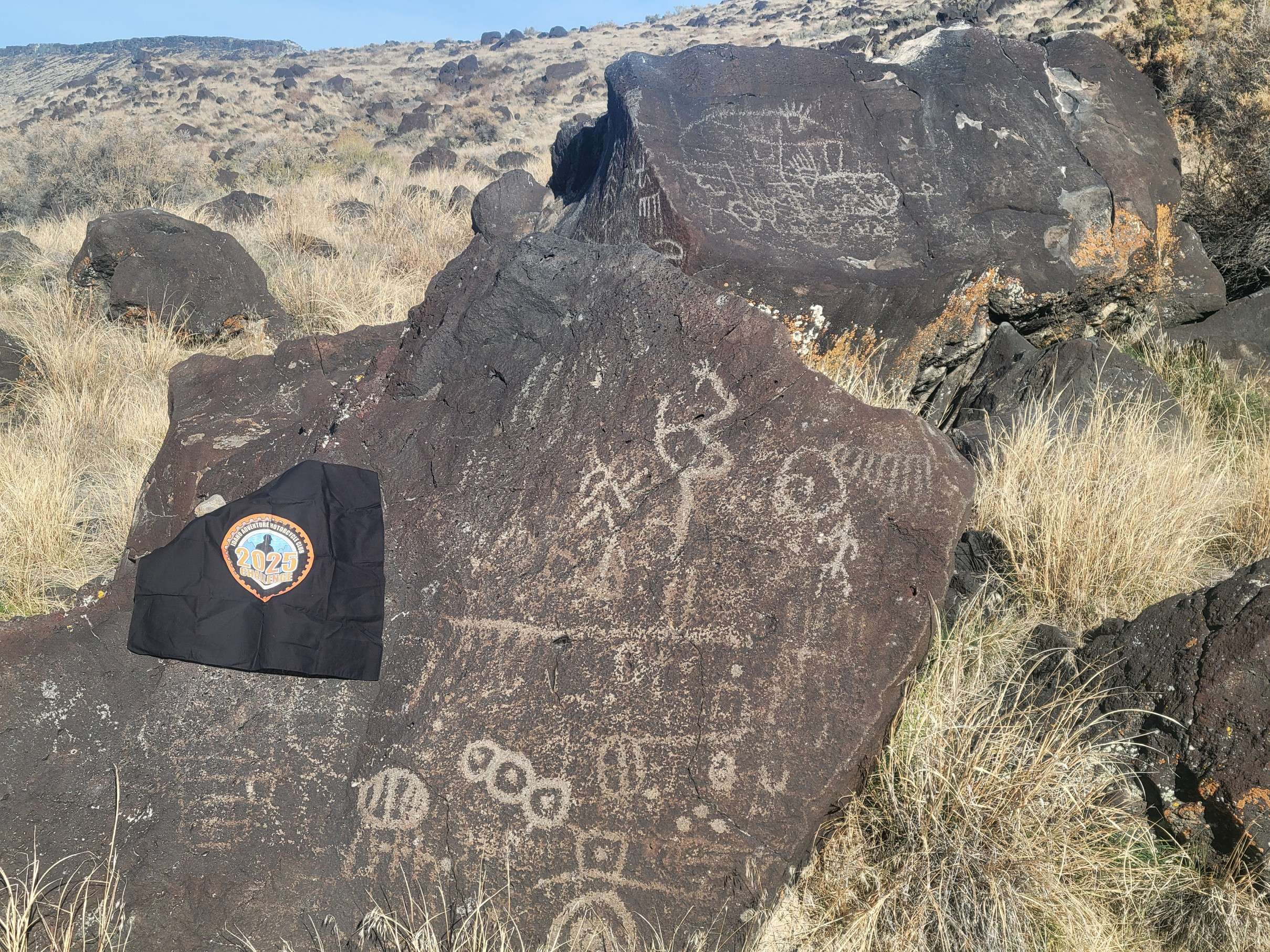
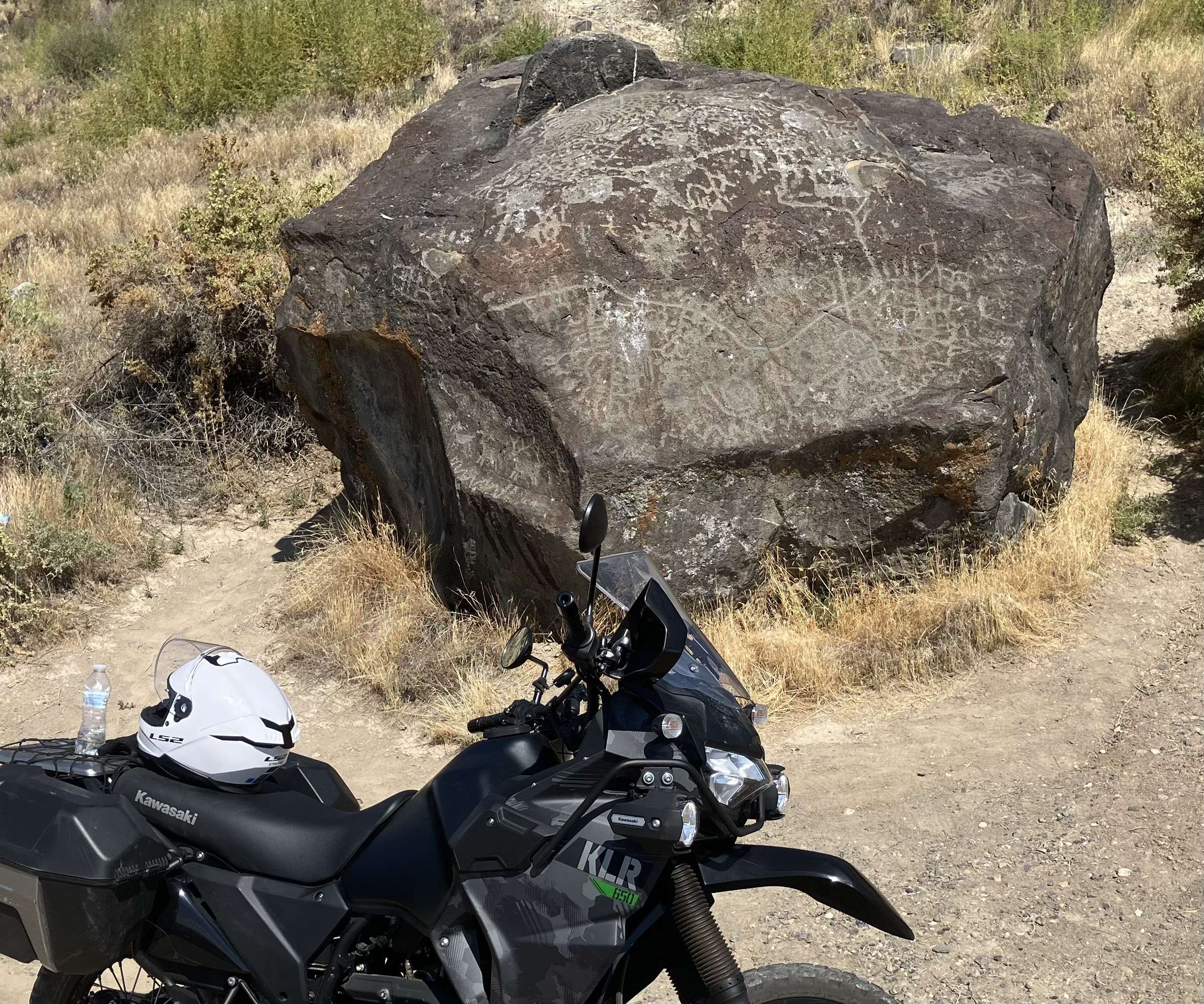
Map Rock Petroglyphs Historic District in Canyon County, Idaho, is an archaeological site featuring a large collection of ancient petroglyphs carved into basalt rocks. The most prominent feature is Map Rock, a massive stone covered in carvings believed to have been made by the Northern Shoshone people before the arrival of 19th-century settlers. Explorer Robert Limbert named the rock in the 1920s, suggesting the carvings might represent a map of the Snake River Valley. Some have speculated that if it is a map, it could be among the oldest in the world.
In 1924, there was a plan to move Map Rock to Boise to be displayed at the State Capitol, but the idea was eventually dropped after public concern. Unfortunately, the rock did suffer some damage during that time. The site, including Map Rock and 38 surrounding acres, was officially acquired by Canyon County in 2012. It remains in its natural setting along the Snake River and is accessible for those interested in history and early Native American art.
More Information
https://en.wikipedia.org/wiki/Map_Rock_Petroglyphs_Historic_District
Coordinates: 43.420731, -116.704179
Elevation: 2744 ft
Difficulty: 1
What to Expect: No info
[reblex id=’779′]
Check In
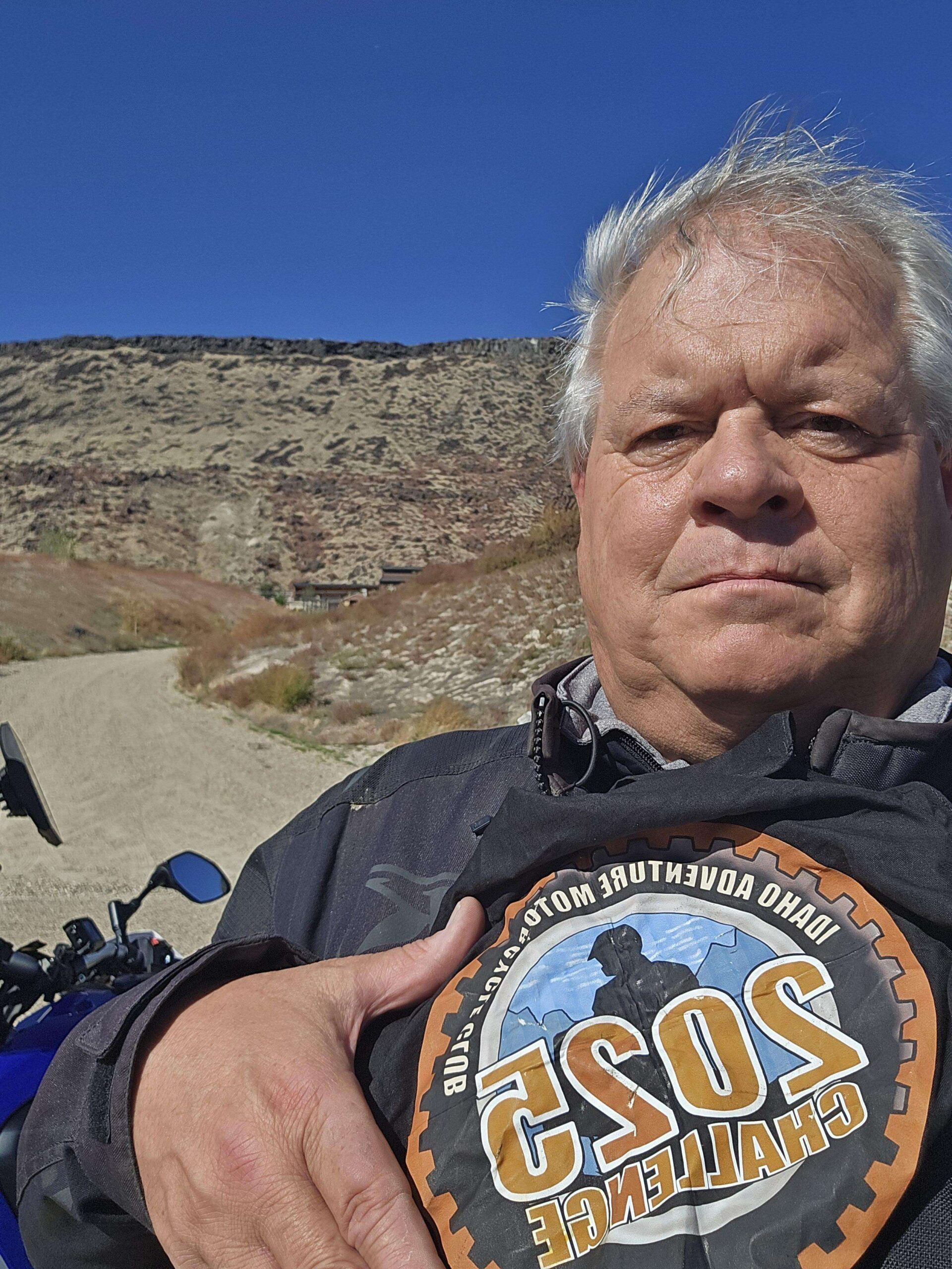
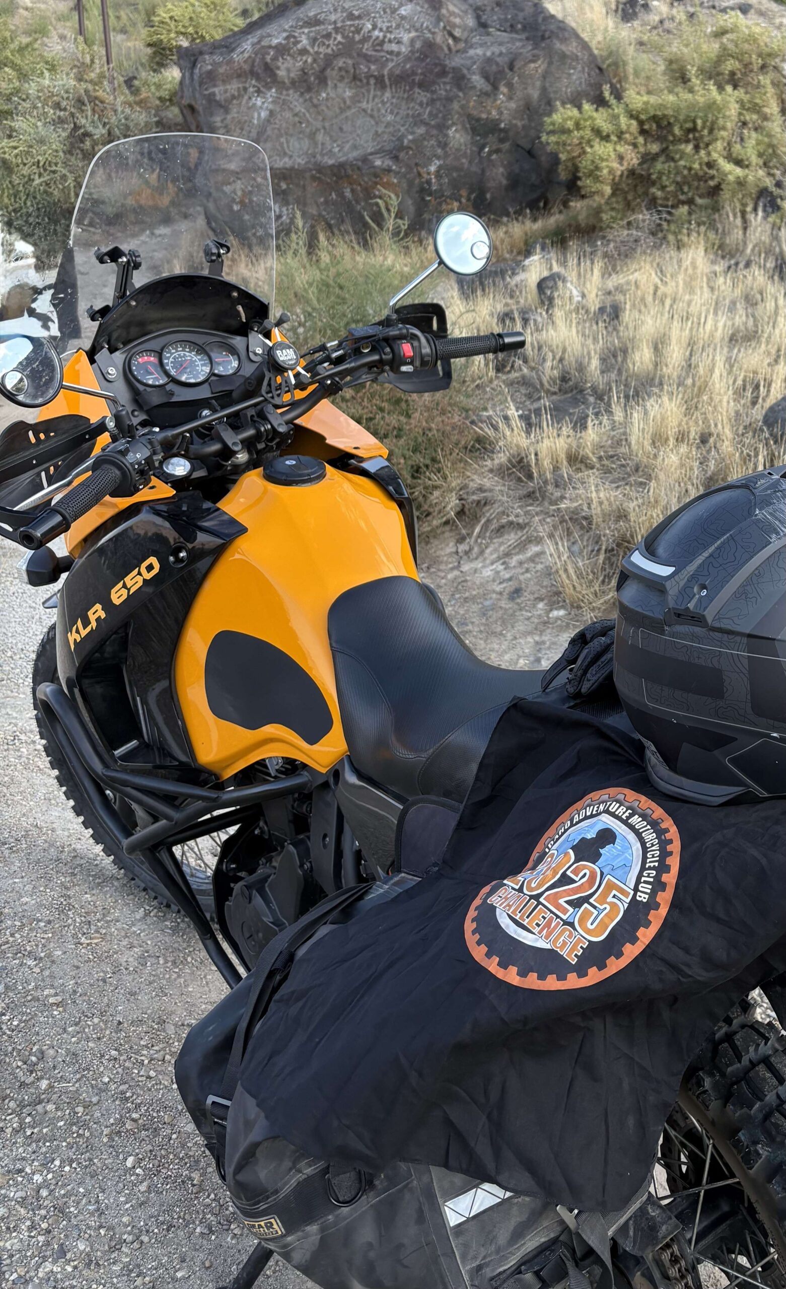
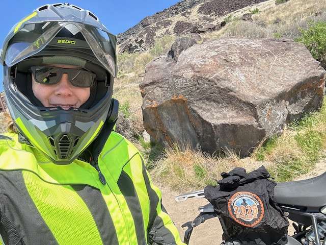
Use the form below to check in. Check-ins must include a photo of you or your bike at the challenge site with the 2025 bandanna. All participants must be registered IAMC Challenge Members. Leave a description of your ride and share road conditions — snow, water, obstacles, and tips for future riders are all appreciated.
Replying to another person's check-in is encouraged, but take care not to accidentally create your own check-in.
The stated difficulty is an estimate. Rating your experience helps future riders stay safe. You alone are responsible for the safety of your ride.
39 Check-Ins
This was a great ride! We went on April 13th and almost missed it because the signage is all faded.
I've never stopped before to check out the rock. That's one of the great things about the challenge points. It gives you a reason to slow down and stop for a bit to look at things you would normally pass by.

Cool rock right on the side of the road. A bit of a steep hike right above it if you're interested.

This is my third time here. The first time, I missed it because the sign is so weathered, you can no longer read it. It's a cool rock. As we were riding along Map Rock Road, I got stung in the neck by a big, bad bee!

Blew by the point a couple of times. Pretty cool once I found it plus I love this part of the Snake


Was surprised there wasn't more signage or anything noting this place

Neat! Have driven by here lots of times but never even noticed it. Thanks IAMC!


The weather was absolutely beautiful as we drove down from Pickles Butte. We saw quite a few ground squirrels, and I was wishing I had my 22 with me.
I also couldn't help but notice all of the awesome properties along the river. I would love to live in this area.
This was a super easy ride and the road is well maintained. You get get here on a moped of you wanted.

This one is always neat. It's best done with Special Ed as he has a lot of cool info about how this all came to be.

First time seeing these rocks. Google maps wanted to take me through some posted private property.


I like this little road, if you look hard enough you will see a few more of these south of this site.


Easy ride, I was going to hit some other sites but dark clouds were coming in over the owyhees so that’s it for today


Sweet little piece of road on this side of the river. Came from sights east of here and exited up Pump Rd.

Beautiful Sunday ride around the south side of Lake Lowell to Map Rock. We spotted Bigfoot on Deer Flat Road just east of Rim Road. Lots of juicy bugs were splattered on my visor along the Snake River.


Pretty cool right along the road. Pretty down in the canyon. Really simple to get to and find.

Coordinates were spot on using Google Maps. Easy to find if you're looking for it on the side of the road opposite the river.

I have driven by this a dozen times and never knew it was here. Interesting markings on this rock. Easy ride right next to road.

Love fishing this area. Watch out for marmots and quail, had tons of them running across the road this evening.

A fun curvy ride along the Snake River gets you to Map Rock located right on the north side of the road.

Very interesting, and it makes you wonder how long it has been there, and how much of it has deteriorated over time. Easy access, right along the side of the road.


It was a beautiful evening for a quick ride down to Map Rock. Another club member, Brent (@BW5743), was already there, so we got to shooting the breeze a bit. It was nice to meet you Brent!

Very scenic ride that many motorcyclists pass by without knowing it’s there. The road is paved and the site is right off the shoulder. As I was leaving, met another club member named Justin and we chatted for a bit. Great day for a ride!

Really cool to see in person! It's surprising just how close to the road it is. The steep hike up the hill is pretty entertaining too.
Be warned if you're using Google Maps to navigate, I was approaching from the Northeast, and it wanted to take me down some private farm roads.

I've ridden past this rock many times not knowing the significance of it. Maybe my focus was on the sweet homes across the river on the other side of the road from the rock.


Easy access if you know where it is and don’t fly by it (don’t be the leader if you don’t know where the checkpoint is…apologies to John and Dan). 🤪

This was a great ride! We went on April 13th and almost missed it because the signage is all faded.
I’ve never stopped before to check out the rock. That’s one of the great things about the challenge points. It gives you a reason to slow down and stop for a bit to look at things you would normally pass by.
Always a cool place to stop for a few minutes.
I didn’t locate the actual map rock, but I was very close to it.
Interesting rock. Never knew it was there!
Easy scenic ride. Also, found some new spots to fish!
Hot day.
Cool rock right on the side of the road. A bit of a steep hike right above it if you’re interested.
This is my third time here. The first time, I missed it because the sign is so weathered, you can no longer read it. It’s a cool rock. As we were riding along Map Rock Road, I got stung in the neck by a big, bad bee!
Blew by the point a couple of times. Pretty cool once I found it plus I love this part of the Snake
blink and you’ll miss it!
Was surprised there wasn’t more signage or anything noting this place
Neat! Have driven by here lots of times but never even noticed it. Thanks IAMC!
Cool!
Easy stop. Great place to take kids for a history lesson.
The weather was absolutely beautiful as we drove down from Pickles Butte. We saw quite a few ground squirrels, and I was wishing I had my 22 with me.
I also couldn’t help but notice all of the awesome properties along the river. I would love to live in this area.
This was a super easy ride and the road is well maintained. You get get here on a moped of you wanted.
This one is always neat. It’s best done with Special Ed as he has a lot of cool info about how this all came to be.
First time seeing these rocks. Google maps wanted to take me through some posted private property.
Nice day even Harleys made it.
I like this little road, if you look hard enough you will see a few more of these south of this site.
Yep still there
Easy ride, I was going to hit some other sites but dark clouds were coming in over the owyhees so that’s it for today
Nice easy Easter day ride.
Sweet little piece of road on this side of the river. Came from sights east of here and exited up Pump Rd.
Beautiful Sunday ride around the south side of Lake Lowell to Map Rock. We spotted Bigfoot on Deer Flat Road just east of Rim Road. Lots of juicy bugs were splattered on my visor along the Snake River.
Cool rock
Pretty cool right along the road. Pretty down in the canyon. Really simple to get to and find.
1 of 4 challenge sites today!
Coordinates were spot on using Google Maps. Easy to find if you’re looking for it on the side of the road opposite the river.
I have driven by this a dozen times and never knew it was here. Interesting markings on this rock. Easy ride right next to road.
Love fishing this area. Watch out for marmots and quail, had tons of them running across the road this evening.
A fun curvy ride along the Snake River gets you to Map Rock located right on the north side of the road.
Very interesting, and it makes you wonder how long it has been there, and how much of it has deteriorated over time. Easy access, right along the side of the road.
Missed it twice….but got a little hike up the hill out of it.
It was a beautiful evening for a quick ride down to Map Rock. Another club member, Brent (@BW5743), was already there, so we got to shooting the breeze a bit. It was nice to meet you Brent!
It was great meeting you as well!
Very scenic ride that many motorcyclists pass by without knowing it’s there. The road is paved and the site is right off the shoulder. As I was leaving, met another club member named Justin and we chatted for a bit. Great day for a ride!
Really cool to see in person! It’s surprising just how close to the road it is. The steep hike up the hill is pretty entertaining too.
Be warned if you’re using Google Maps to navigate, I was approaching from the Northeast, and it wanted to take me down some private farm roads.
I’ve ridden past this rock many times not knowing the significance of it. Maybe my focus was on the sweet homes across the river on the other side of the road from the rock.
Easy access if you know where it is and don’t fly by it (don’t be the leader if you don’t know where the checkpoint is…apologies to John and Dan). 🤪
Comments are closed.