Notifications
Clear all

Topic starter
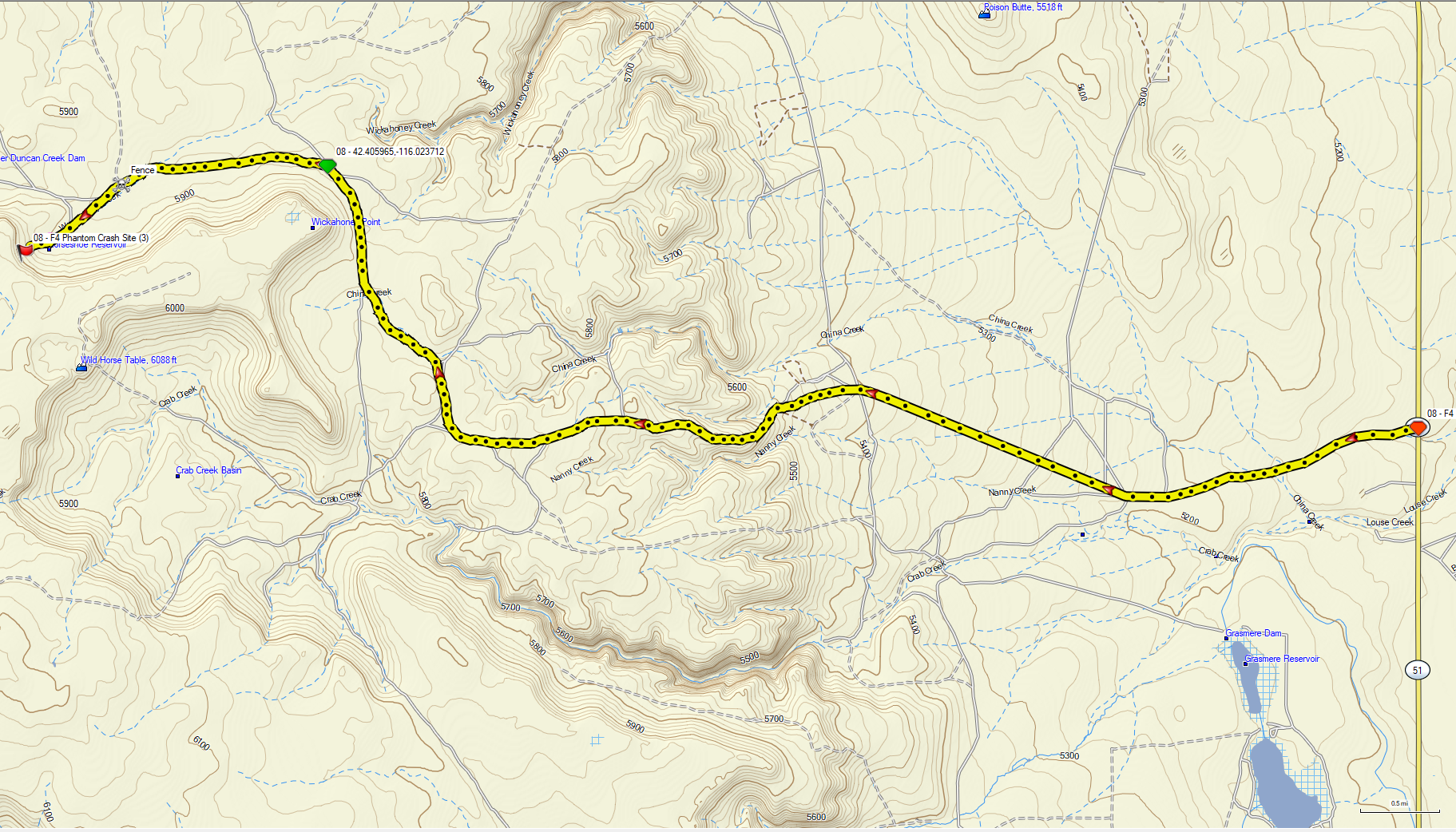
I pulled this map image off the GPS today, but I can't add it to my site check-in. Chatty's full route into the F4 crash site from HWY 51. Note there are a LOT of branch two-tracks splitting off, so stay on your toes. The unmarked fence gate is also shown. The rocky climb people are referring to is the steep section north of Nanny Creek.
This topic was modified 2 months ago by KaptSlow
'05 R1200GS, '89 TransAlp, '05 WR450f, '05 WR250f, '04 TW200 and a 2018 PCX 150
Posted : August 3, 2026 9:26 am
chatty reacted